
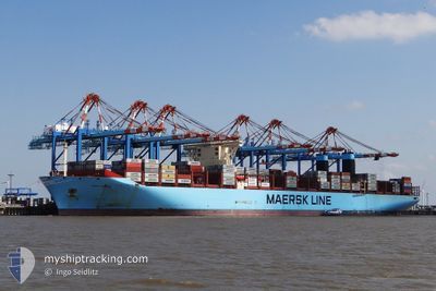
MARY MAERSK
Container Ship
Current Trip
| Time Travelled | 1 day |
|---|---|
| Remaining Time | 23 days |
| Distance Travelled | 697.12 морская миля |
| Remaining Distance | 10048.44 морская миля |
| AVG Speed | 14.7 Узлы |
| MAX Speed | 17.9 Узлы |
| AVG Wind | 12.7 knots |
| MAX Wind | 18.7 knots |
| MIN Temp | 14.4°C / 57.92°F |
| MAX Temp | 18.9°C / 66.02°F |
| Осадка | 15.1 м |
| Позиция Получена | Сейчас |
Current Position
| Долгота | -15.05875° |
|---|---|
| Широта | 27.99257° |
| Статус | Under way using engine |
| Скорость | 17.9 Узлы |
| Курс | 200.3° |
| Район | North Atlantic Ocean |
| Станция | T-AIS |
| Позиция Получена | Сейчас |
Info
Information
The current position of MARY MAERSK is in North Atlantic Ocean with coordinates 27.99257° / -15.05875° as reported on 2024-04-30 01:30 by AIS to our vessel tracker app. The vessel's current speed is 17.9 Узлы and is heading at the port of SINGAPORE. The estimated time of arrival as calculated by MyShipTracking vessel tracking app is 2024-05-23 17:50 LT
The vessel MARY MAERSK (IMO: 9619921, MMSI: 219018692) is a Container Ship that was built in 2013 ( 11 лет ). It's sailing under the flag of [DK] Denmark.
In this page you can find informations about the vessels current position, last detected port calls, and current voyage information. If the vessels is not in coverage by AIS you will find the latest position.
The current position of MARY MAERSK is detected by our AIS receivers and we are not responsible for the reliability of the data. The last position was recorded while the vessel was in Coverage by the Ais receivers of our vessel tracking app.
The current draught of MARY MAERSK as reported by AIS is 15.1 meters
Weather
| Temperature | 18.8°C / 65.84°F |
|---|---|
| Wind Speed | 17 knots |
| Direction | 18° NNE |
| Pressure | 1023.8 hPa |
| Humidity | 68.1 % |
| Cloud Coverage | 12 % |
Featured Company
Last Port Calls
| Port | Arrival | Departure | Time In Port |
|---|---|---|---|
| 2024-04-27 06:11 | 2024-04-28 08:25 | 1 d | |
| 2024-04-22 14:06 | 2024-04-23 07:50 | 17 h | |
| 2024-04-20 08:24 | 2024-04-22 08:30 | 2 d | |
| 2024-04-17 02:57 | 2024-04-18 14:17 | 1 d | |
| 2024-04-13 16:27 | 2024-04-16 18:08 | 3 d | |
| 2024-04-09 21:33 | 2024-04-11 02:48 | 1 d | |
| 2024-04-06 15:19 | 2024-04-08 15:31 | 2 d | |
| 2024-03-09 00:34 | 2024-03-10 21:15 | 1 d | |
| 2024-02-26 22:52 | 2024-02-28 05:13 | 1 d | |
| 2024-02-22 12:22 | 2024-02-23 05:35 | 17 h |
Most Visited Ports (Last year)
| Port | Arrivals | |
|---|---|---|
| 7 | ||
| 6 | ||
| 5 | ||
| 4 | ||
| 3 | ||
| 3 |
Last Trips
| Origin | Departure | Destination | Arrival | Distance | |
|---|---|---|---|---|---|
| 2024-04-23 09:50 | 2024-04-27 07:11 | 1668.41 морская миля | |||
| 2024-04-22 10:30 | 2024-04-22 16:06 | 53.83 морская миля | |||
| 2024-04-18 16:17 | 2024-04-20 10:24 | 511.84 морская миля | |||
| 2024-04-16 20:08 | 2024-04-17 04:57 | 139.33 морская миля | |||
| 2024-04-11 04:48 | 2024-04-13 18:27 | 401.40 морская миля | |||
| 2024-04-08 17:31 | 2024-04-09 23:33 | 298.44 морская миля | |||
| 2024-03-11 05:15 | 2024-04-06 17:19 | 11777.86 морская миля | |||
| 2024-02-28 14:13 | 2024-03-09 08:34 | 2974.64 морская миля | |||
| 2024-02-23 13:35 | 2024-02-27 07:52 | 674.34 морская миля | |||
| 2024-02-09 00:00 | 2024-02-22 20:22 | 3194.28 морская миля |
Events
| Время | Событие | Детали | Позиция / Направление | Информация |
|---|---|---|---|---|
| 2024-04-29 22:02 | Статус изменился | Under way using engine Default |
28.87070 / -14.52898
MAPTM>SGSIN
|
Скорость: 16.8 kn Курс: 225° |
| 2024-04-29 21:58 | Статус изменился | Default Under way using engine |
28.88357 / -14.51420
MAPTM>SGSIN
|
Скорость: 17 kn Курс: 224.9° |
| 2024-04-29 21:50 | Обнаружено в море | Spanish (Canary Islands) part of the North Atlantic Ocean |
28.90920 / -14.48503
North Atlantic Ocean
MAPTM>SGSIN
|
Скорость: 17 kn Курс: 224.9° |
| 2024-04-29 21:50 | Статус изменился | Under way using engine Default |
28.90920 / -14.48503
MAPTM>SGSIN
|
Скорость: 17 kn Курс: 225° |
| 2024-04-29 21:46 | В покрытии |
28.90920 / -14.48503
North Atlantic Ocean
MAPTM>SGSIN
|
Скорость: 17 kn Курс: 224.9° |
|
| 2024-04-28 12:13 | Статус изменился | Default Under way using engine |
35.73762 / -6.35290
MAPTM>SGSIN
|
Скорость: 17.2 kn Курс: 227.3° |
| 2024-04-28 12:08 | Статус изменился | Under way using engine Default |
35.75632 / -6.32752
MAPTM>SGSIN
|
Скорость: 17.3 kn Курс: 227° |
| 2024-04-28 12:08 | Вне покрытия |
35.75632 / -6.32752
North Atlantic Ocean
MAPTM>SGSIN
|
Скорость: 17.2 kn Курс: 227.3° |
|
| 2024-04-28 12:07 | Статус изменился | Default Under way using engine |
35.75705 / -6.32655
MAPTM>SGSIN
|
Скорость: 17.1 kn Курс: 242.9° |
| 2024-04-28 11:31 | Статус изменился | Under way using engine Default |
35.86142 / -6.10025
MAPTM>SGSIN
|
Скорость: 17.1 kn Курс: 246° |