

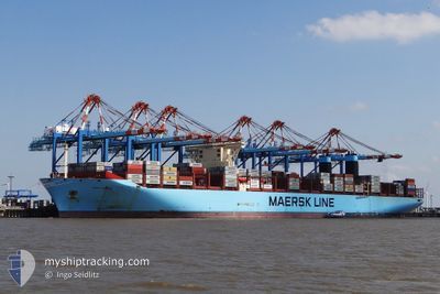
MARY MAERSK
Container Ship

Current Trip
| Time Travelled | 9 days |
|---|---|
| Remaining Time | 12 days |
| Distance Travelled | 4640.93 nm |
| Remaining Distance | 6133.41 nm |
| AVG Speed | 19.3 Knots |
| MAX Speed | 21.8 Knots |
| AVG Wind | 13.2 knots |
| MAX Wind | 28.3 knots |
| MIN Temp | 14.2°C / 57.56°F |
| MAX Temp | 27.9°C / 82.22°F |
| Dybgang | 16 m |
| Position Modtaget | 8 d siden |
Current Position
| Longitude | --- |
|---|---|
| Latitude | --- |
| Status | Under way using engine |
| Fart | 20.9 Knots |
| Kurs | 202.7° |
| Område | North Atlantic Ocean |
| Station | T-AIS |
| Position Modtaget | 8 d siden |
Information
The current position of MARY MAERSK is in North Atlantic Ocean with coordinates 27.40255° / -15.34530° as reported on 2025-03-21 14:18 by AIS to our vessel tracker app. The vessel's current speed is 20.9 Knots and is heading at the port of SINGAPORE. The estimated time of arrival as calculated by MyShipTracking vessel tracking app is 2025-04-11 16:33 LT
The vessel MARY MAERSK (IMO: 9619921, MMSI: 219018692) is a Container Ship that was built in 2013 ( 12 år gamle ). It's sailing under the flag of [DK] Denmark.
In this page you can find informations about the vessels current position, last detected port calls, and current voyage information. If the vessels is not in coverage by AIS you will find the latest position.
The current position of MARY MAERSK is detected by our AIS receivers and we are not responsible for the reliability of the data. The last position was recorded while the vessel was in Coverage by the Ais receivers of our vessel tracking app.
The current draught of MARY MAERSK as reported by AIS is 16 meters
Weather
| Temperature | 20.3°C / 68.54°F |
|---|---|
| Wind Speed | 18 knots |
| Direction | 154° SSE |
| Pressure | 1017 hPa |
| Humidity | 80.9 % |
| Cloud Coverage | 1 % |


Featured Company
Last Port Calls
| Port | Arrival | Departure | Time In Port |
|---|---|---|---|
| 2025-03-18 20:01 | 2025-03-19 23:20 | 1 d | |
| 2025-03-09 23:54 | 2025-03-12 01:37 | 2 d | |
| 2025-03-08 03:04 | 2025-03-09 19:26 | 1 d | |
| 2025-03-05 04:16 | 2025-03-06 15:50 | 1 d | |
| 2025-03-02 20:05 | 2025-03-04 17:42 | 1 d | |
| 2025-02-27 22:06 | 2025-03-01 05:22 | 1 d | |
| 2025-02-22 09:54 | 2025-02-24 13:47 | 2 d | |
| 2025-01-24 02:23 | 2025-01-25 04:38 | 1 d | |
| 2025-01-08 08:07 | 2025-01-09 15:00 | 1 d | |
| 2025-01-04 23:53 | 2025-01-06 05:57 | 1 d |
Most Visited Ports (Last year)
| Port | Arrivals | |
|---|---|---|
| 8 | ||
| 4 | ||
| 4 | ||
| 4 | ||
| 4 | ||
| 4 |
Last Trips
| Origin | Departure | Destination | Arrival | Distance | |
|---|---|---|---|---|---|
| 2025-03-12 02:37 | 2025-03-18 20:01 | 1803.23 nm | |||
| 2025-03-09 20:26 | 2025-03-10 00:54 | 51.06 nm | |||
| 2025-03-06 16:50 | 2025-03-08 04:04 | 513.82 nm | |||
| 2025-03-04 18:42 | 2025-03-05 05:16 | 139.34 nm | |||
| 2025-03-01 06:22 | 2025-03-02 21:05 | 403.58 nm | |||
| 2025-02-24 14:47 | 2025-02-27 23:06 | 280.10 nm | |||
| 2025-01-25 12:38 | 2025-02-22 10:54 | 11937.58 nm | |||
| 2025-01-10 00:00 | 2025-01-24 10:23 | 3030.13 nm | |||
| 2025-01-06 13:57 | 2025-01-08 17:07 | 728.22 nm | |||
| 2024-12-31 22:45 | 2025-01-05 07:53 | 871.13 nm |
Events
| Tid | Hændelsen | Detaljer | Position / Dest | Info |
|---|---|---|---|---|
| 2025-03-21 14:24 | Status er ændret | Default Under way using engine |
27.37408 / -15.36005
MAPTM>SGSIN
|
Fart: 20.9 kn Kurs: 202.7° |
| 2025-03-21 14:18 | Status er ændret | Under way using engine Default |
27.40255 / -15.34530
MAPTM>SGSIN
|
Fart: 20.9 kn Kurs: 203° |
| 2025-03-21 14:18 | Udenfor Dækning |
27.40255 / -15.34530
North Atlantic Ocean
MAPTM>SGSIN
|
Fart: 20.9 kn Kurs: 202.7° |
|
| 2025-03-21 14:04 | Status er ændret | Default Under way using engine |
27.48047 / -15.30808
MAPTM>SGSIN
|
Fart: 21.3 kn Kurs: 204.5° |
| 2025-03-21 09:58 | Fundet i havområde | Spanish (Canary Islands) part of the North Atlantic Ocean |
28.75532 / -14.61130
North Atlantic Ocean
MAPTM>SGSIN
|
Fart: 20 kn Kurs: 213.5° |
| 2025-03-21 09:56 | Status er ændret | Under way using engine Default |
28.76130 / -14.60663
MAPTM>SGSIN
|
Fart: 20.1 kn Kurs: 215° |
| 2025-03-21 09:41 | Indenfor Dækning |
28.75532 / -14.61130
North Atlantic Ocean
MAPTM>SGSIN
|
Fart: 20 kn Kurs: 213.5° |
|
| 2025-03-20 01:04 | Status er ændret | Default Under way using engine |
35.95010 / -5.85402
MAPTM>SGSIN
|
Fart: 17.7 kn Kurs: 270.2° |
| 2025-03-20 00:57 | Udenfor Dækning |
35.95095 / -5.81082
Strait of Gibraltar
MAPTM>SGSIN
|
Fart: 17.7 kn Kurs: 270.2° |
|
| 2025-03-20 00:01 | Ændre havområde | Spanish part of the Strait of Gibraltar Moroccan part of the Strait of Gibraltar |
35.95448 / -5.54557
Strait of Gibraltar
MAPTM>SGSIN
|
Fart: 10.7 kn Kurs: 265.8° |