
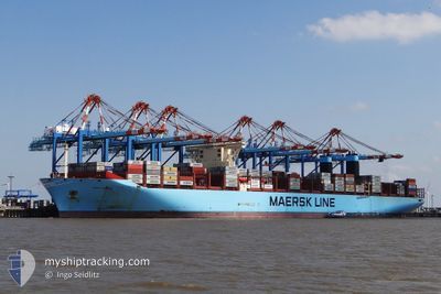
MARY MAERSK
Container Ship
Current Trip
| Time Travelled | 19 days |
|---|---|
| Remaining Time | --- |
| Distance Travelled | 7320.19 nm |
| Remaining Distance | 3533.39 nm |
| AVG Speed | 15.7 Knopen |
| MAX Speed | 18.5 Knopen |
| AVG Wind | 14.4 knots |
| MAX Wind | 25.8 knots |
| MIN Temp | 14.4°C / 57.92°F |
| MAX Temp | 29.6°C / 85.28°F |
| Diepgang | 15.1 M |
| Positie ontvangen | 5 d geleden |
Current Position
| Lengtegraad | 18.60052° |
|---|---|
| Breedtegraat | -34.80018° |
| Status | Under way using engine |
| Snelheid | 16.8 Knopen |
| Koers | 109.6° |
| Gebied | South Atlantic Ocean |
| Station | T-AIS |
| Positie ontvangen | 5 d geleden |
Info
Information
The current position of MARY MAERSK is in South Atlantic Ocean with coordinates -34.80018° / 18.60052° as reported on 2024-05-11 22:32 by AIS to our vessel tracker app. The vessel's current speed is 16.8 Knopen and is heading at the port of SINGAPORE. The estimated time of arrival as calculated by MyShipTracking vessel tracking app is 2024-05-26 20:00 LT
The vessel MARY MAERSK (IMO: 9619921, MMSI: 219018692) is a Container Ship that was built in 2013 ( 11 Jaar oud ). It's sailing under the flag of [DK] Denmark.
In this page you can find informations about the vessels current position, last detected port calls, and current voyage information. If the vessels is not in coverage by AIS you will find the latest position.
The current position of MARY MAERSK is detected by our AIS receivers and we are not responsible for the reliability of the data. The last position was recorded while the vessel was in Coverage by the Ais receivers of our vessel tracking app.
The current draught of MARY MAERSK as reported by AIS is 15.1 meters
Weather
| Temperature | 24.5°C / 76.1°F |
|---|---|
| Wind Speed | 17 knots |
| Direction | 92° E |
| Pressure | 1018.9 hPa |
| Humidity | 63.1 % |
| Cloud Coverage | 100 % |
Featured Company
Last Port Calls
| Port | Arrival | Departure | Time In Port |
|---|---|---|---|
| 2024-04-27 06:11 | 2024-04-28 08:25 | 1 d | |
| 2024-04-22 14:06 | 2024-04-23 07:50 | 17 h | |
| 2024-04-20 08:24 | 2024-04-22 08:30 | 2 d | |
| 2024-04-17 02:57 | 2024-04-18 14:17 | 1 d | |
| 2024-04-13 16:27 | 2024-04-16 18:08 | 3 d | |
| 2024-04-09 21:33 | 2024-04-11 02:48 | 1 d | |
| 2024-04-06 15:19 | 2024-04-08 15:31 | 2 d | |
| 2024-03-09 00:34 | 2024-03-10 21:15 | 1 d |
Most Visited Ports (Last year)
| Port | Arrivals | |
|---|---|---|
| 7 | ||
| 6 | ||
| 5 | ||
| 3 | ||
| 3 | ||
| 2 |
Last Trips
| Origin | Departure | Destination | Arrival | Distance | |
|---|---|---|---|---|---|
| 2024-04-23 09:50 | 2024-04-27 07:11 | 1668.41 nm | |||
| 2024-04-22 10:30 | 2024-04-22 16:06 | 53.83 nm | |||
| 2024-04-18 16:17 | 2024-04-20 10:24 | 511.84 nm | |||
| 2024-04-16 20:08 | 2024-04-17 04:57 | 139.33 nm | |||
| 2024-04-11 04:48 | 2024-04-13 18:27 | 401.40 nm | |||
| 2024-04-08 17:31 | 2024-04-09 23:33 | 298.44 nm | |||
| 2024-03-11 05:15 | 2024-04-06 17:19 | 11777.86 nm | |||
| 2024-02-28 14:13 | 2024-03-09 08:34 | 2974.64 nm |
Events
| Tijd | Evenement | Details | Positie / Bestemming | Info |
|---|---|---|---|---|
| 2024-05-11 22:41 | Status Changed | Default Under way using engine |
-34.81417 / 18.64717
MAPTM>SGSIN
|
Snelheid: 16.8 kn Koers: 109.6° |
| 2024-05-11 22:32 | Status Changed | Under way using engine Default |
-34.80018 / 18.60052
MAPTM>SGSIN
|
Snelheid: 16.7 kn Koers: 110° |
| 2024-05-11 22:32 | Buitenbereik |
-34.80018 / 18.60052
South Atlantic Ocean
MAPTM>SGSIN
|
Snelheid: 16.8 kn Koers: 109.6° |
|
| 2024-05-11 22:30 | Status Changed | Default Under way using engine |
-34.79666 / 18.58892
MAPTM>SGSIN
|
Snelheid: 16.6 kn Koers: 109.5° |
| 2024-05-11 20:18 | ETA Changed | 2024/05/26 20:00 2024/05/25 20:00 |
-34.45988 / 17.99303
MAPTM>SGSIN
|
Snelheid: 16.5 kn Koers: 136.6° |
| 2024-05-11 20:13 | Status Changed | Under way using engine Default |
-34.44445 / 17.97508
MAPTM>SGSIN
|
Snelheid: 16.3 kn Koers: 137° |
| 2024-05-11 20:11 | Status Changed | Default Under way using engine |
-34.43620 / 17.96550
MAPTM>SGSIN
|
Snelheid: 16.4 kn Koers: 137° |
| 2024-05-11 18:45 | Status Changed | Under way using engine Default |
-34.16490 / 17.64543
MAPTM>SGSIN
|
Snelheid: 15.8 kn Koers: 129° |
| 2024-05-11 18:40 | Binnenbereik |
-34.16490 / 17.64543
South Atlantic Ocean
MAPTM>SGSIN
|
Snelheid: 15.8 kn Koers: 131.6° |
|
| 2024-05-11 17:17 | Buitenbereik |
-33.87970 / 17.36702
South Atlantic Ocean
MAPTM>SGSIN
|
Snelheid: 16.2 kn Koers: 138.2° |