
ERK IZMIR
Vehicles Carrier
Current Trip
| Time Travelled | 4 days |
|---|---|
| Remaining Time | 1 day |
| Distance Travelled | 1255.96 nm |
| Remaining Distance | 570.34 nm |
| AVG Speed | 12.8 Knots |
| MAX Speed | 16.6 Knots |
| AVG Wind | 10.5 knots |
| MAX Wind | 22.9 knots |
| MIN Temp | 17.5°C / 63.5°F |
| MAX Temp | 28.4°C / 83.12°F |
| Draught | 5.4 m |
| Position Received | 3 h, 17 m ago |
Current Position
| Longitude | 6.85405° |
|---|---|
| Latitude | 37.44493° |
| Status | Under way using engine |
| Speed | 13.9 Knots |
| Course | 262.8° |
| Area | Mediterranean Sea - Western Basin |
| Station | T-AIS |
| Position Received | 3 h, 17 m ago |
Info
Information
The current position of ERK IZMIR is in Mediterranean Sea - Western Basin with coordinates 37.44493° / 6.85405° as reported on 2024-06-10 14:06 by AIS to our vessel tracker app. The vessel's current speed is 13.9 Knots and is heading at the port of TANGER MED. The estimated time of arrival as calculated by MyShipTracking vessel tracking app is 2024-06-12 10:56 LT
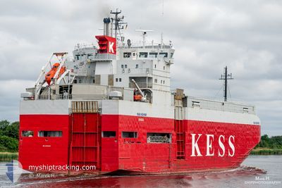
The vessel ERK IZMIR (IMO: 9179983, MMSI: 352002302) is a Vehicles Carrier that was built in 1998 ( 26 years old ). It's sailing under the flag of [PA] Panama.
In this page you can find informations about the vessels current position, last detected port calls, and current voyage information. If the vessels is not in coverage by AIS you will find the latest position.
The current position of ERK IZMIR is detected by our AIS receivers and we are not responsible for the reliability of the data. The last position was recorded while the vessel was in Coverage by the Ais receivers of our vessel tracking app.
The current draught of ERK IZMIR as reported by AIS is 5.4 meters
Weather
| Temperature | 21.9°C / 71.42°F |
|---|---|
| Wind Speed | 11 knots |
| Direction | 67° ENE |
| Pressure | 1010.8 hPa |
| Humidity | 83 % |
| Cloud Coverage | 100 % |
Featured Company
Last Port Calls
| Port | Arrival | Departure | Time In Port |
|---|---|---|---|
| 2024-06-06 05:16 | 2024-06-06 20:23 | 15 h | |
| 2024-05-20 09:16 | 2024-05-20 20:18 | 11 h | |
| 2024-05-13 16:36 | 2024-05-15 13:49 | 1 d | |
| 2024-05-09 07:21 | 2024-05-09 14:24 | 7 h | |
| 2024-05-02 15:20 | 2024-05-03 00:45 | 9 h | |
| 2024-04-08 06:46 | 2024-04-26 13:58 | 18 d | |
| 2024-04-04 01:17 | 2024-04-04 16:19 | 15 h |
Last Trips
| Origin | Departure | Destination | Arrival | Distance | |
|---|---|---|---|---|---|
| 2024-05-20 20:18 | 2024-06-06 05:16 | 194.80 nm | |||
| 2024-05-15 13:49 | 2024-05-20 09:16 | 1345.96 nm | |||
| 2024-05-09 14:24 | 2024-05-13 16:36 | 365.67 nm | |||
| 2024-05-03 00:45 | 2024-05-09 07:21 | 1768.09 nm | |||
| 2024-04-26 13:58 | 2024-05-02 15:20 | 306.00 nm | |||
| 2024-04-04 16:19 | 2024-04-08 06:46 | 37.88 nm | |||
| 2024-03-28 05:56 | 2024-04-04 01:17 | 1839.57 nm |
Events
| Time | Event | Details | Position / Dest | Info |
|---|---|---|---|---|
| 2024-06-10 14:17 | Status Changed | Default Under way using engine |
37.43973 / 6.80101
MA PTM
|
Speed: 13.9 kn Course: 262.8° |
| 2024-06-10 14:06 | OUT of Coverage |
37.44493 / 6.85405
Mediterranean Sea - Western Basin
MA PTM
|
Speed: 13.9 kn Course: 262.8° |
|
| 2024-06-10 14:06 | Status Changed | Under way using engine Default |
37.44510 / 6.85579
MA PTM
|
Speed: 13.8 kn Course: 263° |
| 2024-06-10 13:45 | Status Changed | Default Under way using engine |
37.45526 / 6.95577
MA PTM
|
Speed: 13.8 kn Course: 262.3° |
| 2024-06-10 13:40 | Change Sea Area | Algerian part of the Mediterranean Sea - Western Basin Tunisian part of the Mediterranean Sea - Western Basin |
37.45746 / 6.97877
Mediterranean Sea - Western Basin
MA PTM
|
Speed: 13.8 kn Course: 262.3° |
| 2024-06-10 13:40 | Status Changed | Under way using engine Default |
37.45746 / 6.97877
MA PTM
|
Speed: 14 kn Course: 266° |
| 2024-06-10 13:40 | IN Coverage |
37.45746 / 6.97877
Mediterranean Sea - Western Basin
MA PTM
|
Speed: 13.8 kn Course: 262.3° |
|
| 2024-06-10 00:14 | Status Changed | Default Under way using engine |
37.60622 / 10.43086
MA PTM
|
Speed: 11.9 kn Course: 281.6° |
| 2024-06-10 00:12 | OUT of Coverage |
37.60454 / 10.44107
Mediterranean Sea - Western Basin
MA PTM
|
Speed: 11.9 kn Course: 281.6° |
|
| 2024-06-10 00:02 | Status Changed | Under way using engine Default |
37.59797 / 10.47943
MA PTM
|
Speed: 11.8 kn Course: 283° |