

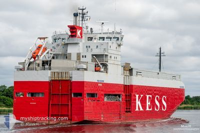
ERK IZMIR
Vehicles Carrier
Current Trip
| Time Travelled | 5 days |
|---|---|
| Remaining Time | --- |
| Distance Travelled | 1382.76 nm |
| Remaining Distance | --- |
| AVG Speed | 11.1 Noeuds |
| MAX Speed | 14.2 Noeuds |
| AVG Wind | 15.8 knots |
| MAX Wind | 28 knots |
| MIN Temp | -2.1°C / 28.22°F |
| MAX Temp | 14.2°C / 57.56°F |
| Tirant d eau | 5.4 m |
| Position reçue | Maintenant |
Current Position
| Longitude | --- |
|---|---|
| Latitude | --- |
| Etat | Moored |
| Vitesse | |
| Parcours | 328° |
| Zone | Sea of Marmara |
| Station | T-AIS |
| Position reçue | Maintenant |
Information
The current position of ERK IZMIR is in Sea of Marmara with coordinates 40.69304° / 29.42863° as reported on 2025-02-13 04:45 by AIS to our vessel tracker app. The vessel's current speed is 0 Noeuds
The vessel ERK IZMIR (IMO: 9179983, MMSI: 352002302) is a Vehicles Carrier that was built in 1998 ( 27 Age ). It's sailing under the flag of [PA] Panama.
In this page you can find informations about the vessels current position, last detected port calls, and current voyage information. If the vessels is not in coverage by AIS you will find the latest position.
The current position of ERK IZMIR is detected by our AIS receivers and we are not responsible for the reliability of the data. The last position was recorded while the vessel was in Coverage by the Ais receivers of our vessel tracking app.
The current draught of ERK IZMIR as reported by AIS is 5.4 meters
Weather
| Temperature | 3.7°C / 38.66°F |
|---|---|
| Wind Speed | 3 knots |
| Direction | 328° NNW |
| Pressure | 1028.5 hPa |
| Humidity | 82.5 % |
| Cloud Coverage | 99 % |
Featured Company
Last Port Calls
| Port | Arrival | Departure | Time In Port |
|---|---|---|---|
| 2025-02-07 04:54 | 2025-02-07 18:34 | 13 h | |
| 2025-02-06 02:41 | 2025-02-06 19:11 | 16 h | |
| 2025-02-05 06:39 | 2025-02-05 19:34 | 12 h | |
| 2025-02-04 05:06 | 2025-02-04 12:44 | 7 h | |
| 2025-01-30 05:09 | 2025-01-30 17:01 | 11 h | |
| 2025-01-29 11:17 | 2025-01-29 23:25 | 12 h | |
| 2025-01-23 14:13 | 2025-01-24 21:37 | 1 d | |
| 2025-01-20 19:45 | 2025-01-21 18:38 | 22 h | |
| 2025-01-16 23:08 | 2025-01-18 17:49 | 1 d | |
| 2025-01-04 12:10 | 2025-01-04 17:28 | 5 h |
Most Visited Ports (Last year)
| Port | Arrivals | |
|---|---|---|
| 9 | ||
| 8 | ||
| 5 | ||
| 5 | ||
| 4 | ||
| 4 |
Last Trips
| Origin | Departure | Destination | Arrival | Distance | |
|---|---|---|---|---|---|
| 2025-02-06 20:11 | 2025-02-07 05:54 | 78.82 nm | |||
| 2025-02-05 20:34 | 2025-02-06 03:41 | 64.12 nm | |||
| 2025-02-04 13:44 | 2025-02-05 07:39 | 217.29 nm | |||
| 2025-01-30 20:01 | 2025-02-04 06:06 | 1275.52 nm | |||
| 2025-01-30 02:25 | 2025-01-30 08:09 | 52.59 nm | |||
| 2025-01-24 22:37 | 2025-01-29 14:17 | 1369.34 nm | |||
| 2025-01-21 19:38 | 2025-01-23 15:13 | 547.64 nm | |||
| 2025-01-18 18:49 | 2025-01-20 20:45 | 330.04 nm | |||
| 2025-01-04 18:28 | 2025-01-17 00:08 | 1421.94 nm | |||
| 2025-01-02 20:14 | 2025-01-04 13:10 | 536.80 nm |
Events
| Heure | Evenement | Détails | Position/ Destination | Info |
|---|---|---|---|---|
| 2025-02-12 22:18 | Etat Changé | Moored Default |
40.69304 / 29.42863
TRYAL
|
Vitesse: Parcours: 329° |
| 2025-02-12 21:54 | Etat Changé | Default Moored |
40.69304 / 29.42863
TRYAL
|
Vitesse: Parcours: 329° |
| 2025-02-12 21:27 | Etat Changé | Moored Default |
40.69304 / 29.42863
TRYAL
|
Vitesse: Parcours: 329° |
| 2025-02-12 21:15 | Etat Changé | Default Moored |
40.69304 / 29.42862
TRYAL
|
Vitesse: Parcours: 329° |
| 2025-02-12 16:59 | Etat Changé | Moored Under way using engine |
40.69307 / 29.42860
TRYAL
|
Vitesse: Parcours: 327° |
| 2025-02-12 16:46 | Arret | 0.25 nm, West of TOPCULAR |
40.69369 / 29.42817
TRYAL
|
Vitesse: 0.3 kn Parcours: 328° |
| 2025-02-12 11:15 | Changement d'ETA | 2025/02/12 15:00 2025/02/12 12:00 |
40.75637 / 28.09660
TRYAL
|
Vitesse: 12.2 kn Parcours: 81.7° |
| 2025-02-12 07:20 | Etat Changé | Under way using engine Default |
40.55961 / 27.13365
TRYAL
|
Vitesse: 11.6 kn Parcours: 63° |
| 2025-02-12 07:20 | Dans la zone couverte |
40.56201 / 27.14038
Sea of Marmara
TRYAL
|
Vitesse: 12.1 kn Parcours: 65.9° |
|
| 2025-02-12 04:39 | Hors de la zone couverte |
40.28923 / 26.57431
Sea of Marmara
TRYAL
|
Vitesse: 11.6 kn Parcours: 48.4° |