
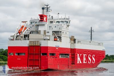
ERK IZMIR
Vehicles Carrier
Current Trip
| Time Travelled | 2 h, 2 mins |
|---|---|
| Remaining Time | --- |
| Distance Travelled | 11.16 nm |
| Remaining Distance | --- |
| AVG Speed | 12.5 Knopen |
| MAX Speed | 13.4 Knopen |
| AVG Wind | 12.3 knots |
| MAX Wind | 18 knots |
| MIN Temp | 9.7°C / 49.46°F |
| MAX Temp | 12.6°C / 54.68°F |
| Diepgang | 5.2 M |
| Positie ontvangen | 1 h, 7 m geleden |
Current Position
| Lengtegraad | --- |
|---|---|
| Breedtegraat | --- |
| Status | Under way using engine |
| Snelheid | 13.4 Knopen |
| Koers | 84.2° |
| Gebied | Alboran Sea |
| Station | T-AIS |
| Positie ontvangen | 1 h, 7 m geleden |
Info
Information
The current position of ERK IZMIR is in Alboran Sea with coordinates 35.96471° / -5.29828° as reported on 2026-01-08 21:58 by AIS to our vessel tracker app. The vessel's current speed is 13.4 Knopen
The vessel ERK IZMIR (IMO: 9179983, MMSI: 352002302) is a Vehicles Carrier that was built in 1998 ( 28 Jaar oud ). It's sailing under the flag of [PA] Panama.
In this page you can find informations about the vessels current position, last detected port calls, and current voyage information. If the vessels is not in coverage by AIS you will find the latest position.
The current position of ERK IZMIR is detected by our AIS receivers and we are not responsible for the reliability of the data. The last position was recorded while the vessel was in Coverage by the Ais receivers of our vessel tracking app.
The current draught of ERK IZMIR as reported by AIS is 5.2 meters
Weather
| Temperature | 12.7°C / 54.86°F |
|---|---|
| Wind Speed | 18 knots |
| Direction | 271° W |
| Pressure | 1031.2 hPa |
| Humidity | 78.5 % |
| Cloud Coverage | --- |
Featured Company
Last Port Calls
| Port | Arrival | Departure | Time In Port |
|---|---|---|---|
| 2026-01-08 12:08 | 2026-01-08 22:04 | 9 h | |
| 2026-01-05 11:55 | 2026-01-06 11:11 | 23 h | |
| 2025-12-30 09:36 | 2026-01-02 15:09 | 3 d | |
| 2025-12-26 07:49 | 2025-12-26 20:28 | 12 h | |
| 2025-12-22 10:14 | 2025-12-23 23:22 | 1 d | |
| 2025-12-20 10:19 | 2025-12-20 21:02 | 10 h | |
| 2025-12-19 07:34 | 2025-12-19 16:38 | 9 h | |
| 2025-12-15 19:44 | 2025-12-16 05:47 | 10 h | |
| 2025-12-15 00:03 | 2025-12-15 11:02 | 10 h | |
| 2025-12-09 10:59 | 2025-12-09 21:18 | 10 h |
Most Visited Ports (Last year)
| Port | Arrivals | |
|---|---|---|
| 21 | ||
| 11 | ||
| 10 | ||
| 6 | ||
| 4 | ||
| 4 |
Last Trips
| Origin | Departure | Destination | Arrival | Distance | |
|---|---|---|---|---|---|
| 2026-01-06 11:11 | 2026-01-08 12:08 | 559.64 nm | |||
| 2026-01-02 15:09 | 2026-01-05 11:55 | 529.24 nm | |||
| 2025-12-26 20:28 | 2025-12-30 09:36 | 993.22 nm | |||
| 2025-12-23 23:22 | 2025-12-26 07:49 | 629.05 nm | |||
| 2025-12-20 21:02 | 2025-12-22 10:14 | 387.89 nm | |||
| 2025-12-19 16:38 | 2025-12-20 10:19 | 203.17 nm | |||
| 2025-12-16 05:47 | 2025-12-19 07:34 | 888.82 nm | |||
| 2025-12-15 11:02 | 2025-12-15 19:44 | 54.66 nm | |||
| 2025-12-09 21:18 | 2025-12-15 00:03 | 854.85 nm | |||
| 2025-12-07 19:48 | 2025-12-09 10:59 | 464.72 nm |
Events
| Tijd | Evenement | Details | Positie / Bestemming | Info |
|---|---|---|---|---|
| 2026-01-08 21:58 | Buitenbereik |
35.96471 / -5.29828
Alboran Sea
ESCEU
|
Snelheid: 13.4 kn Koers: 84.2° |
|
| 2026-01-08 21:54 | Gevonden in zee | Spanish part of the Alboran Sea |
35.96319 / -5.31730
Alboran Sea
ESCEU
|
Snelheid: 13.4 kn Koers: 84.8° |
| 2026-01-08 21:40 | Wijzig zee gebeid | Spanish part of the Strait of Gibraltar Moroccan part of the Strait of Gibraltar |
35.95830 / -5.37858
Strait of Gibraltar
ESCEU
|
Snelheid: 12.9 kn Koers: 83.9° |
| 2026-01-08 21:21 | ETA Changed | 2026/01/08 22:15 2026/01/08 22:00 |
35.94255 / -5.46114
ESCEU
|
Snelheid: 12.3 kn Koers: 71.2° |
| 2026-01-08 21:04 | Vertrekhaven |
|
35.90237 / -5.49199
ESCEU
|
Snelheid: 8.7 kn Koers: 339° |
| 2026-01-08 20:57 | Start beweging |
35.89065 / -5.50008
[MA] TANGER MED
|
Snelheid: 4.5 kn Koers: 40° |
|
| 2026-01-08 20:52 | Status Changed | Under way using engine Moored |
35.88946 / -5.50213
[MA] TANGER MED
|
Snelheid: Koers: 38° |
| 2026-01-08 20:44 | Status Changed | Moored Default |
35.88947 / -5.50213
[MA] TANGER MED
|
Snelheid: Koers: 38° |
| 2026-01-08 20:33 | Draught Changed | 5.2 5.1 |
35.88948 / -5.50213
[MA] TANGER MED
|
Snelheid: Koers: 38° |
| 2026-01-08 20:33 | Destination Changed | ESCEU MAPTM |
35.88948 / -5.50213
[MA] TANGER MED
|
Snelheid: Koers: 38° |