
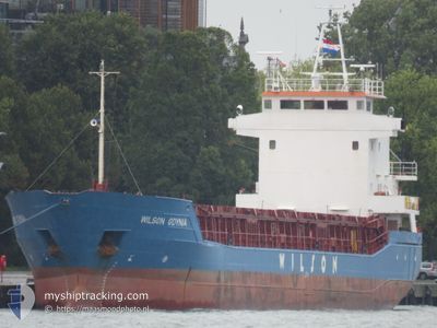
WILSON GDYNIA
General Cargo
Current Trip
| Time Travelled | 3 days |
|---|---|
| Remaining Time | 9 h, 58 mins |
| Distance Travelled | 620.58 nm |
| Remaining Distance | 119.57 nm |
| AVG Speed | 8.3 Knots |
| MAX Speed | 12.4 Knots |
| AVG Wind | 9.8 knots |
| MAX Wind | 20 knots |
| MIN Temp | 13°C / 55.4°F |
| MAX Temp | 22.8°C / 73.04°F |
| Draught | 5.7 m |
| Position Received | 2 h, 1 m ago |
Current Position
| Longitude | 16.20915° |
|---|---|
| Latitude | 54.75410° |
| Status | Under way using engine |
| Speed | 10.1 Knots |
| Course | 83.3° |
| Area | Baltic Sea |
| Station | T-AIS |
| Position Received | 2 h, 1 m ago |
Info
Information
The current position of WILSON GDYNIA is in Baltic Sea with coordinates 54.75410° / 16.20915° as reported on 2024-07-02 14:44 by AIS to our vessel tracker app. The vessel's current speed is 10.1 Knots and is heading at the port of GDANSK. The estimated time of arrival as calculated by MyShipTracking vessel tracking app is 2024-07-03 02:43 LT
The vessel WILSON GDYNIA (IMO: 9056064, MMSI: 314192000) is a General Cargo that was built in 1994 ( 30 years old ). It's sailing under the flag of [BB] Barbados.
In this page you can find informations about the vessels current position, last detected port calls, and current voyage information. If the vessels is not in coverage by AIS you will find the latest position.
The current position of WILSON GDYNIA is detected by our AIS receivers and we are not responsible for the reliability of the data. The last position was recorded while the vessel was in Coverage by the Ais receivers of our vessel tracking app.
The current draught of WILSON GDYNIA as reported by AIS is 5.7 meters
Weather
| Temperature | 15.7°C / 60.26°F |
|---|---|
| Wind Speed | 13 knots |
| Direction | 276° W |
| Pressure | 1005.7 hPa |
| Humidity | 74.8 % |
| Cloud Coverage | 100 % |
Featured Company
Last Port Calls
| Port | Arrival | Departure | Time In Port |
|---|---|---|---|
| 2024-06-27 14:53 | 2024-06-29 15:56 | 2 d | |
| 2024-06-21 06:05 | 2024-06-25 20:25 | 4 d | |
| 2024-06-07 01:15 | 2024-06-07 23:49 | 22 h | |
| 2024-06-06 04:40 | 2024-06-06 13:25 | 8 h | |
| 2024-05-25 19:06 | 2024-05-28 16:24 | 2 d | |
| 2024-05-25 17:02 | 2024-05-25 18:13 | 1 h | |
| 2024-05-18 16:48 | 2024-05-21 19:02 | 3 d | |
| 2024-05-13 12:33 | 2024-05-16 18:24 | 3 d | |
| 2024-05-08 11:18 | 2024-05-08 22:05 | 10 h | |
| 2024-05-05 13:27 | 2024-05-08 00:37 | 2 d |
Last Trips
| Origin | Departure | Destination | Arrival | Distance | |
|---|---|---|---|---|---|
| 2024-06-25 21:25 | 2024-06-27 16:53 | 289.71 nm | |||
| 2024-06-08 01:49 | 2024-06-21 07:05 | 2038.86 nm | |||
| 2024-06-06 15:25 | 2024-06-07 03:15 | 113.29 nm | |||
| 2024-05-28 18:24 | 2024-06-06 06:40 | 1886.91 nm | |||
| 2024-05-25 20:13 | 2024-05-25 21:06 | 6.33 nm | |||
| 2024-05-21 21:02 | 2024-05-25 19:02 | 853.43 nm | |||
| 2024-05-16 20:24 | 2024-05-18 18:48 | 423.50 nm | |||
| 2024-05-09 00:05 | 2024-05-13 14:33 | 1107.60 nm | |||
| 2024-05-08 02:37 | 2024-05-08 13:18 | 97.43 nm | |||
| 2024-04-30 23:40 | 2024-05-05 15:27 | 1052.97 nm |
Events
| Time | Event | Details | Position / Dest | Info |
|---|---|---|---|---|
| 2024-07-02 14:44 | OUT of Coverage |
54.75410 / 16.20915
Baltic Sea
PLGDN
|
Speed: 10.1 kn Course: 83.3° |
|
| 2024-07-02 09:59 | Detected in Sea | Polish part of the Baltic Sea |
54.63303 / 14.86142
Baltic Sea
PLGDN
|
Speed: 10.1 kn Course: 80.1° |
| 2024-07-02 08:47 | Change Sea Area | Danish part of the Kattegat German part of the Baltic Sea |
54.60518 / 14.51933
Kattegat
PLGDN
|
Speed: 9.8 kn Course: 82° |
| 2024-07-02 00:50 | Change Sea Area | German part of the Baltic Sea Danish part of the Baltic Sea |
54.58702 / 12.32791
Baltic Sea
PLGDN
|
Speed: 9.7 kn Course: 56.8° |
| 2024-07-02 00:47 | Change Sea Area | Danish part of the Baltic Sea German part of the Baltic Sea |
54.58289 / 12.31665
Baltic Sea
PLGDN
|
Speed: 9.2 kn Course: 55.5° |
| 2024-07-01 23:08 | Detected in Sea | German part of the Baltic Sea |
54.39688 / 12.06071
Baltic Sea
PLGDN
|
Speed: 10.1 kn Course: 88.9° |
| 2024-07-01 20:59 | Change Sea Area | Danish part of the Baltic Sea German part of the Baltic Sea |
54.48566 / 11.47181
Baltic Sea
PLGDN
|
Speed: 10.1 kn Course: 118.2° |
| 2024-07-01 18:20 | Detected in Sea | German part of the Baltic Sea |
54.56181 / 10.76711
Baltic Sea
PLGDN
|
Speed: 10 kn Course: 85.8° |
| 2024-07-01 17:47 | Change Sea Area | Danish part of the Baltic Sea German part of the Baltic Sea |
54.55529 / 10.61035
Baltic Sea
PLGDN
|
Speed: 9.9 kn Course: 84.5° |
| 2024-07-01 16:26 | Change Sea Area | German part of the Baltic Sea German part of the North Sea |
54.45848 / 10.27201
Baltic Sea
PLGDN
|
Speed: 9.9 kn Course: 40.9° |