

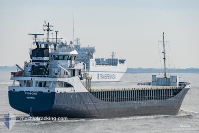
SYDBORG
General Cargo

Current Trip
| Time Travelled | 3 days |
|---|---|
| Remaining Time | 15 h, 25 mins |
| Distance Travelled | 737.56 nm |
| Remaining Distance | 106.09 nm |
| AVG Speed | 9.2 Knots |
| MAX Speed | 12.5 Knots |
| AVG Wind | 9.1 knots |
| MAX Wind | 24 knots |
| MIN Temp | 1.8°C / 35.24°F |
| MAX Temp | 12.7°C / 54.86°F |
| Draught | 5.3 m |
| Position Received | Now |
Current Position
| Longitude | --- |
|---|---|
| Latitude | --- |
| Status | Under way using engine |
| Speed | 5.7 Knots |
| Course | 226.2° |
| Area | Baltic Sea |
| Station | T-AIS |
| Position Received | Now |
Information
The current position of SYDBORG is in Baltic Sea with coordinates 53.90536° / 9.16550° as reported on 2025-03-09 19:32 by AIS to our vessel tracker app. The vessel's current speed is 5.7 Knots and is heading at the port of BREMEN. The estimated time of arrival as calculated by MyShipTracking vessel tracking app is 2025-03-10 10:58 LT
The vessel SYDBORG (IMO: 9196204, MMSI: 244901000) is a General Cargo that was built in 2000 ( 25 years old ). It's sailing under the flag of [NL] Netherlands.
In this page you can find informations about the vessels current position, last detected port calls, and current voyage information. If the vessels is not in coverage by AIS you will find the latest position.
The current position of SYDBORG is detected by our AIS receivers and we are not responsible for the reliability of the data. The last position was recorded while the vessel was in Coverage by the Ais receivers of our vessel tracking app.
The current draught of SYDBORG as reported by AIS is 5.3 meters
Weather
| Temperature | 6.1°C / 42.98°F |
|---|---|
| Wind Speed | 6 knots |
| Direction | 43° NE |
| Pressure | 1005.1 hPa |
| Humidity | 79.7 % |
| Cloud Coverage | 7 % |


Featured Company
Last Port Calls
| Port | Arrival | Departure | Time In Port |
|---|---|---|---|
| 2025-03-06 18:18 | |||
| 2025-03-02 11:27 | 2025-03-04 16:28 | 2 d | |
| 2025-02-20 20:38 | 2025-02-22 23:16 | 2 d | |
| 2025-02-15 19:27 | 2025-02-18 20:52 | 3 d | |
| 2025-02-09 10:31 | 2025-02-11 00:19 | 1 d | |
| 2025-02-05 08:28 | 2025-02-07 10:22 | 2 d | |
| 2025-02-02 07:52 | 2025-02-02 08:58 | 1 h | |
| 2025-01-30 13:14 | 2025-02-01 13:38 | 2 d | |
| 2025-01-19 08:04 | 2025-01-24 09:13 | 5 d | |
| 2025-01-14 10:30 | 2025-01-16 20:03 | 2 d |
Last Trips
| Origin | Departure | Destination | Arrival | Distance | |
|---|---|---|---|---|---|
| 2025-02-22 23:16 | 2025-03-02 12:27 | 1472.97 nm | |||
| 2025-02-18 20:52 | 2025-02-20 20:38 | 89.08 nm | |||
| 2025-02-11 01:19 | 2025-02-15 19:27 | 1021.02 nm | |||
| 2025-02-07 11:22 | 2025-02-09 11:31 | 479.10 nm | |||
| 2025-02-02 09:58 | 2025-02-05 09:28 | 517.06 nm | |||
| 2025-02-01 14:38 | 2025-02-02 08:52 | 133.40 nm | |||
| 2025-01-24 11:13 | 2025-01-30 14:14 | 1277.47 nm | |||
| 2025-01-16 21:03 | 2025-01-19 10:04 | 532.55 nm | |||
| 2025-01-07 21:04 | 2025-01-14 11:30 | 1467.38 nm | |||
| 2025-01-02 10:33 | 2025-01-03 18:39 | 229.83 nm |
Events
| Time | Event | Details | Position / Dest | Info |
|---|---|---|---|---|
| 2025-03-09 18:16 | Status Changed | Under way using engine Default |
54.02106 / 9.29851
FIKAS > DEBRE
|
Speed: 6.7 kn Course: 189° |
| 2025-03-09 18:14 | Status Changed | Default Under way using engine |
54.02502 / 9.29955
FIKAS > DEBRE
|
Speed: 6.4 kn Course: 186.6° |
| 2025-03-09 17:56 | Status Changed | Under way using engine Default |
54.05557 / 9.30785
FIKAS > DEBRE
|
Speed: 5.3 kn Course: 193° |
| 2025-03-09 17:54 | Status Changed | Default Under way using engine |
54.05875 / 9.30909
FIKAS > DEBRE
|
Speed: 6.5 kn Course: 195.6° |
| 2025-03-09 17:41 | Status Changed | Under way using engine Default |
54.08028 / 9.31902
FIKAS > DEBRE
|
Speed: 6.8 kn Course: 198° |
| 2025-03-09 17:37 | Status Changed | Default Under way using engine |
54.08717 / 9.32272
FIKAS > DEBRE
|
Speed: 6.4 kn Course: 188.3° |
| 2025-03-09 11:59 | START Moving | 1.43 nm, South West of STICKENHΟRN SPORT |
54.36680 / 10.13802
FIKAS > DEBRE
|
Speed: 4.1 kn Course: 282° |
| 2025-03-09 11:23 | STOP Moving | 1.36 nm, South West of STICKENHΟRN SPORT |
54.36635 / 10.14134
FIKAS > DEBRE
|
Speed: 0.3 kn Course: 284° |
| 2025-03-09 08:59 | Change Sea Area | German part of the Baltic Sea Danish part of the Baltic Sea |
54.56195 / 10.55656
Baltic Sea
FIKAS > DEBRE
|
Speed: 10.8 kn Course: 246° |
| 2025-03-09 08:11 | Change Sea Area | Danish part of the Baltic Sea German part of the Baltic Sea |
54.58364 / 10.80323
Baltic Sea
FIKAS > DEBRE
|
Speed: 10.6 kn Course: 263.3° |