
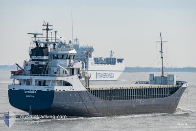
SYDBORG
General Cargo
Current Trip
| Time Travelled | 19 h, 6 mins |
|---|---|
| Remaining Time | 1 h, 20 mins |
| Distance Travelled | 192.15 nm |
| Remaining Distance | 16.97 nm |
| AVG Speed | 10.8 Knopen |
| MAX Speed | 12 Knopen |
| AVG Wind | 10.8 knots |
| MAX Wind | 14.7 knots |
| MIN Temp | -2°C / 28.4°F |
| MAX Temp | -0.3°C / 31.46°F |
| Diepgang | 3.5 M |
| Positie ontvangen | 6 m geleden |
Current Position
| Lengtegraad | --- |
|---|---|
| Breedtegraat | --- |
| Status | Under way using engine |
| Snelheid | 10.9 Knopen |
| Koers | 54° |
| Gebied | Gulf of Finland |
| Station | T-AIS |
| Positie ontvangen | 6 m geleden |
Info
Information
The current position of SYDBORG is in Gulf of Finland with coordinates 60.25772° / 26.84936° as reported on 2025-12-13 07:57 by AIS to our vessel tracker app. The vessel's current speed is 10.9 Knopen and is heading at the port of KOTKA. The estimated time of arrival as calculated by MyShipTracking vessel tracking app is 2025-12-13 11:23 LT
The vessel SYDBORG (IMO: 9196204, MMSI: 244901000) is a General Cargo that was built in 2000 ( 25 Jaar oud ). It's sailing under the flag of [NL] Netherlands.
In this page you can find informations about the vessels current position, last detected port calls, and current voyage information. If the vessels is not in coverage by AIS you will find the latest position.
The current position of SYDBORG is detected by our AIS receivers and we are not responsible for the reliability of the data. The last position was recorded while the vessel was in Coverage by the Ais receivers of our vessel tracking app.
The current draught of SYDBORG as reported by AIS is 3.5 meters
Weather
| Temperature | -2°C / 28.4°F |
|---|---|
| Wind Speed | 9 knots |
| Direction | 2° N |
| Pressure | 1028.4 hPa |
| Humidity | 60.4 % |
| Cloud Coverage | 100 % |
Featured Company
Last Port Calls
| Port | Arrival | Departure | Time In Port |
|---|---|---|---|
| 2025-12-11 10:09 | 2025-12-12 14:57 | 1 d | |
| 2025-12-08 16:23 | 2025-12-09 13:19 | 20 h | |
| 2025-12-07 10:20 | 2025-12-07 10:25 | 4 m | |
| 2025-12-04 11:28 | 2025-12-06 02:57 | 1 d | |
| 2025-11-21 22:13 | 2025-11-25 07:24 | 3 d | |
| 2025-11-18 20:58 | 2025-11-20 11:46 | 1 d | |
| 2025-11-09 10:55 | 2025-11-14 09:01 | 4 d | |
| 2025-11-07 10:39 | 2025-11-07 16:35 | 5 h | |
| 2025-11-06 02:52 | 2025-11-06 04:37 | 1 h | |
| 2025-11-01 17:32 | 2025-11-04 22:36 | 3 d |
Most Visited Ports (Last year)
| Port | Arrivals | |
|---|---|---|
| 5 | ||
| 5 | ||
| 4 | ||
| 3 | ||
| 3 | ||
| 2 |
Last Trips
| Origin | Departure | Destination | Arrival | Distance | |
|---|---|---|---|---|---|
| 2025-12-09 13:19 | 2025-12-11 10:09 | 402.40 nm | |||
| 2025-12-07 10:25 | 2025-12-08 16:23 | 224.50 nm | |||
| 2025-12-06 02:57 | 2025-12-07 10:20 | 278.68 nm | |||
| 2025-11-25 07:24 | 2025-12-04 11:28 | 1323.32 nm | |||
| 2025-11-20 11:46 | 2025-11-21 22:13 | 368.00 nm | |||
| 2025-11-14 09:01 | 2025-11-18 20:58 | 349.30 nm | |||
| 2025-11-07 16:35 | 2025-11-09 10:55 | 401.05 nm | |||
| 2025-11-06 04:37 | 2025-11-07 10:39 | 272.63 nm | |||
| 2025-11-04 22:36 | 2025-11-06 02:52 | 229.11 nm | |||
| 2025-10-31 16:59 | 2025-11-01 17:32 | 282.66 nm |
Events
| Tijd | Evenement | Details | Positie / Bestemming | Info |
|---|---|---|---|---|
| 2025-12-13 05:34 | Status Changed | Under way using engine Default |
60.02320 / 26.21195
FIKTK
|
Snelheid: 9.6 kn Koers: 56° |
| 2025-12-13 05:33 | Status Changed | Default Under way using engine |
60.02116 / 26.20596
FIKTK
|
Snelheid: 9.6 kn Koers: 55.7° |
| 2025-12-13 04:36 | Destination Changed | FIKTK FIKTU |
59.92956 / 25.96100
FIKTK
|
Snelheid: 9.6 kn Koers: 53.4° |
| 2025-12-13 03:41 | Wijzig zee gebeid | Finnish part of the Gulf of Finland Estonian part of the Gulf of Finland |
59.87102 / 25.70210
Gulf of Finland
FIKTU
|
Snelheid: 9.8 kn Koers: 79.5° |
| 2025-12-12 23:29 | Wijzig zee gebeid | Estonian part of the Gulf of Finland Finnish part of the Gulf of Finland |
59.72991 / 24.38785
Gulf of Finland
FIKTU
|
Snelheid: 9.6 kn Koers: 78.5° |
| 2025-12-12 23:18 | ETA Changed | 2025/12/13 09:00 2025/12/13 11:00 |
59.72407 / 24.33118
FIKTU
|
Snelheid: 9.5 kn Koers: 77.3° |
| 2025-12-12 23:10 | Status Changed | Under way using engine Default |
59.72048 / 24.29435
FIKTU
|
Snelheid: 9.6 kn Koers: 84° |
| 2025-12-12 23:05 | Status Changed | Default Under way using engine |
59.71903 / 24.26462
FIKTU
|
Snelheid: 9.6 kn Koers: 87.7° |
| 2025-12-12 23:00 | Status Changed | Under way using engine Default |
59.71838 / 24.23738
FIKTU
|
Snelheid: 9.6 kn Koers: 88° |
| 2025-12-12 22:53 | Status Changed | Default Under way using engine |
59.71752 / 24.20208
FIKTU
|
Snelheid: 9.6 kn Koers: 87.2° |