
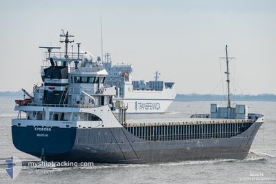
SYDBORG
General Cargo
Current Trip
| Time Travelled | 3 days |
|---|---|
| Remaining Time | --- |
| Distance Travelled | 759.24 nm |
| Remaining Distance | --- |
| AVG Speed | 8.5 Noeuds |
| MAX Speed | 12.3 Noeuds |
| AVG Wind | 8.9 knots |
| MAX Wind | 30 knots |
| MIN Temp | 1.2°C / 34.16°F |
| MAX Temp | 9.6°C / 49.28°F |
| Tirant d eau | 5.3 m |
| Position reçue | Maintenant |
Current Position
| Longitude | 2.38933° |
|---|---|
| Latitude | 51.84361° |
| Etat | Under way using engine |
| Vitesse | 4 Noeuds |
| Parcours | 284° |
| Zone | North Sea |
| Station | T-AIS |
| Position reçue | Maintenant |
Info
Information
The current position of SYDBORG is in North Sea with coordinates 51.84361° / 2.38933° as reported on 2024-04-19 17:40 by AIS to our vessel tracker app. The vessel's current speed is 4 Noeuds and is heading at the port of BRUGGE. The estimated time of arrival as calculated by MyShipTracking vessel tracking app is 2024-04-20 10:00 LT
The vessel SYDBORG (IMO: 9196204, MMSI: 244901000) is a General Cargo that was built in 2000 ( 24 Age ). It's sailing under the flag of [NL] Netherlands.
In this page you can find informations about the vessels current position, last detected port calls, and current voyage information. If the vessels is not in coverage by AIS you will find the latest position.
The current position of SYDBORG is detected by our AIS receivers and we are not responsible for the reliability of the data. The last position was recorded while the vessel was in Coverage by the Ais receivers of our vessel tracking app.
The current draught of SYDBORG as reported by AIS is 5.3 meters
Weather
| Temperature | 8.2°C / 46.76°F |
|---|---|
| Wind Speed | 29 knots |
| Direction | 342° NNW |
| Pressure | 1017 hPa |
| Humidity | 67.7 % |
| Cloud Coverage | 45 % |
Featured Company
Last Port Calls
| Port | Arrival | Departure | Time In Port |
|---|---|---|---|
| 2024-04-13 02:59 | 2024-04-16 09:18 | 3 d | |
| 2024-04-08 10:36 | 2024-04-09 16:12 | 1 d | |
| 2024-04-06 10:46 | 2024-04-08 10:16 | 1 d | |
| 2024-03-31 17:09 | 2024-04-02 17:44 | 2 d | |
| 2024-03-27 15:23 | 2024-03-28 17:34 | 1 d | |
| 2024-03-21 08:58 | 2024-03-22 20:47 | 1 d | |
| 2024-03-17 18:47 | 2024-03-20 18:36 | 2 d | |
| 2024-03-07 10:00 | 2024-03-08 18:29 | 1 d | |
| 2024-02-29 08:11 | 2024-03-01 16:05 | 1 d | |
| 2024-02-27 08:32 | 2024-02-28 02:23 | 17 h |
Last Trips
| Origin | Departure | Destination | Arrival | Distance | |
|---|---|---|---|---|---|
| 2024-04-09 18:12 | 2024-04-13 05:59 | 782.08 nm | |||
| 2024-04-08 12:16 | 2024-04-08 12:36 | 0.07 nm | |||
| 2024-04-02 18:44 | 2024-04-06 12:46 | 309.01 nm | |||
| 2024-03-28 18:34 | 2024-03-31 18:09 | 737.40 nm | |||
| 2024-03-22 21:47 | 2024-03-27 16:23 | 792.08 nm | |||
| 2024-03-20 19:36 | 2024-03-21 09:58 | 120.68 nm | |||
| 2024-03-08 20:29 | 2024-03-17 19:47 | 1359.90 nm | |||
| 2024-03-01 17:05 | 2024-03-07 12:00 | 759.71 nm | |||
| 2024-02-28 03:23 | 2024-02-29 09:11 | 333.18 nm | |||
| 2024-02-24 16:23 | 2024-02-27 09:32 | 666.26 nm |
Events
| Heure | Evenement | Détails | Position/ Destination | Info |
|---|---|---|---|---|
| 2024-04-19 16:34 | Changement de zone | United Kingdom part of the North Sea Dutch part of the North Sea |
51.89203 / 2.55342
North Sea
LTKLJ>BEBGS
|
Vitesse: 8.9 kn Parcours: 236.1° |
| 2024-04-19 16:06 | Changement d'ETA | 2024/04/20 10:00 2024/04/19 18:00 |
51.94046 / 2.63320
LTKLJ>BEBGS
|
Vitesse: 9.1 kn Parcours: 218.6° |
| 2024-04-19 15:04 | Dans la zone couverte |
52.04091 / 2.80897
North Sea
LTKLJ>BEBGS
|
Vitesse: 8.6 kn Parcours: 233.5° |
|
| 2024-04-19 06:13 | Hors de la zone couverte |
53.09002 / 4.23448
North Sea
LTKLJ>BEBGS
|
Vitesse: 9.6 kn Parcours: 224.3° |
|
| 2024-04-19 05:52 | Dans la zone couverte |
53.12331 / 4.28885
North Sea
LTKLJ>BEBGS
|
Vitesse: 9.6 kn Parcours: 226.5° |
|
| 2024-04-19 03:17 | Hors de la zone couverte |
53.45017 / 4.62251
North Sea
LTKLJ>BEBGS
|
Vitesse: 7.5 kn Parcours: 210.8° |
|
| 2024-04-18 21:12 | Dans la zone couverte |
53.70764 / 5.79931
North Sea
LTKLJ>BEBGS
|
Vitesse: 9.6 kn Parcours: 249.1° |
|
| 2024-04-18 19:52 | Hors de la zone couverte |
53.77574 / 6.15424
North Sea
LTKLJ>BEBGS
|
Vitesse: 9.5 kn Parcours: 252.4° |
|
| 2024-04-18 19:47 | Detecté en mer | Dutch part of the North Sea |
53.78040 / 6.17741
North Sea
LTKLJ>BEBGS
|
Vitesse: 9.4 kn Parcours: 250° |
| 2024-04-18 14:13 | Dans la zone couverte |
53.99776 / 7.56249
North Sea
LTKLJ>BEBGS
|
Vitesse: 9.8 kn Parcours: 255° |