
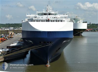
GOLIATH LEADER
Vehicles Carrier
Current Trip
| Time Travelled | 15 days |
|---|---|
| Remaining Time | 23 h, 22 mins |
| Distance Travelled | 5453.61 nm |
| Remaining Distance | 306.50 nm |
| AVG Speed | 14.6 Knots |
| MAX Speed | 18.6 Knots |
| AVG Wind | 13.1 knots |
| MAX Wind | 34.2 knots |
| MIN Temp | 15.6°C / 60.08°F |
| MAX Temp | 29.6°C / 85.28°F |
| Draught | 9.4 m |
| Position Received | 11 m ago |
Current Position
| Longitude | -11.32298° |
|---|---|
| Latitude | 37.67154° |
| Status | Under way using engine |
| Speed | 12.9 Knots |
| Course | 17.6° |
| Area | North Atlantic Ocean |
| Station | T-AIS |
| Position Received | 11 m ago |
Info
Information
The current position of GOLIATH LEADER is in North Atlantic Ocean with coordinates 37.67154° / -11.32298° as reported on 2024-05-11 14:01 by AIS to our vessel tracker app. The vessel's current speed is 12.9 Knots and is heading at the port of VIGO. The estimated time of arrival as calculated by MyShipTracking vessel tracking app is 2024-05-12 13:35 LT
The vessel GOLIATH LEADER (IMO: 9357315, MMSI: 308369000) is a Vehicles Carrier that was built in 2008 ( 16 years old ). It's sailing under the flag of [BS] Bahamas.
In this page you can find informations about the vessels current position, last detected port calls, and current voyage information. If the vessels is not in coverage by AIS you will find the latest position.
The current position of GOLIATH LEADER is detected by our AIS receivers and we are not responsible for the reliability of the data. The last position was recorded while the vessel was in Coverage by the Ais receivers of our vessel tracking app.
The current draught of GOLIATH LEADER as reported by AIS is 9.4 meters
Weather
| Temperature | 16.7°C / 62.06°F |
|---|---|
| Wind Speed | 17 knots |
| Direction | 348° NNW |
| Pressure | 1019.5 hPa |
| Humidity | 83.9 % |
| Cloud Coverage | 1 % |
Featured Company
Last Port Calls
| Port | Arrival | Departure | Time In Port |
|---|---|---|---|
| 2024-04-24 09:31 | 2024-04-25 20:11 | 1 d | |
| 2024-04-23 05:09 | 2024-04-23 18:18 | 13 h | |
| 2024-04-19 05:44 | 2024-04-22 12:31 | 3 d | |
| 2024-04-13 18:53 | 2024-04-14 15:15 | 20 h | |
| 2024-04-10 02:16 | 2024-04-11 11:48 | 1 d | |
| 2024-04-03 01:22 | 2024-04-03 06:44 | 5 h | |
| 2024-03-29 16:01 | 2024-03-30 12:05 | 20 h | |
| 2024-03-15 04:18 | 2024-03-18 07:49 | 3 d | |
| 2024-03-13 09:06 | 2024-03-14 07:02 | 21 h | |
| 2024-03-12 09:25 | 2024-03-13 07:57 | 22 h |
Last Trips
| Origin | Departure | Destination | Arrival | Distance | |
|---|---|---|---|---|---|
| 2024-04-23 20:18 | 2024-04-24 11:31 | 140.65 nm | |||
| 2024-04-22 14:31 | 2024-04-23 07:09 | 262.76 nm | |||
| 2024-04-14 18:15 | 2024-04-19 07:44 | 1619.67 nm | |||
| 2024-04-11 14:48 | 2024-04-13 21:53 | 300.52 nm | |||
| 2024-04-03 12:14 | 2024-04-10 05:16 | 2682.89 nm | |||
| 2024-03-30 20:05 | 2024-04-03 06:52 | 1451.10 nm | |||
| 2024-03-18 16:49 | 2024-03-30 00:01 | 2839.57 nm | |||
| 2024-03-14 16:02 | 2024-03-15 13:18 | 260.72 nm | |||
| 2024-03-13 16:57 | 2024-03-13 18:06 | 10.57 nm | |||
| 2024-03-11 17:20 | 2024-03-12 18:25 | 364.88 nm |
Events
| Time | Event | Details | Position / Dest | Info |
|---|---|---|---|---|
| 2024-05-11 14:06 | Status Changed | Default Under way using engine |
37.68835 / -11.31532
ES VGO
|
Speed: 12.9 kn Course: 17.6° |
| 2024-05-11 13:53 | Status Changed | Under way using engine Default |
37.64122 / -11.33546
ES VGO
|
Speed: 12.8 kn Course: 17° |
| 2024-05-11 13:50 | Status Changed | Default Under way using engine |
37.63099 / -11.33954
ES VGO
|
Speed: 12.9 kn Course: 14.7° |
| 2024-05-11 13:32 | Status Changed | Under way using engine Default |
37.57042 / -11.36048
ES VGO
|
Speed: 12.8 kn Course: 14° |
| 2024-05-11 13:23 | Status Changed | Default Under way using engine |
37.53735 / -11.37111
ES VGO
|
Speed: 12.9 kn Course: 15.5° |
| 2024-05-11 13:11 | Status Changed | Under way using engine Default |
37.49631 / -11.38468
ES VGO
|
Speed: 12.9 kn Course: 15° |
| 2024-05-11 13:06 | Status Changed | Default Under way using engine |
37.48120 / -11.38970
ES VGO
|
Speed: 12.9 kn Course: 14.1° |
| 2024-05-11 12:30 | Status Changed | Under way using engine Default |
37.35537 / -11.43262
ES VGO
|
Speed: 12.8 kn Course: 18° |
| 2024-05-11 12:08 | Status Changed | Default Under way using engine |
37.28046 / -11.46482
ES VGO
|
Speed: 12.9 kn Course: 18.6° |
| 2024-05-11 11:32 | Status Changed | Under way using engine Default |
37.15563 / -11.51694
ES VGO
|
Speed: 12.9 kn Course: 18° |