
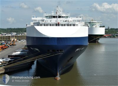
GOLIATH LEADER
Vehicles Carrier
Current Trip
| Time Travelled | 13 h, 23 mins |
|---|---|
| Remaining Time | 4 days |
| Distance Travelled | 98.28 nm |
| Remaining Distance | 1038.72 nm |
| AVG Speed | 10.6 Noeuds |
| MAX Speed | 13.3 Noeuds |
| AVG Wind | 13.9 knots |
| MAX Wind | 19 knots |
| MIN Temp | 11.1°C / 51.98°F |
| MAX Temp | 13.8°C / 56.84°F |
| Tirant d eau | 9.1 m |
| Position reçue | 4 h, 58 m depuis |
Current Position
| Longitude | -9.57364° |
|---|---|
| Latitude | 42.61038° |
| Etat | Under way using engine |
| Vitesse | 7.8 Noeuds |
| Parcours | 336.3° |
| Zone | North Atlantic Ocean |
| Station | T-AIS |
| Position reçue | 4 h, 58 m depuis |
Info
Information
The current position of GOLIATH LEADER is in North Atlantic Ocean with coordinates 42.61038° / -9.57364° as reported on 2024-05-15 12:51 by AIS to our vessel tracker app. The vessel's current speed is 7.8 Noeuds and is heading at the port of BREMERHAVEN. The estimated time of arrival as calculated by MyShipTracking vessel tracking app is 2024-05-20 10:45 LT
The vessel GOLIATH LEADER (IMO: 9357315, MMSI: 308369000) is a Vehicles Carrier that was built in 2008 ( 16 Age ). It's sailing under the flag of [BS] Bahamas.
In this page you can find informations about the vessels current position, last detected port calls, and current voyage information. If the vessels is not in coverage by AIS you will find the latest position.
The current position of GOLIATH LEADER is detected by our AIS receivers and we are not responsible for the reliability of the data. The last position was recorded while the vessel was in Coverage by the Ais receivers of our vessel tracking app.
The current draught of GOLIATH LEADER as reported by AIS is 9.1 meters
Weather
| Temperature | 13.4°C / 56.12°F |
|---|---|
| Wind Speed | 19 knots |
| Direction | 283° WNW |
| Pressure | 1009.5 hPa |
| Humidity | 70.4 % |
| Cloud Coverage | 88 % |
Featured Company
Last Port Calls
| Port | Arrival | Departure | Time In Port |
|---|---|---|---|
| 2024-05-13 18:17 | 2024-05-15 04:27 | 1 d | |
| 2024-04-24 09:31 | 2024-04-25 20:11 | 1 d | |
| 2024-04-23 05:09 | 2024-04-23 18:18 | 13 h | |
| 2024-04-19 05:44 | 2024-04-22 12:31 | 3 d | |
| 2024-04-13 18:53 | 2024-04-14 15:15 | 20 h | |
| 2024-04-10 02:16 | 2024-04-11 11:48 | 1 d | |
| 2024-04-03 01:22 | 2024-04-03 06:44 | 5 h | |
| 2024-03-29 16:01 | 2024-03-30 12:05 | 20 h | |
| 2024-03-15 04:18 | 2024-03-18 07:49 | 3 d | |
| 2024-03-13 09:06 | 2024-03-14 07:02 | 21 h |
Last Trips
| Origin | Departure | Destination | Arrival | Distance | |
|---|---|---|---|---|---|
| 2024-04-25 22:11 | 2024-05-13 20:17 | 5809.22 nm | |||
| 2024-04-23 20:18 | 2024-04-24 11:31 | 140.65 nm | |||
| 2024-04-22 14:31 | 2024-04-23 07:09 | 262.76 nm | |||
| 2024-04-14 18:15 | 2024-04-19 07:44 | 1619.67 nm | |||
| 2024-04-11 14:48 | 2024-04-13 21:53 | 300.52 nm | |||
| 2024-04-03 12:14 | 2024-04-10 05:16 | 2682.89 nm | |||
| 2024-03-30 20:05 | 2024-04-03 06:52 | 1451.10 nm | |||
| 2024-03-18 16:49 | 2024-03-30 00:01 | 2839.57 nm | |||
| 2024-03-14 16:02 | 2024-03-15 13:18 | 260.72 nm | |||
| 2024-03-13 16:57 | 2024-03-13 18:06 | 10.57 nm |
Events
| Heure | Evenement | Détails | Position/ Destination | Info |
|---|---|---|---|---|
| 2024-05-15 12:58 | Etat Changé | Default Under way using engine |
42.62396 / -9.58237
DE BRV
|
Vitesse: 7.8 kn Parcours: 336.3° |
| 2024-05-15 12:51 | Hors de la zone couverte |
42.61038 / -9.57364
North Atlantic Ocean
DE BRV
|
Vitesse: 7.8 kn Parcours: 336.3° |
|
| 2024-05-15 12:42 | Etat Changé | Under way using engine Default |
42.59170 / -9.56174
DE BRV
|
Vitesse: 7.9 kn Parcours: 338° |
| 2024-05-15 12:32 | Etat Changé | Default Under way using engine |
42.57135 / -9.54914
DE BRV
|
Vitesse: 8.6 kn Parcours: 335.4° |
| 2024-05-15 12:28 | Etat Changé | Under way using engine Default |
42.56112 / -9.54264
DE BRV
|
Vitesse: 8.5 kn Parcours: 337° |
| 2024-05-15 12:22 | Etat Changé | Default Under way using engine |
42.54985 / -9.53546
DE BRV
|
Vitesse: 7.8 kn Parcours: 333.5° |
| 2024-05-15 12:14 | Etat Changé | Under way using engine Default |
42.53162 / -9.52320
DE BRV
|
Vitesse: 8.9 kn Parcours: 333° |
| 2024-05-15 12:10 | Etat Changé | Default Under way using engine |
42.52451 / -9.51803
DE BRV
|
Vitesse: 7.8 kn Parcours: 331.6° |
| 2024-05-15 12:03 | Etat Changé | Under way using engine Default |
42.50933 / -9.50704
DE BRV
|
Vitesse: 8.9 kn Parcours: 330° |
| 2024-05-15 12:03 | Dans la zone couverte |
42.50933 / -9.50704
North Atlantic Ocean
DE BRV
|
Vitesse: 7.8 kn Parcours: 331.6° |