
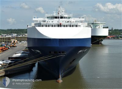
GOLIATH LEADER
Vehicles Carrier
Current Trip
| Time Travelled | 14 days |
|---|---|
| Remaining Time | 1 day |
| Distance Travelled | 5212.92 nm |
| Remaining Distance | 551.20 nm |
| AVG Speed | 14.7 Knop |
| MAX Speed | 18.6 Knop |
| AVG Wind | 12.9 knots |
| MAX Wind | 34.2 knots |
| MIN Temp | 15.6°C / 60.08°F |
| MAX Temp | 29.6°C / 85.28°F |
| Djupgående | 9.4 m |
| Position mottagen | 1 m sen |
Current Position
| Longitud | -12.79097° |
|---|---|
| Latitude | 33.87152° |
| Status | Under way using engine |
| Fart | 13.1 Knop |
| Kurs | 16.4° |
| Område | North Atlantic Ocean |
| Station | T-AIS |
| Position mottagen | 1 m sen |
Info
Information
The current position of GOLIATH LEADER is in North Atlantic Ocean with coordinates 33.87152° / -12.79097° as reported on 2024-05-10 19:30 by AIS to our vessel tracker app. The vessel's current speed is 13.1 Knop and is heading at the port of VIGO. The estimated time of arrival as calculated by MyShipTracking vessel tracking app is 2024-05-12 14:12 LT
The vessel GOLIATH LEADER (IMO: 9357315, MMSI: 308369000) is a Vehicles Carrier that was built in 2008 ( 16 År gammal ). It's sailing under the flag of [BS] Bahamas.
In this page you can find informations about the vessels current position, last detected port calls, and current voyage information. If the vessels is not in coverage by AIS you will find the latest position.
The current position of GOLIATH LEADER is detected by our AIS receivers and we are not responsible for the reliability of the data. The last position was recorded while the vessel was in Coverage by the Ais receivers of our vessel tracking app.
The current draught of GOLIATH LEADER as reported by AIS is 9.4 meters
Weather
| Temperature | 18.8°C / 65.84°F |
|---|---|
| Wind Speed | 16 knots |
| Direction | --- N |
| Pressure | 1016 hPa |
| Humidity | 84.9 % |
| Cloud Coverage | --- |
Featured Company
Last Port Calls
| Port | Arrival | Departure | Time In Port |
|---|---|---|---|
| 2024-04-24 09:31 | 2024-04-25 20:11 | 1 d | |
| 2024-04-23 05:09 | 2024-04-23 18:18 | 13 h | |
| 2024-04-19 05:44 | 2024-04-22 12:31 | 3 d | |
| 2024-04-13 18:53 | 2024-04-14 15:15 | 20 h | |
| 2024-04-10 02:16 | 2024-04-11 11:48 | 1 d | |
| 2024-04-03 01:22 | 2024-04-03 06:44 | 5 h | |
| 2024-03-29 16:01 | 2024-03-30 12:05 | 20 h | |
| 2024-03-15 04:18 | 2024-03-18 07:49 | 3 d | |
| 2024-03-13 09:06 | 2024-03-14 07:02 | 21 h | |
| 2024-03-12 09:25 | 2024-03-13 07:57 | 22 h |
Last Trips
| Origin | Departure | Destination | Arrival | Distance | |
|---|---|---|---|---|---|
| 2024-04-23 20:18 | 2024-04-24 11:31 | 140.65 nm | |||
| 2024-04-22 14:31 | 2024-04-23 07:09 | 262.76 nm | |||
| 2024-04-14 18:15 | 2024-04-19 07:44 | 1619.67 nm | |||
| 2024-04-11 14:48 | 2024-04-13 21:53 | 300.52 nm | |||
| 2024-04-03 12:14 | 2024-04-10 05:16 | 2682.89 nm | |||
| 2024-03-30 20:05 | 2024-04-03 06:52 | 1451.10 nm | |||
| 2024-03-18 16:49 | 2024-03-30 00:01 | 2839.57 nm | |||
| 2024-03-14 16:02 | 2024-03-15 13:18 | 260.72 nm | |||
| 2024-03-13 16:57 | 2024-03-13 18:06 | 10.57 nm | |||
| 2024-03-11 17:20 | 2024-03-12 18:25 | 364.88 nm |
Events
| Tid | Event | Detaljer | Position / Dest | Information |
|---|---|---|---|---|
| 2024-05-10 19:22 | Status ändrad | Under way using engine Default |
33.84365 / -12.80105
ES VGO
|
Fart: 12.8 kn Kurs: 17° |
| 2024-05-10 19:15 | Status ändrad | Default Under way using engine |
33.82130 / -12.80911
ES VGO
|
Fart: 12.8 kn Kurs: 17.1° |
| 2024-05-10 18:47 | Status ändrad | Under way using engine Default |
33.72511 / -12.84535
ES VGO
|
Fart: 12.7 kn Kurs: 18° |
| 2024-05-10 18:42 | Status ändrad | Default Under way using engine |
33.71093 / -12.85077
ES VGO
|
Fart: 12.6 kn Kurs: 18.7° |
| 2024-05-10 18:31 | Status ändrad | Under way using engine Default |
33.67338 / -12.86508
ES VGO
|
Fart: 12.6 kn Kurs: 16° |
| 2024-05-10 18:30 | Status ändrad | Default Under way using engine |
33.67049 / -12.86607
ES VGO
|
Fart: 12.6 kn Kurs: 16.7° |
| 2024-05-10 10:17 | Byter havsområde | Portuguese (Madeira) part of the North Atlantic Ocean Spanish (Canary Islands) part of the North Atlantic Ocean |
31.97124 / -13.50269
North Atlantic Ocean
ES VGO
|
Fart: 13 kn Kurs: 16.9° |
| 2024-05-09 12:26 | Status ändrad | Under way using engine Default |
27.46942 / -15.18219
ES VGO
|
Fart: 13 kn Kurs: 19° |
| 2024-05-09 12:18 | Status ändrad | Default Under way using engine |
27.44411 / -15.19211
ES VGO
|
Fart: 13.1 kn Kurs: 19.2° |
| 2024-05-09 12:18 | Status ändrad | Under way using engine Default |
27.44130 / -15.19321
ES VGO
|
Fart: 13.1 kn Kurs: 17° |