
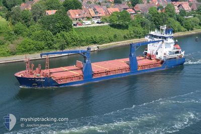
OPTIMA
General Cargo
Current Trip
ESCAS
| Time Travelled | 12 days |
|---|---|
| Remaining Time | --- |
| Distance Travelled | 1800.64 nm |
| Remaining Distance | --- |
| AVG Speed | 8.8 Knop |
| MAX Speed | 12.8 Knop |
| AVG Wind | 13.5 knots |
| MAX Wind | 31 knots |
| MIN Temp | 4.3°C / 39.74°F |
| MAX Temp | 17.5°C / 63.5°F |
| Djupgående | 8.4 m |
| Position mottagen | 3 d sen |
Current Position
| Longitud | --- |
|---|---|
| Latitude | --- |
| Status | Under way using engine |
| Fart | 10.9 Knop |
| Kurs | 87.2° |
| Område | North Atlantic Ocean |
| Station | T-AIS |
| Position mottagen | 3 d sen |
Info
Information
The current position of OPTIMA is in North Atlantic Ocean with coordinates 52.51066° / -10.15926° as reported on 2026-03-31 04:45 by AIS to our vessel tracker app. The vessel's current speed is 10.9 Knop
The vessel OPTIMA (IMO: 9210244, MMSI: 305162000) is a General Cargo that was built in 2000 ( 26 År gammal ). It's sailing under the flag of [AG] Antigua Barbuda.
In this page you can find informations about the vessels current position, last detected port calls, and current voyage information. If the vessels is not in coverage by AIS you will find the latest position.
The current position of OPTIMA is detected by our AIS receivers and we are not responsible for the reliability of the data. The last position was recorded while the vessel was in Coverage by the Ais receivers of our vessel tracking app.
The current draught of OPTIMA as reported by AIS is 8.4 meters
Weather
| Temperature | 11.2°C / 52.16°F |
|---|---|
| Wind Speed | 25 knots |
| Direction | 245° WSW |
| Pressure | 1004.5 hPa |
| Humidity | 92.6 % |
| Cloud Coverage | 100 % |
Featured Company
Last Port Calls
| Port | Arrival | Departure | Time In Port |
|---|---|---|---|
| 2026-03-19 20:33 | 2026-03-21 17:25 | 1 d | |
| 2026-03-03 08:25 | 2026-03-03 11:08 | 2 h | |
| 2026-02-23 20:25 | 2026-02-26 03:03 | 2 d | |
| 2026-02-17 16:40 | 2026-02-17 16:42 | 2 m | |
| 2026-02-06 17:17 | 2026-02-08 07:52 | 1 d |
Most Visited Ports (Last year)
| Port | Arrivals | |
|---|---|---|
| 6 | ||
| 4 | ||
| 3 | ||
| 3 | ||
| 2 | ||
| 2 |
Last Trips
| Origin | Departure | Destination | Arrival | Distance | |
|---|---|---|---|---|---|
| 2026-03-03 11:08 | 2026-03-19 20:33 | 2110.70 nm | |||
| 2026-02-26 03:03 | 2026-03-03 08:25 | 824.20 nm | |||
| 2026-02-17 16:42 | 2026-02-23 20:25 | 1137.54 nm | |||
| 2026-02-08 07:52 | 2026-02-17 16:40 | 1927.02 nm | |||
| 2026-01-28 18:30 | 2026-02-06 17:17 | 272.90 nm |
Events
| Tid | Event | Detaljer | Position / Dest | Information |
|---|---|---|---|---|
| 2026-04-02 19:35 | STOPPAR förflyttning | --- |
52.59903 / -9.55219
ESCAS
|
Fart: 0.2 kn Kurs: 157° |
| 2026-03-31 07:23 | STOPPAR förflyttning | --- |
52.59899 / -9.55403
ESCAS
|
Fart: 0.3 kn Kurs: 124° |
| 2026-03-31 04:51 | Status ändrad | Default Under way using engine |
52.51228 / -10.12714
ESCAS
|
Fart: 10.9 kn Kurs: 87.2° |
| 2026-03-31 04:45 | Status ändrad | Under way using engine Default |
52.51066 / -10.15926
ESCAS
|
Fart: 11.6 kn Kurs: 99° |
| 2026-03-31 04:45 | UTANFÖR täckningsområde |
52.51066 / -10.15926
North Atlantic Ocean
|
Fart: 10.9 kn Kurs: 87.2° |
|
| 2026-03-31 04:40 | I täckningsområde |
52.51066 / -10.15926
North Atlantic Ocean
|
Fart: 10.9 kn Kurs: 87.2° |
|
| 2026-03-31 00:03 | Status ändrad | Default Under way using engine |
51.80689 / -10.93355
ESCAS
|
Fart: 10.8 kn Kurs: 342.7° |
| 2026-03-30 23:59 | UTANFÖR täckningsområde |
51.79382 / -10.93051
North Atlantic Ocean
|
Fart: 10.8 kn Kurs: 342.7° |
|
| 2026-03-30 23:49 | Status ändrad | Under way using engine Default |
51.76527 / -10.92455
ESCAS
|
Fart: 10.2 kn Kurs: 0° |
| 2026-03-30 23:12 | Status ändrad | Default Under way using engine |
51.66453 / -10.87991
ESCAS
|
Fart: 10.4 kn Kurs: 349.7° |