

EEBORG
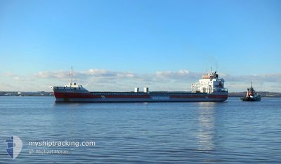
General Cargo

Current Trip
ESCOUMIN
| Time Travelled | 6 days |
|---|---|
| Remaining Time | --- |
| Distance Travelled | 1477.22 nm |
| Remaining Distance | --- |
| AVG Speed | 9.8 Knop |
| MAX Speed | 13.8 Knop |
| AVG Wind | 13.4 knots |
| MAX Wind | 31 knots |
| MIN Temp | -1.9°C / 28.58°F |
| MAX Temp | 8.3°C / 46.94°F |
| Djupgående | 7.2 m |
| Position mottagen | 1 d sen |
Current Position
| Longitud | --- |
|---|---|
| Latitude | --- |
| Status | Under way using engine |
| Fart | 7.1 Knop |
| Kurs | 280.3° |
| Område | North Sea |
| Station | T-AIS |
| Position mottagen | 1 d sen |
Information
The current position of EEBORG is in North Sea with coordinates 58.06297° / 4.17125° as reported on 2025-03-28 14:39 by AIS to our vessel tracker app. The vessel's current speed is 7.1 Knop
The vessel EEBORG (IMO: 9568328, MMSI: 246846000) is a General Cargo that was built in 2012 ( 13 År gammal ). It's sailing under the flag of [NL] Netherlands.
In this page you can find informations about the vessels current position, last detected port calls, and current voyage information. If the vessels is not in coverage by AIS you will find the latest position.
The current position of EEBORG is detected by our AIS receivers and we are not responsible for the reliability of the data. The last position was recorded while the vessel was in Coverage by the Ais receivers of our vessel tracking app.
The current draught of EEBORG as reported by AIS is 7.2 meters
Weather
| Temperature | 8.4°C / 47.12°F |
|---|---|
| Wind Speed | 21 knots |
| Direction | 317° NW |
| Pressure | 997.7 hPa |
| Humidity | 82.6 % |
| Cloud Coverage | 6 % |


Featured Company
Last Port Calls
| Port | Arrival | Departure | Time In Port |
|---|---|---|---|
| 2025-03-21 06:01 | 2025-03-23 14:58 | 2 d | |
| 2025-03-14 14:36 | 2025-03-19 21:11 | 5 d | |
| 2025-03-12 14:16 | 2025-03-14 11:37 | 1 d | |
| 2025-03-09 10:46 | 2025-03-12 13:37 | 3 d | |
| 2025-03-06 01:34 | 2025-03-06 01:39 | 4 m | |
| 2025-03-01 03:32 | 2025-03-04 05:47 | 3 d | |
| 2025-02-21 15:27 | 2025-02-27 12:48 | 5 d | |
| 2025-02-14 00:08 | 2025-02-14 01:02 | 54 m | |
| 2025-02-10 18:06 | 2025-02-13 00:46 | 2 d | |
| 2025-02-06 16:54 | 2025-02-08 22:48 | 2 d |
Most Visited Ports (Last year)
| Port | Arrivals | |
|---|---|---|
| 4 | ||
| 4 | ||
| 3 | ||
| 2 | ||
| 2 | ||
| 2 |
Last Trips
| Origin | Departure | Destination | Arrival | Distance | |
|---|---|---|---|---|---|
| 2025-03-19 21:11 | 2025-03-21 06:01 | 329.30 nm | |||
| 2025-03-14 11:37 | 2025-03-14 14:36 | 36.12 nm | |||
| 2025-03-12 13:37 | 2025-03-12 14:16 | 0.19 nm | |||
| 2025-03-06 01:39 | 2025-03-09 10:46 | 677.33 nm | |||
| 2025-03-04 05:47 | 2025-03-06 01:34 | 414.62 nm | |||
| 2025-02-27 12:48 | 2025-03-01 03:32 | 34.40 nm | |||
| 2025-02-14 01:02 | 2025-02-21 15:27 | 397.59 nm | |||
| 2025-02-13 00:46 | 2025-02-14 00:08 | 225.34 nm | |||
| 2025-02-08 22:48 | 2025-02-10 18:06 | 171.89 nm | |||
| 2025-02-03 11:37 | 2025-02-06 16:54 | 770.51 nm |
Events
| Tid | Event | Detaljer | Position / Dest | Information |
|---|---|---|---|---|
| 2025-03-28 14:49 | Status ändrad | Default Under way using engine |
58.06637 / 4.13559
ESCOUMIN
|
Fart: 7.1 kn Kurs: 280.3° |
| 2025-03-28 14:39 | UTANFÖR täckningsområde |
58.06297 / 4.17125
North Sea
ESCOUMIN
|
Fart: 7.1 kn Kurs: 280.3° |
|
| 2025-03-28 04:51 | Upptäckt i hav | Norwegian part of the North Sea |
57.76037 / 7.42675
North Sea
ESCOUMIN
|
Fart: 10.6 kn Kurs: 272° |
| 2025-03-27 23:46 | Byter havsområde | Norwegian part of the Skaggerak Danish part of the Skaggerak |
57.80231 / 9.06480
Skaggerak
ESCOUMIN
|
Fart: 10.3 kn Kurs: 264.7° |
| 2025-03-27 18:07 | Byter havsområde | Danish part of the Skaggerak Danish part of the Kattegat |
57.80777 / 10.94964
Skaggerak
ESCOUMIN
|
Fart: 11.3 kn Kurs: 299.5° |
| 2025-03-27 17:40 | Byter havsområde | Danish part of the Kattegat Swedish part of the Kattegat |
57.76532 / 11.08820
Kattegat
ESCOUMIN
|
Fart: 11.4 kn Kurs: 297.8° |
| 2025-03-27 15:45 | STARTAR förflyttning | 3.4 nm, South West of SANDVIK |
57.59563 / 11.67571
ESCOUMIN
|
Fart: 3.5 kn Kurs: 214° |
| 2025-03-27 15:25 | Status ändrad | Under way using engine At anchor |
57.59898 / 11.67601
ESCOUMIN
|
Fart: Kurs: 203° |
| 2025-03-27 13:23 | Status ändrad | At anchor Default |
57.59904 / 11.67418
ESCOUMIN
|
Fart: Kurs: 165° |
| 2025-03-27 13:20 | Status ändrad | Default At anchor |
57.59903 / 11.67422
ESCOUMIN
|
Fart: Kurs: 168° |