
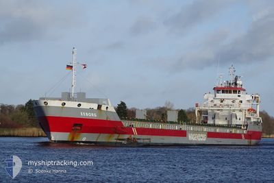
EEBORG
General Cargo
Current Trip
| Time Travelled | 8 days |
|---|---|
| Remaining Time | --- |
| Distance Travelled | 2298.90 nm |
| Remaining Distance | --- |
| AVG Speed | 11.5 Knots |
| MAX Speed | 14.7 Knots |
| AVG Wind | 13.8 knots |
| MAX Wind | 34.8 knots |
| MIN Temp | 7.4°C / 45.32°F |
| MAX Temp | 18°C / 64.4°F |
| Dybgang | 7.6 m |
| Position Modtaget | 2 h, 43 m siden |
Current Position
| Longitude | 2.69385° |
|---|---|
| Latitude | 52.05109° |
| Status | Under way using engine |
| Fart | 13.3 Knots |
| Kurs | 5.3° |
| Område | North Sea |
| Station | T-AIS |
| Position Modtaget | 2 h, 43 m siden |
Info
Information
The current position of EEBORG is in North Sea with coordinates 52.05109° / 2.69385° as reported on 2024-04-28 17:10 by AIS to our vessel tracker app. The vessel's current speed is 13.3 Knots and is heading at the port of GRENAA. The estimated time of arrival as calculated by MyShipTracking vessel tracking app is 2024-04-30 16:00 LT
The vessel EEBORG (IMO: 9568328, MMSI: 246846000) is a General Cargo that was built in 2012 ( 12 år gamle ). It's sailing under the flag of [NL] Netherlands.
In this page you can find informations about the vessels current position, last detected port calls, and current voyage information. If the vessels is not in coverage by AIS you will find the latest position.
The current position of EEBORG is detected by our AIS receivers and we are not responsible for the reliability of the data. The last position was recorded while the vessel was in Coverage by the Ais receivers of our vessel tracking app.
The current draught of EEBORG as reported by AIS is 7.6 meters
Weather
| Temperature | 9.1°C / 48.38°F |
|---|---|
| Wind Speed | 16 knots |
| Direction | 227° SW |
| Pressure | 1011.1 hPa |
| Humidity | 79.9 % |
| Cloud Coverage | 90 % |
Featured Company
Last Port Calls
| Port | Arrival | Departure | Time In Port |
|---|---|---|---|
| 2024-04-18 09:34 | 2024-04-20 12:48 | 2 d | |
| 2024-04-13 09:21 | 2024-04-14 13:53 | 1 d | |
| 2024-03-29 04:27 | 2024-03-31 02:17 | 1 d | |
| 2024-03-29 03:13 | 2024-03-29 03:26 | 12 m | |
| 2024-03-26 23:16 | 2024-03-28 22:02 | 1 d | |
| 2024-03-19 23:12 | 2024-03-21 11:38 | 1 d | |
| 2024-03-16 12:12 | 2024-03-17 14:00 | 1 d | |
| 2024-03-12 22:57 | 2024-03-15 23:18 | 3 d | |
| 2024-03-10 22:17 | 2024-03-11 20:32 | 22 h | |
| 2024-02-22 00:10 | 2024-02-26 21:37 | 4 d |
Last Trips
| Origin | Departure | Destination | Arrival | Distance | |
|---|---|---|---|---|---|
| 2024-04-14 15:53 | 2024-04-18 11:34 | 802.10 nm | |||
| 2024-03-31 04:17 | 2024-04-13 11:21 | 3101.19 nm | |||
| 2024-03-29 04:26 | 2024-03-29 05:27 | 7.08 nm | |||
| 2024-03-28 23:02 | 2024-03-29 04:13 | 24.44 nm | |||
| 2024-03-21 12:38 | 2024-03-27 00:16 | 1333.60 nm | |||
| 2024-03-17 15:00 | 2024-03-20 00:12 | 631.00 nm | |||
| 2024-03-16 00:18 | 2024-03-16 13:12 | 157.02 nm | |||
| 2024-03-11 21:32 | 2024-03-12 23:57 | 265.90 nm | |||
| 2024-02-26 23:37 | 2024-03-10 23:17 | 2898.49 nm | |||
| 2024-02-14 07:31 | 2024-02-16 02:28 | 320.87 nm |
Events
| Tid | Hændelsen | Detaljer | Position / Dest | Info |
|---|---|---|---|---|
| 2024-04-28 17:13 | Status er ændret | Default Under way using engine |
52.06167 / 2.69500
ITPEM>DKGRE
|
Fart: 13.3 kn Kurs: 5.3° |
| 2024-04-28 17:10 | Udenfor Dækning |
52.05109 / 2.69385
North Sea
ITPEM>DKGRE
|
Fart: 13.3 kn Kurs: 5.3° |
|
| 2024-04-28 16:07 | Ændre havområde | Dutch part of the North Sea Belgian part of the North Sea |
51.82902 / 2.61662
North Sea
ITPEM>DKGRE
|
Fart: 13.4 kn Kurs: 27.5° |
| 2024-04-28 14:25 | Fundet i havområde | Belgian part of the North Sea |
51.52002 / 2.26781
North Sea
ITPEM>DKGRE
|
Fart: 12.8 kn Kurs: 46.3° |
| 2024-04-28 13:40 | Ændre havområde | French part of the North Sea United Kingdom part of the North Sea |
51.40595 / 2.07935
North Sea
ITPEM>DKGRE
|
Fart: 13.1 kn Kurs: 43.6° |
| 2024-04-28 11:31 | Ændre havområde | United Kingdom part of the North Sea French part of the North Sea |
51.06951 / 1.63745
North Sea
ITPEM>DKGRE
|
Fart: 10.6 kn Kurs: 43.8° |
| 2024-04-28 11:13 | Ændre havområde | French part of the North Sea French part of the English Channel |
51.02773 / 1.57501
North Sea
ITPEM>DKGRE
|
Fart: 11.4 kn Kurs: 44° |
| 2024-04-28 08:52 | Status er ændret | Under way using engine Default |
50.66567 / 1.28937
ITPEM>DKGRE
|
Fart: 11.1 kn Kurs: 45° |
| 2024-04-28 08:36 | Status er ændret | Default Under way using engine |
50.63096 / 1.23334
ITPEM>DKGRE
|
Fart: 11.2 kn Kurs: 44.5° |
| 2024-04-28 08:22 | Ændre havområde | French part of the English Channel United Kingdom part of the English Channel |
50.59978 / 1.18504
English Channel
ITPEM>DKGRE
|
Fart: 11 kn Kurs: 44.4° |