
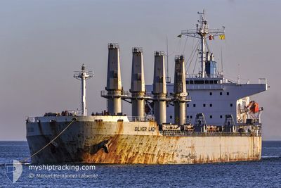
M/V SILVER LADY
Bulk Carrier
Current Trip
| Time Travelled | 7 days |
|---|---|
| Remaining Time | 8 days |
| Distance Travelled | 1873.66 морская миля |
| Remaining Distance | 2143.41 морская миля |
| AVG Speed | 9.8 Узлы |
| MAX Speed | 14.4 Узлы |
| AVG Wind | 16.6 knots |
| MAX Wind | 33 knots |
| MIN Temp | -6.1°C / 21.02°F |
| MAX Temp | 10.1°C / 50.18°F |
| Осадка | 11.7 м |
| Позиция Получена | 5 m тому назад |
Current Position
| Долгота | --- |
|---|---|
| Широта | --- |
| Статус | Under way using engine |
| Скорость | 11.8 Узлы |
| Курс | 210° |
| Район | Celtic Sea |
| Станция | T-AIS |
| Позиция Получена | 5 m тому назад |
Info
Information
The current position of M/V SILVER LADY is in Celtic Sea with coordinates 48.50538° / -6.15003° as reported on 2025-01-14 07:04 by AIS to our vessel tracker app. The vessel's current speed is 11.8 Узлы and is heading at the port of DAKAR. The estimated time of arrival as calculated by MyShipTracking vessel tracking app is 2025-01-22 17:35 LT
The vessel M/V SILVER LADY (IMO: 9279367, MMSI: 249008000) is a Bulk Carrier that was built in 2003 ( 22 лет ). It's sailing under the flag of [MT] Malta.
In this page you can find informations about the vessels current position, last detected port calls, and current voyage information. If the vessels is not in coverage by AIS you will find the latest position.
The current position of M/V SILVER LADY is detected by our AIS receivers and we are not responsible for the reliability of the data. The last position was recorded while the vessel was in Coverage by the Ais receivers of our vessel tracking app.
The current draught of M/V SILVER LADY as reported by AIS is 11.7 meters
Weather
| Temperature | 10°C / 50°F |
|---|---|
| Wind Speed | 7 knots |
| Direction | 187° S |
| Pressure | 1035.3 hPa |
| Humidity | 68.4 % |
| Cloud Coverage | 100 % |
Featured Company
Last Port Calls
| Port | Arrival | Departure | Time In Port |
|---|---|---|---|
| 2025-01-04 05:11 | 2025-01-06 21:09 | 2 d | |
| 2024-12-14 12:53 | 2024-12-23 14:09 | 9 d | |
| 2024-11-09 17:35 | 2024-11-16 18:51 | 7 d | |
| 2024-11-02 21:14 |
Most Visited Ports (Last year)
| Port | Arrivals | |
|---|---|---|
| 3 | ||
| 2 | ||
| 1 | ||
| 1 | ||
| 1 | ||
| 1 |
Last Trips
| Origin | Departure | Destination | Arrival | Distance | |
|---|---|---|---|---|---|
| 2024-12-23 15:09 | 2025-01-04 08:11 | 2279.47 морская миля | |||
| 2024-11-16 20:51 | 2024-12-14 13:53 | 6678.23 морская миля | |||
| 2024-11-02 23:14 | 2024-11-09 19:35 | 393.83 морская миля |
Events
| Время | Событие | Детали | Позиция / Направление | Информация |
|---|---|---|---|---|
| 2025-01-14 06:58 | Статус изменился | Under way using engine Default |
48.52155 / -6.13457
SN DKR
|
Скорость: 11.5 kn Курс: 211° |
| 2025-01-14 06:55 | Статус изменился | Default Under way using engine |
48.53035 / -6.12610
SN DKR
|
Скорость: 11.9 kn Курс: 212° |
| 2025-01-14 06:41 | Статус изменился | Under way using engine Default |
48.56938 / -6.08893
SN DKR
|
Скорость: 11.7 kn Курс: 211° |
| 2025-01-14 06:03 | Статус изменился | Default Under way using engine |
48.67263 / -5.99760
SN DKR
|
Скорость: 10.7 kn Курс: 209° |
| 2025-01-14 05:55 | Статус изменился | Under way using engine Default |
48.69402 / -5.97957
SN DKR
|
Скорость: 10.8 kn Курс: 211° |
| 2025-01-14 05:39 | Статус изменился | Default Under way using engine |
48.73432 / -5.94365
SN DKR
|
Скорость: 10.7 kn Курс: 210° |
| 2025-01-14 05:38 | Статус изменился | Under way using engine Default |
48.73687 / -5.94135
SN DKR
|
Скорость: 10.7 kn Курс: 211° |
| 2025-01-14 05:35 | Статус изменился | Default Under way using engine |
48.74497 / -5.93405
SN DKR
|
Скорость: 10.4 kn Курс: 213° |
| 2025-01-14 04:17 | Статус изменился | Under way using engine Default |
48.91232 / -5.74165
SN DKR
|
Скорость: 8.8 kn Курс: 239° |
| 2025-01-14 04:11 | Статус изменился | Default Under way using engine |
48.92008 / -5.72093
SN DKR
|
Скорость: 8.6 kn Курс: 240° |