
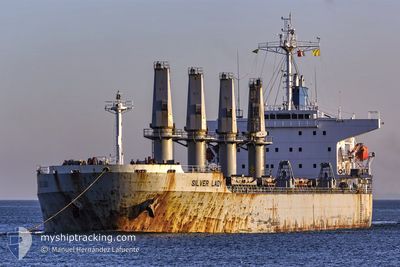
M/V SILVER LADY
Bulk Carrier
Current Trip
| Time Travelled | 9 days |
|---|---|
| Remaining Time | --- |
| Distance Travelled | 2606.64 nm |
| Remaining Distance | --- |
| AVG Speed | 11.8 Knots |
| MAX Speed | 14.6 Knots |
| AVG Wind | 12.5 knots |
| MAX Wind | 28.1 knots |
| MIN Temp | 2.4°C / 36.32°F |
| MAX Temp | 15.3°C / 59.54°F |
| Dybgang | 11.9 m |
| Position Modtaget | 2 d siden |
Current Position
| Longitude | -5.84490° |
|---|---|
| Latitude | 48.85893° |
| Status | Under way using engine |
| Fart | 12.5 Knots |
| Kurs | 212° |
| Område | Celtic Sea |
| Station | T-AIS |
| Position Modtaget | 2 d siden |
Info
Information
The current position of M/V SILVER LADY is in Celtic Sea with coordinates 48.85893° / -5.84490° as reported on 2024-05-03 21:23 by AIS to our vessel tracker app. The vessel's current speed is 12.5 Knots and is heading at the port of ARATU. The estimated time of arrival as calculated by MyShipTracking vessel tracking app is 2024-05-15 02:00 LT
The vessel M/V SILVER LADY (IMO: 9279367, MMSI: 249008000) is a Bulk Carrier that was built in 2003 ( 21 år gamle ). It's sailing under the flag of [MT] Malta.
In this page you can find informations about the vessels current position, last detected port calls, and current voyage information. If the vessels is not in coverage by AIS you will find the latest position.
The current position of M/V SILVER LADY is detected by our AIS receivers and we are not responsible for the reliability of the data. The last position was recorded while the vessel was in Coverage by the Ais receivers of our vessel tracking app.
The current draught of M/V SILVER LADY as reported by AIS is 11.9 meters
Weather
| Temperature | 14.7°C / 58.46°F |
|---|---|
| Wind Speed | 7 knots |
| Direction | 6° N |
| Pressure | 1018.4 hPa |
| Humidity | 72.3 % |
| Cloud Coverage | 1 % |
Featured Company
Most Visited Ports (Last year)
| Port | Arrivals | |
|---|---|---|
| 3 | ||
| 2 | ||
| 2 | ||
| 2 | ||
| 1 | ||
| 1 |
Last Trips
| Origin | Departure | Destination | Arrival | Distance | |
|---|---|---|---|---|---|
| 2024-02-25 19:32 | 2024-03-30 20:48 | 1246.69 nm |
Events
| Tid | Hændelsen | Detaljer | Position / Dest | Info |
|---|---|---|---|---|
| 2024-05-03 21:26 | Status er ændret | Default Under way using engine |
48.84983 / -5.85385
ARATU
|
Fart: 12.5 kn Kurs: 212° |
| 2024-05-03 21:23 | Fundet i havområde | French part of the Celtic Sea |
48.85893 / -5.84490
Celtic Sea
ARATU
|
Fart: 12.5 kn Kurs: 212° |
| 2024-05-03 21:23 | Status er ændret | Under way using engine Default |
48.85893 / -5.84490
ARATU
|
Fart: 12.8 kn Kurs: 239° |
| 2024-05-03 21:23 | Indenfor Dækning |
48.85893 / -5.84490
Celtic Sea
ARATU
|
Fart: 12.5 kn Kurs: 212° |
|
| 2024-05-03 21:23 | Udenfor Dækning |
48.85893 / -5.84490
Celtic Sea
ARATU
|
Fart: 12.5 kn Kurs: 212° |
|
| 2024-05-03 17:39 | Status er ændret | Default Under way using engine |
49.27395 / -4.83505
ARATU
|
Fart: 13.5 kn Kurs: 238° |
| 2024-05-03 17:27 | Udenfor Dækning |
49.29735 / -4.77563
English Channel
ARATU
|
Fart: 13.5 kn Kurs: 238° |
|
| 2024-05-03 17:19 | Indenfor Dækning |
49.31242 / -4.73712
English Channel
ARATU
|
Fart: 13.4 kn Kurs: 238° |
|
| 2024-05-03 17:17 | Status er ændret | Under way using engine Default |
49.31653 / -4.72628
ARATU
|
Fart: 13.4 kn Kurs: 240° |
| 2024-05-03 16:11 | Udenfor Dækning |
49.44095 / -4.40165
English Channel
ARATU
|
Fart: 13.1 kn Kurs: 239° |