
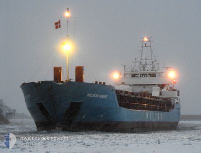
WILSON GHENT
General Cargo
Current Trip
| Time Travelled | 5 days |
|---|---|
| Remaining Time | --- |
| Distance Travelled | 809.61 nm |
| Remaining Distance | --- |
| AVG Speed | 8.1 Knopen |
| MAX Speed | 11.2 Knopen |
| AVG Wind | 20.4 knots |
| MAX Wind | 34.5 knots |
| MIN Temp | -17.6°C / 0.32°F |
| MAX Temp | 7.3°C / 45.14°F |
| Diepgang | 3.6 M |
| Positie ontvangen | 1 m geleden |
Current Position
| Lengtegraad | --- |
|---|---|
| Breedtegraat | --- |
| Status | Under way using engine |
| Snelheid | 6.1 Knopen |
| Koers | 179.2° |
| Gebied | Norwegian Sea |
| Station | T-AIS |
| Positie ontvangen | 1 m geleden |
Info
Information
The current position of WILSON GHENT is in Norwegian Sea with coordinates 61.63886° / 4.20622° as reported on 2024-12-21 16:47 by AIS to our vessel tracker app. The vessel's current speed is 6.1 Knopen and is heading at the port of KOLDING. The estimated time of arrival as calculated by MyShipTracking vessel tracking app is 2024-12-24 06:00 LT
The vessel WILSON GHENT (IMO: 9150236, MMSI: 314548000) is a General Cargo that was built in 1996 ( 28 Jaar oud ). It's sailing under the flag of [BB] Barbados.
In this page you can find informations about the vessels current position, last detected port calls, and current voyage information. If the vessels is not in coverage by AIS you will find the latest position.
The current position of WILSON GHENT is detected by our AIS receivers and we are not responsible for the reliability of the data. The last position was recorded while the vessel was in Coverage by the Ais receivers of our vessel tracking app.
The current draught of WILSON GHENT as reported by AIS is 3.6 meters
Weather
| Temperature | 6.8°C / 44.24°F |
|---|---|
| Wind Speed | 26 knots |
| Direction | 204° SSW |
| Pressure | 973.7 hPa |
| Humidity | 79.4 % |
| Cloud Coverage | 100 % |
Featured Company
Last Port Calls
| Port | Arrival | Departure | Time In Port |
|---|---|---|---|
| 2024-12-09 00:17 | 2024-12-16 09:49 | 7 d | |
| 2024-12-05 16:36 | 2024-12-06 17:38 | 1 d | |
| 2024-12-05 06:25 | 2024-12-05 14:41 | 8 h | |
| 2024-11-23 14:24 | 2024-11-26 17:32 | 3 d | |
| 2024-11-20 12:52 | 2024-11-20 12:56 | 3 m | |
| 2024-11-20 03:55 | 2024-11-20 04:08 | 13 m | |
| 2024-11-14 04:48 | 2024-11-15 14:19 | 1 d | |
| 2024-11-11 20:38 | 2024-11-13 19:57 | 1 d | |
| 2024-11-07 03:14 | 2024-11-07 03:24 | 9 m | |
| 2024-10-22 23:43 | 2024-10-23 16:02 | 16 h |
Most Visited Ports (Last year)
| Port | Arrivals | |
|---|---|---|
| 4 | ||
| 3 | ||
| 3 | ||
| 2 | ||
| 2 | ||
| 2 |
Last Trips
| Origin | Departure | Destination | Arrival | Distance | |
|---|---|---|---|---|---|
| 2024-12-06 18:38 | 2024-12-09 01:17 | 613.10 nm | |||
| 2024-12-05 15:41 | 2024-12-05 17:36 | 16.53 nm | |||
| 2024-11-26 18:32 | 2024-12-05 07:25 | 1580.12 nm | |||
| 2024-11-20 13:56 | 2024-11-23 15:24 | 708.46 nm | |||
| 2024-11-20 05:08 | 2024-11-20 13:52 | 47.47 nm | |||
| 2024-11-15 15:19 | 2024-11-20 04:55 | 1037.85 nm | |||
| 2024-11-13 20:57 | 2024-11-14 05:48 | 58.18 nm | |||
| 2024-11-07 04:24 | 2024-11-11 21:38 | 821.11 nm | |||
| 2024-10-23 18:02 | 2024-11-07 04:14 | 2557.11 nm | |||
| 2024-10-23 01:10 | 2024-10-23 01:43 | 6.09 nm |
Events
| Tijd | Evenement | Details | Positie / Bestemming | Info |
|---|---|---|---|---|
| 2024-12-17 20:37 | Start beweging | 5.53 nm, East of OKSFJORD |
70.25959 / 22.61292
KOLDING
|
Snelheid: 3.5 kn Koers: 213° |
| 2024-12-17 20:25 | Status Changed | Under way using engine Moored |
70.26186 / 22.61468
KOLDING
|
Snelheid: Koers: 218° |
| 2024-12-17 20:24 | Destination Changed | KOLDING STERJNOY |
70.26186 / 22.61466
KOLDING
|
Snelheid: Koers: 218° |
| 2024-12-17 20:24 | ETA Changed | 2024/12/24 06:00 2024/12/16 07:30 |
70.26186 / 22.61466
KOLDING
|
Snelheid: Koers: 218° |
| 2024-12-17 19:38 | Status Changed | Moored Default |
70.26186 / 22.61459
STERJNOY
|
Snelheid: Koers: 217° |
| 2024-12-17 19:35 | Status Changed | Default Moored |
70.26186 / 22.61461
STERJNOY
|
Snelheid: Koers: 217° |
| 2024-12-16 14:32 | Status Changed | Moored Under way using engine |
70.26194 / 22.61484
STERJNOY
|
Snelheid: Koers: 216° |
| 2024-12-16 14:09 | Stop beweging | 5.59 nm, East of OKSFJORD |
70.26181 / 22.61487
STERJNOY
|
Snelheid: 0.3 kn Koers: 216° |
| 2024-12-16 09:52 | Status Changed | Under way using engine Moored |
70.61968 / 23.59973
STERJNOY
|
Snelheid: 9.7 kn Koers: 324.6° |
| 2024-12-16 09:49 | Vertrekhaven |
|
70.61681 / 23.61567
STERJNOY
|
Snelheid: 10.1 kn Koers: 221° |