
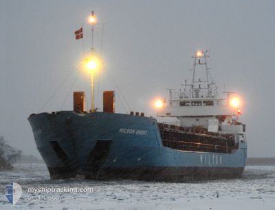
WILSON GHENT
General Cargo
Current Trip
| Time Travelled | 15 days |
|---|---|
| Remaining Time | --- |
| Distance Travelled | 3393.96 nm |
| Remaining Distance | --- |
| AVG Speed | 8.8 Knots |
| MAX Speed | 13.6 Knots |
| AVG Wind | 17.1 knots |
| MAX Wind | 31 knots |
| MIN Temp | 2.8°C / 37.04°F |
| MAX Temp | 18.9°C / 66.02°F |
| Draught | 5.5 m |
| Position Received | Now |
Current Position
| Longitude | 18.60374° |
|---|---|
| Latitude | 40.27537° |
| Status | Under way using engine |
| Speed | 9.7 Knots |
| Course | 345.8° |
| Area | Adriatic Sea |
| Station | T-AIS |
| Position Received | Now |
Info
Information
The current position of WILSON GHENT is in Adriatic Sea with coordinates 40.27537° / 18.60374° as reported on 2024-04-24 11:04 by AIS to our vessel tracker app. The vessel's current speed is 9.7 Knots and is heading at the port of PORTO NOGARO. The estimated time of arrival as calculated by MyShipTracking vessel tracking app is 2024-04-26 10:00 LT
The vessel WILSON GHENT (IMO: 9150236, MMSI: 314548000) is a General Cargo that was built in 1996 ( 28 years old ). It's sailing under the flag of [BB] Barbados.
In this page you can find informations about the vessels current position, last detected port calls, and current voyage information. If the vessels is not in coverage by AIS you will find the latest position.
The current position of WILSON GHENT is detected by our AIS receivers and we are not responsible for the reliability of the data. The last position was recorded while the vessel was in Coverage by the Ais receivers of our vessel tracking app.
The current draught of WILSON GHENT as reported by AIS is 5.5 meters
Weather
| Temperature | 14.7°C / 58.46°F |
|---|---|
| Wind Speed | 11 knots |
| Direction | 88° E |
| Pressure | 1009.2 hPa |
| Humidity | 60.8 % |
| Cloud Coverage | 5 % |
Featured Company
Last Port Calls
| Port | Arrival | Departure | Time In Port |
|---|---|---|---|
| 2024-04-05 19:58 | 2024-04-08 20:30 | 3 d | |
| 2024-04-05 12:13 | 2024-04-05 16:21 | 4 h | |
| 2024-04-04 08:49 | 2024-04-05 02:12 | 17 h | |
| 2024-04-02 02:41 | 2024-04-02 16:18 | 13 h | |
| 2024-03-26 06:44 | |||
| 2024-03-16 03:11 | 2024-03-20 07:17 | 4 d | |
| 2024-02-28 13:02 | 2024-03-04 14:00 | 5 d | |
| 2024-02-20 13:41 | 2024-02-21 18:45 | 1 d | |
| 2024-02-17 01:31 | 2024-02-19 17:05 | 2 d | |
| 2024-02-14 10:49 | 2024-02-16 22:34 | 2 d |
Last Trips
| Origin | Departure | Destination | Arrival | Distance | |
|---|---|---|---|---|---|
| 2024-04-05 18:21 | 2024-04-05 21:58 | 40.93 nm | |||
| 2024-04-05 04:12 | 2024-04-05 14:13 | 106.70 nm | |||
| 2024-04-02 18:18 | 2024-04-04 10:49 | 351.15 nm | |||
| 2024-03-26 06:44 | 2024-04-02 04:41 | 746.25 nm | |||
| 2024-03-04 15:00 | 2024-03-16 03:11 | 1984.00 nm | |||
| 2024-02-21 19:45 | 2024-02-28 14:02 | 1030.14 nm | |||
| 2024-02-19 17:05 | 2024-02-20 14:41 | 199.05 nm | |||
| 2024-02-16 22:34 | 2024-02-17 01:31 | 31.23 nm | |||
| 2024-02-12 04:13 | 2024-02-14 10:49 | 378.42 nm | |||
| 2024-02-10 06:24 | 2024-02-12 02:30 | 404.91 nm |
Events
| Time | Event | Details | Position / Dest | Info |
|---|---|---|---|---|
| 2024-04-24 09:47 | Change Sea Area | Italian part of the Adriatic Sea Italian part of the Ionian Sea |
40.09069 / 18.63514
Adriatic Sea
PORTO NOGARO
|
Speed: 9.4 kn Course: 22.2° |
| 2024-04-24 09:46 | Status Changed | Under way using engine Default |
40.08785 / 18.63362
PORTO NOGARO
|
Speed: 9.5 kn Course: 22° |
| 2024-04-24 09:32 | IN Coverage |
40.09069 / 18.63514
Adriatic Sea
PORTO NOGARO
|
Speed: 9.4 kn Course: 22.2° |
|
| 2024-04-23 21:16 | OUT of Coverage |
38.66640 / 17.06347
Ionian Sea
PORTO NOGARO
|
Speed: 8.2 kn Course: 44.1° |
|
| 2024-04-23 21:01 | IN Coverage |
38.64054 / 17.03317
Ionian Sea
PORTO NOGARO
|
Speed: 8.2 kn Course: 42.3° |
|
| 2024-04-23 17:01 | Status Changed | Default Under way using engine |
38.22214 / 16.51771
PORTO NOGARO
|
Speed: 8.6 kn Course: 41.8° |
| 2024-04-23 16:46 | OUT of Coverage |
38.19517 / 16.48751
Ionian Sea
PORTO NOGARO
|
Speed: 8.6 kn Course: 41.8° |
|
| 2024-04-23 16:39 | Status Changed | Under way using engine Default |
38.18273 / 16.47350
PORTO NOGARO
|
Speed: 8.7 kn Course: 39° |
| 2024-04-23 16:30 | Status Changed | Default Under way using engine |
38.16568 / 16.45468
PORTO NOGARO
|
Speed: 8.7 kn Course: 42.2° |
| 2024-04-23 16:15 | Status Changed | Under way using engine Default |
38.13884 / 16.42523
PORTO NOGARO
|
Speed: 8.5 kn Course: 42° |