

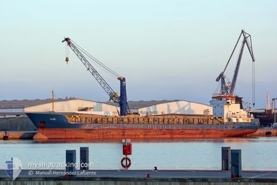
XT PEACE
Tanker

Current Trip
| Time Travelled | 8 days |
|---|---|
| Remaining Time | 1 h, 9 mins |
| Distance Travelled | 1555.99 nm |
| Remaining Distance | 16.02 nm |
| AVG Speed | 9.4 Knots |
| MAX Speed | 12.5 Knots |
| AVG Wind | 10.3 knots |
| MAX Wind | 25.4 knots |
| MIN Temp | 3.6°C / 38.48°F |
| MAX Temp | 18.1°C / 64.58°F |
| Draught | 5.3 m |
| Position Received | 1 m ago |
Current Position
| Longitude | --- |
|---|---|
| Latitude | --- |
| Status | Under way using engine |
| Speed | 2.4 Knots |
| Course | 237° |
| Area | North Atlantic Ocean |
| Station | T-AIS |
| Position Received | 1 m ago |
Information
The current position of XT PEACE is in North Atlantic Ocean with coordinates 37.72717° / -9.07905° as reported on 2025-02-21 06:37 by AIS to our vessel tracker app. The vessel's current speed is 2.4 Knots and is heading at the port of SINES. The estimated time of arrival as calculated by MyShipTracking vessel tracking app is 2025-02-21 07:47 LT
The vessel XT PEACE (IMO: 9980265, MMSI: 256928000) is a Tanker It's sailing under the flag of [MT] Malta.
In this page you can find informations about the vessels current position, last detected port calls, and current voyage information. If the vessels is not in coverage by AIS you will find the latest position.
The current position of XT PEACE is detected by our AIS receivers and we are not responsible for the reliability of the data. The last position was recorded while the vessel was in Coverage by the Ais receivers of our vessel tracking app.
The current draught of XT PEACE as reported by AIS is 5.3 meters
Weather
| Temperature | 14.7°C / 58.46°F |
|---|---|
| Wind Speed | 12 knots |
| Direction | 161° SSE |
| Pressure | 1020.8 hPa |
| Humidity | 86.3 % |
| Cloud Coverage | 100 % |


Featured Company
Last Port Calls
| Port | Arrival | Departure | Time In Port |
|---|---|---|---|
| 2025-02-12 13:12 | 2025-02-12 14:10 | 58 m | |
| 2025-02-11 12:11 | 2025-02-12 12:12 | 1 d | |
| 2025-02-11 10:57 | 2025-02-11 11:27 | 30 m | |
| 2025-02-06 22:50 | 2025-02-09 08:48 | 2 d | |
| 2025-01-30 02:50 | 2025-01-31 07:29 | 1 d | |
| 2025-01-29 19:06 | 2025-01-30 00:14 | 5 h | |
| 2025-01-27 13:31 | 2025-01-29 00:21 | 1 d | |
| 2025-01-23 23:29 | 2025-01-24 00:03 | 34 m | |
| 2025-01-05 17:01 | 2025-01-05 17:31 | 29 m | |
| 2025-01-02 20:52 | 2025-01-03 14:34 | 17 h |
Most Visited Ports (Last year)
| Port | Arrivals | |
|---|---|---|
| 12 | ||
| 5 | ||
| 3 | ||
| 2 | ||
| 2 | ||
| 2 |
Last Trips
| Origin | Departure | Destination | Arrival | Distance | |
|---|---|---|---|---|---|
| 2025-02-12 12:12 | 2025-02-12 13:12 | 5.28 nm | |||
| 2025-02-11 11:27 | 2025-02-11 12:11 | 5.51 nm | |||
| 2025-02-09 08:48 | 2025-02-11 10:57 | 94.06 nm | |||
| 2025-01-31 07:29 | 2025-02-06 22:50 | 1421.94 nm | |||
| 2025-01-30 00:14 | 2025-01-30 02:50 | 18.40 nm | |||
| 2025-01-29 00:21 | 2025-01-29 19:06 | 195.43 nm | |||
| 2025-01-24 00:03 | 2025-01-27 13:31 | 224.41 nm | |||
| 2025-01-05 17:31 | 2025-01-23 23:29 | 1911.61 nm | |||
| 2025-01-03 14:34 | 2025-01-05 17:01 | 120.75 nm | |||
| 2025-01-02 17:47 | 2025-01-02 20:52 | 24.95 nm |
Events
| Time | Event | Details | Position / Dest | Info |
|---|---|---|---|---|
| 2025-02-21 06:34 | STOP Moving | 16.48 nm, South West of SINES |
37.72657 / -9.07878
ES HUV>PT SIN
|
Speed: 0.3 kn Course: 228° |
| 2025-02-20 17:50 | Destination Changed | ES HUV>PT SIN ES HUE>PT SIN |
36.69931 / -8.06481
ES HUV>PT SIN
|
Speed: 10.8 kn Course: 254.1° |
| 2025-02-20 14:34 | Change Sea Area | Portuguese part of the North Atlantic Ocean Spanish part of the North Atlantic Ocean |
36.81460 / -7.36498
North Atlantic Ocean
ES HUE>PT SIN
|
Speed: 10.5 kn Course: 260.7° |
| 2025-02-20 11:46 | ETA Changed | 2025/02/21 08:30 2025/02/18 11:00 |
37.06550 / -6.82591
ES HUE>PT SIN
|
Speed: 10.7 kn Course: 227.6° |
| 2025-02-20 10:47 | START Moving | 4.49 nm, North West of HUELVA |
37.20026 / -6.94000
ES HUE>PT SIN
|
Speed: 5.3 kn Course: 174.8° |
| 2025-02-20 10:42 | Draught Changed | 5.3 5.9 |
37.20224 / -6.93928
ES HUE>PT SIN
|
Speed: 0.6 kn Course: 330° |
| 2025-02-20 10:42 | Destination Changed | ES HUE>PT SIN NL AMS>ES HUE |
37.20224 / -6.93928
ES HUE>PT SIN
|
Speed: 0.6 kn Course: 330° |
| 2025-02-20 10:39 | IN Coverage |
37.20229 / -6.93915
North Atlantic Ocean
|
Speed: 0.2 kn Course: 257.7° |
|
| 2025-02-19 09:14 | OUT of Coverage |
37.19633 / -6.93829
North Atlantic Ocean
|
Speed: 3.4 kn Course: 342.2° |
|
| 2025-02-19 07:33 | START Moving | 3.33 nm, South of HUELVA |
37.09099 / -6.87677
NL AMS>ES HUE
|
Speed: 4.4 kn Course: 143° |