
XT PEACE
Tanker
Current Trip
| Time Travelled | 17 h, 41 mins |
|---|---|
| Remaining Time | --- |
| Distance Travelled | 1.60 nm |
| Remaining Distance | --- |
| AVG Speed | --- |
| MAX Speed | --- |
| AVG Wind | 9.2 knots |
| MAX Wind | 13 knots |
| MIN Temp | 18.8°C / 65.84°F |
| MAX Temp | 24.1°C / 75.38°F |
| Tirant d eau | 5.4 m |
| Position reçue | 3 m depuis |
Current Position
| Longitude | -5.42798° |
|---|---|
| Latitude | 36.16823° |
| Etat | At anchor |
| Vitesse | 0.1 Noeuds |
| Parcours | 129° |
| Zone | Strait of Gibraltar |
| Station | T-AIS |
| Position reçue | 3 m depuis |
Info
Information
The current position of XT PEACE is in Strait of Gibraltar with coordinates 36.16823° / -5.42798° as reported on 2024-09-19 19:37 by AIS to our vessel tracker app. The vessel's current speed is 0.1 Noeuds and is heading at the port of ALGECIRAS. The estimated time of arrival as calculated by MyShipTracking vessel tracking app is 2024-09-17 14:00 LT
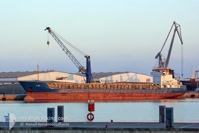
The vessel XT PEACE (IMO: 9980265, MMSI: 256928000) is a Tanker It's sailing under the flag of [MT] Malta.
In this page you can find informations about the vessels current position, last detected port calls, and current voyage information. If the vessels is not in coverage by AIS you will find the latest position.
The current position of XT PEACE is detected by our AIS receivers and we are not responsible for the reliability of the data. The last position was recorded while the vessel was in Coverage by the Ais receivers of our vessel tracking app.
The current draught of XT PEACE as reported by AIS is 5.4 meters
Weather
| Temperature | 18.9°C / 66.02°F |
|---|---|
| Wind Speed | 5 knots |
| Direction | 99° E |
| Pressure | 1013.2 hPa |
| Humidity | 94.6 % |
| Cloud Coverage | 31 % |
Featured Company
Last Port Calls
| Port | Arrival | Departure | Time In Port |
|---|---|---|---|
| 2024-09-17 15:04 | 2024-09-19 02:00 | 1 d | |
| 2024-09-14 12:49 | 2024-09-15 15:21 | 1 d | |
| 2024-09-07 11:58 | 2024-09-08 13:38 | 1 d | |
| 2024-09-06 09:53 | 2024-09-07 09:52 | 23 h | |
| 2024-09-01 02:29 | 2024-09-01 19:48 | 17 h | |
| 2024-08-31 06:44 | 2024-08-31 23:44 | 17 h | |
| 2024-08-29 19:54 | 2024-08-30 00:02 | 4 h | |
| 2024-08-25 11:50 | |||
| 2024-08-20 02:35 | 2024-08-21 13:48 | 1 d | |
| 2024-08-13 16:58 | 2024-08-14 22:45 | 1 d |
Most Visited Ports (Last year)
| Port | Arrivals | |
|---|---|---|
| 3 | ||
| 2 | ||
| 1 | ||
| 1 | ||
| 1 | ||
| 1 |
Last Trips
| Origin | Departure | Destination | Arrival | Distance | |
|---|---|---|---|---|---|
| 2024-09-15 17:21 | 2024-09-17 17:04 | 494.03 nm | |||
| 2024-09-08 15:38 | 2024-09-14 14:49 | 544.22 nm | |||
| 2024-09-07 11:52 | 2024-09-07 13:58 | 17.89 nm | |||
| 2024-09-01 20:48 | 2024-09-06 11:53 | 71.91 nm | |||
| 2024-09-01 01:44 | 2024-09-01 03:29 | 24.25 nm | |||
| 2024-08-30 02:02 | 2024-08-31 08:44 | 109.04 nm | |||
| 2024-08-21 15:48 | 2024-08-25 13:50 | 389.45 nm | |||
| 2024-08-15 00:45 | 2024-08-20 04:35 | 1373.96 nm | |||
| 2024-08-13 17:29 | 2024-08-13 18:58 | 12.39 nm | |||
| 2024-08-11 12:18 | 2024-08-13 03:05 | 372.94 nm |
Events
| Heure | Evenement | Détails | Position/ Destination | Info |
|---|---|---|---|---|
| 2024-09-19 05:46 | Etat Changé | At anchor Moored |
36.16730 / -5.42819
ALGECIRAS
|
Vitesse: 0.2 kn Parcours: 92° |
| 2024-09-19 05:46 | Tirant d'eau modifié | 5.4 6.6 |
36.16730 / -5.42824
ALGECIRAS
|
Vitesse: 0.2 kn Parcours: 92° |
| 2024-09-19 02:12 | Arret | 0.53 nm, South of PALMONES |
36.16746 / -5.42443
ALGECIRAS
|
Vitesse: 0.1 kn Parcours: 269° |
| 2024-09-19 02:00 | PORT DE DEPART |
|
36.17440 / -5.39955
ALGECIRAS
|
Vitesse: 9.2 kn Parcours: 245° |
| 2024-09-19 01:59 | Démarrage |
36.17597 / -5.39499
[ES] CARTEYA GUADARRANQUE
|
Vitesse: 7.5 kn Parcours: 244° |
|
| 2024-09-17 15:14 | Etat Changé | Moored Under way using engine |
36.17768 / -5.39438
[ES] CARTEYA GUADARRANQUE
|
Vitesse: 0.1 kn Parcours: 263° |
| 2024-09-17 15:06 | Arret |
36.17779 / -5.39423
[ES] CARTEYA GUADARRANQUE
|
Vitesse: 0.3 kn Parcours: 260° |
|
| 2024-09-17 15:04 | Port d'arrivée |
|
36.17801 / -5.39410
[ES] CARTEYA GUADARRANQUE
|
Vitesse: 0.6 kn Parcours: 245° |
| 2024-09-17 14:37 | Changement de zone | Spanish part of the Strait of Gibraltar Gibraltarian part of the Strait of Gibraltar |
36.14794 / -5.39466
Strait of Gibraltar
ALGECIRAS
|
Vitesse: 5.1 kn Parcours: 331° |
| 2024-09-17 14:28 | Démarrage | 1.45 nm, South West of GIBRALTAR |
36.13616 / -5.38907
ALGECIRAS
|
Vitesse: 3.2 kn Parcours: 343° |