
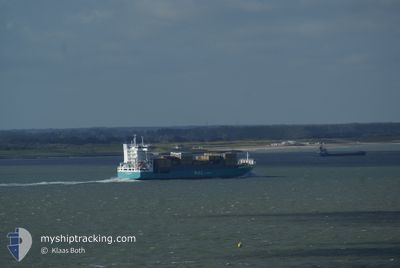
WEC VAN GOGH
Container Ship
Current Trip
| Time Travelled | 1 day |
|---|---|
| Remaining Time | 6 h, 3 mins |
| Distance Travelled | 585.10 nm |
| Remaining Distance | 102.79 nm |
| AVG Speed | 16.3 Knots |
| MAX Speed | 17.3 Knots |
| AVG Wind | 13 knots |
| MAX Wind | 20.4 knots |
| MIN Temp | 15°C / 59°F |
| MAX Temp | 19.2°C / 66.56°F |
| Draught | 8.3 m |
| Position Received | Now |
Current Position
| Longitude | --- |
|---|---|
| Latitude | --- |
| Status | Under way using engine |
| Speed | 16.9 Knots |
| Course | 29.9° |
| Area | North Atlantic Ocean |
| Station | T-AIS |
| Position Received | Now |
Info
Information
The current position of WEC VAN GOGH is in North Atlantic Ocean with coordinates 36.56538° / -10.05070° as reported on 2025-02-17 02:25 by AIS to our vessel tracker app. The vessel's current speed is 16.9 Knots and is heading at the port of SINES. The estimated time of arrival as calculated by MyShipTracking vessel tracking app is 2025-02-17 08:28 LT
The vessel WEC VAN GOGH (IMO: 9246566, MMSI: 212641000) is a Container Ship that was built in 2004 ( 21 years old ). It's sailing under the flag of [CY] Cyprus.
In this page you can find informations about the vessels current position, last detected port calls, and current voyage information. If the vessels is not in coverage by AIS you will find the latest position.
The current position of WEC VAN GOGH is detected by our AIS receivers and we are not responsible for the reliability of the data. The last position was recorded while the vessel was in Coverage by the Ais receivers of our vessel tracking app.
The current draught of WEC VAN GOGH as reported by AIS is 8.3 meters
Weather
| Temperature | 15.1°C / 59.18°F |
|---|---|
| Wind Speed | 7 knots |
| Direction | 358° N |
| Pressure | 1017.6 hPa |
| Humidity | 64.4 % |
| Cloud Coverage | 26 % |
Featured Company
Last Port Calls
| Port | Arrival | Departure | Time In Port |
|---|---|---|---|
| 2025-02-15 05:37 | 2025-02-15 14:04 | 8 h | |
| 2025-02-14 08:48 | 2025-02-15 01:39 | 16 h | |
| 2025-02-13 17:34 | 2025-02-14 05:16 | 11 h | |
| 2025-02-11 12:30 | 2025-02-11 22:34 | 10 h | |
| 2025-02-10 05:16 | 2025-02-10 17:51 | 12 h | |
| 2025-02-09 06:16 | 2025-02-09 16:04 | 9 h | |
| 2025-02-07 02:38 | 2025-02-07 22:59 | 20 h | |
| 2025-02-04 16:53 | 2025-02-04 17:03 | 10 m | |
| 2025-02-04 00:47 | 2025-02-04 16:51 | 16 h | |
| 2025-02-03 06:41 | 2025-02-03 22:18 | 15 h |
Last Trips
| Origin | Departure | Destination | Arrival | Distance | |
|---|---|---|---|---|---|
| 2025-02-15 01:39 | 2025-02-15 05:37 | 58.86 nm | |||
| 2025-02-14 05:16 | 2025-02-14 08:48 | 54.36 nm | |||
| 2025-02-11 22:34 | 2025-02-13 17:34 | 714.31 nm | |||
| 2025-02-10 18:51 | 2025-02-11 12:30 | 277.55 nm | |||
| 2025-02-09 16:04 | 2025-02-10 06:16 | 78.21 nm | |||
| 2025-02-07 23:59 | 2025-02-09 06:16 | 467.69 nm | |||
| 2025-02-04 18:03 | 2025-02-07 03:38 | 813.21 nm | |||
| 2025-02-04 17:51 | 2025-02-04 17:53 | 0.03 nm | |||
| 2025-02-03 23:18 | 2025-02-04 01:47 | 23.70 nm | |||
| 2025-02-02 17:19 | 2025-02-03 07:41 | 170.02 nm |
Events
| Time | Event | Details | Position / Dest | Info |
|---|---|---|---|---|
| 2025-02-17 02:01 | Status Changed | Under way using engine Default |
36.46798 / -10.11503
PTSIE
|
Speed: 17.1 kn Course: 27° |
| 2025-02-17 01:59 | Status Changed | Default Under way using engine |
36.46219 / -10.11888
PTSIE
|
Speed: 16.7 kn Course: 27.1° |
| 2025-02-17 01:48 | Status Changed | Under way using engine Default |
36.41522 / -10.14980
PTSIE
|
Speed: 17.1 kn Course: 28° |
| 2025-02-17 01:35 | Status Changed | Default Under way using engine |
36.36127 / -10.18478
PTSIE
|
Speed: 16.7 kn Course: 25.9° |
| 2025-02-17 01:14 | Status Changed | Under way using engine Default |
36.27456 / -10.24105
PTSIE
|
Speed: 16.3 kn Course: 30° |
| 2025-02-17 01:07 | Status Changed | Default Under way using engine |
36.24656 / -10.26005
PTSIE
|
Speed: 16.5 kn Course: 27.1° |
| 2025-02-17 00:58 | Status Changed | Under way using engine Default |
36.20870 / -10.28617
PTSIE
|
Speed: 16.1 kn Course: 26° |
| 2025-02-17 00:54 | Status Changed | Default Under way using engine |
36.19408 / -10.29626
PTSIE
|
Speed: 15.9 kn Course: 27.9° |
| 2025-02-17 00:47 | Change Sea Area | Portuguese part of the North Atlantic Ocean Spanish (Canary Islands) part of the North Atlantic Ocean |
36.16377 / -10.31646
North Atlantic Ocean
PTSIE
|
Speed: 16 kn Course: 26.7° |
| 2025-02-17 00:44 | Status Changed | Under way using engine Default |
36.15428 / -10.32259
PTSIE
|
Speed: 16.3 kn Course: 28° |