
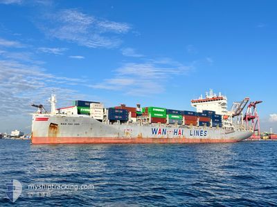
WAN HAI 285
Cargo
Current Trip
| Time Travelled | 5 h, 57 mins |
|---|---|
| Remaining Time | --- |
| Distance Travelled | 96.41 nm |
| Remaining Distance | --- |
| AVG Speed | 16.3 Knots |
| MAX Speed | 17.7 Knots |
| AVG Wind | 11.1 knots |
| MAX Wind | 15.4 knots |
| MIN Temp | 24.8°C / 76.64°F |
| MAX Temp | 28.3°C / 82.94°F |
| Draught | 9.8 m |
| Position Received | 4 d ago |
Current Position
| Longitude | 120.13557° |
|---|---|
| Latitude | 22.24429° |
| Status | Under way using engine |
| Speed | 16.2 Knots |
| Course | 186.6° |
| Area | South China Sea |
| Station | T-AIS |
| Position Received | 4 d ago |
Info
Information
The current position of WAN HAI 285 is in South China Sea with coordinates 22.24429° / 120.13557° as reported on 2024-04-24 12:37 by AIS to our vessel tracker app. The vessel's current speed is 16.2 Knots and is heading at the port of SUBIC. The estimated time of arrival as calculated by MyShipTracking vessel tracking app is 2024-04-23 22:20 LT
The vessel WAN HAI 285 (IMO: 9871323, MMSI: 563126900) is a Cargo It's sailing under the flag of [SG] Singapore.
In this page you can find informations about the vessels current position, last detected port calls, and current voyage information. If the vessels is not in coverage by AIS you will find the latest position.
The current position of WAN HAI 285 is detected by our AIS receivers and we are not responsible for the reliability of the data. The last position was recorded while the vessel was in Coverage by the Ais receivers of our vessel tracking app.
The current draught of WAN HAI 285 as reported by AIS is 9.8 meters
Weather
| Temperature | 28°C / 82.4°F |
|---|---|
| Wind Speed | 12 knots |
| Direction | 75° ENE |
| Pressure | 1010.9 hPa |
| Humidity | 74.1 % |
| Cloud Coverage | 100 % |
Featured Company
Last Port Calls
| Port | Arrival | Departure | Time In Port |
|---|---|---|---|
| 2024-04-28 04:52 | 2024-04-28 17:20 | 12 h | |
| 2024-04-23 22:38 | 2024-04-24 11:16 | 12 h | |
| 2024-04-21 22:36 | 2024-04-22 22:04 | 23 h | |
| 2024-04-20 22:03 | 2024-04-21 05:55 | 7 h | |
| 2024-04-17 14:32 | 2024-04-18 07:10 | 16 h | |
| 2024-04-08 09:06 | 2024-04-08 23:41 | 14 h | |
| 2024-04-06 01:33 | 2024-04-07 02:42 | 1 d | |
| 2024-04-05 15:50 | 2024-04-05 23:48 | 7 h | |
| 2024-03-29 12:19 | 2024-03-30 08:29 | 20 h | |
| 2024-03-25 06:17 | 2024-03-25 20:08 | 13 h |
Last Trips
| Origin | Departure | Destination | Arrival | Distance | |
|---|---|---|---|---|---|
| 2024-04-24 19:16 | 2024-04-28 12:52 | 936.90 nm | |||
| 2024-04-23 06:04 | 2024-04-24 06:38 | 369.81 nm | |||
| 2024-04-21 13:55 | 2024-04-22 06:36 | 23.02 nm | |||
| 2024-04-18 15:10 | 2024-04-21 06:03 | 958.63 nm | |||
| 2024-04-09 07:41 | 2024-04-17 22:32 | 2127.66 nm | |||
| 2024-04-07 10:42 | 2024-04-08 17:06 | 377.26 nm | |||
| 2024-04-06 07:48 | 2024-04-06 09:33 | 18.73 nm | |||
| 2024-03-30 16:29 | 2024-04-05 23:50 | 2048.02 nm | |||
| 2024-03-26 04:08 | 2024-03-29 20:19 | 1039.80 nm | |||
| 2024-03-25 12:30 | 2024-03-25 14:17 | 18.06 nm |
Events
| Time | Event | Details | Position / Dest | Info |
|---|---|---|---|---|
| 2024-04-28 17:20 | PORT DEPARTURE |
|
10.25619 / 123.88779
PH SFS
|
Speed: 6.6 kn Course: 214° |
| 2024-04-28 17:08 | START Moving |
10.28279 / 123.89511
[PH] CEBU
|
Speed: 6.6 kn Course: 214° |
|
| 2024-04-28 05:08 | STOP Moving |
10.30805 / 123.92298
[PH] CEBU
|
Speed: Course: 51° |
|
| 2024-04-28 04:52 | PORT ARRIVAL |
|
10.30771 / 123.92323
[PH] CEBU
|
Speed: 5.7 kn Course: 45° |
| 2024-04-27 14:42 | START Moving | 20.84 nm, North East of CEBU |
10.45178 / 124.23727
PH SFS
|
Speed: 8.1 kn Course: 199° |
| 2024-04-27 09:59 | STOP Moving |
10.45391 / 124.28668
PH SFS
|
Speed: 0.3 kn Course: 194° |
|
| 2024-04-26 08:04 | START Moving | 0.9 nm, South West of GRANDE ISLAND |
14.81024 / 120.26284
PH SFS
|
Speed: 5.8 kn Course: 303° |
| 2024-04-25 17:12 | STOP Moving | 1 nm, South West of GRANDE ISLAND |
14.80336 / 120.26620
PH SFS
|
Speed: 0.2 kn Course: 129° |
| 2024-04-24 12:44 | Status Changed | Default Under way using engine |
22.21068 / 120.13129
PH SFS
|
Speed: 16.2 kn Course: 186.6° |
| 2024-04-24 12:37 | OUT of Coverage |
22.24429 / 120.13557
South China Sea
|
Speed: 16.2 kn Course: 186.6° |