

W NORTH
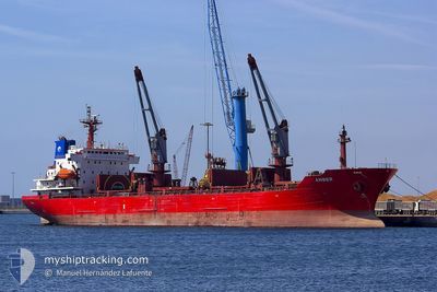
Oil/Chemical Tanker

Current Trip
| Trip Time | 2 days |
|---|---|
| Trip Distance | 632.66 nm |
| AVG Speed | 11.5 Knots |
| MAX Speed | 13.5 Knots |
| Draught | 6.7 m |
| AVG Wind | 10.4 knots |
| MAX Wind | 20 knots |
| MIN Temp | 3.6°C / 38.48°F |
| MAX Temp | 10°C / 50°F |
| Position Received | 2 d ago |
Current Position
| Longitude | --- |
|---|---|
| Latitude | --- |
| Status | Under way using engine |
| Speed | 12.2 Knots |
| Course | 82.4° |
| Area | Black Sea |
| Station | T-AIS |
| Position Received | 2 d ago |
Information
The current position of W NORTH is in Black Sea with coordinates 42.67969° / 31.85704° as reported on 2025-03-18 06:11 by AIS to our vessel tracker app. The vessel's current speed is 12.2 Knots and is currently inside the port of POTI.
The vessel W NORTH (IMO: 9272735, MMSI: 256585000) is a Oil/Chemical Tanker that was built in 2003 ( 22 years old ). It's sailing under the flag of [MT] Malta.
In this page you can find informations about the vessels current position, last detected port calls, and current voyage information. If the vessels is not in coverage by AIS you will find the latest position.
The current position of W NORTH is detected by our AIS receivers and we are not responsible for the reliability of the data. The last position was recorded while the vessel was in Coverage by the Ais receivers of our vessel tracking app.
The current draught of W NORTH as reported by AIS is 6.7 meters
Weather
| Temperature | 3.2°C / 37.76°F |
|---|---|
| Wind Speed | 3 knots |
| Direction | 82° E |
| Pressure | 1024.1 hPa |
| Humidity | 89.2 % |
| Cloud Coverage | 100 % |


Featured Company
Last Port Calls
| Port | Arrival | Departure | Time In Port |
|---|---|---|---|
| 2025-03-20 15:09 | |||
| 2025-03-14 00:06 | 2025-03-17 16:49 | 3 d | |
| 2025-03-10 12:17 | 2025-03-11 23:21 | 1 d | |
| 2025-03-05 23:53 | 2025-03-07 18:29 | 1 d | |
| 2025-02-27 17:25 | 2025-03-01 19:33 | 2 d | |
| 2025-02-19 13:29 | 2025-02-21 05:37 | 1 d | |
| 2025-02-16 00:09 | 2025-02-17 12:25 | 1 d | |
| 2025-02-11 21:29 | 2025-02-13 13:29 | 1 d | |
| 2025-02-08 07:29 | 2025-02-09 19:09 | 1 d | |
| 2025-02-03 14:57 | 2025-02-05 18:41 | 2 d |
Last Trips
| Origin | Departure | Destination | Arrival | Distance | |
|---|---|---|---|---|---|
| 2025-03-17 16:49 | 2025-03-20 15:09 | 632.66 nm | |||
| 2025-03-11 23:21 | 2025-03-14 00:06 | 629.33 nm | |||
| 2025-03-07 18:29 | 2025-03-10 12:17 | 631.42 nm | |||
| 2025-03-01 19:33 | 2025-03-05 23:53 | 631.41 nm | |||
| 2025-02-21 05:37 | 2025-02-27 17:25 | 753.53 nm | |||
| 2025-02-17 12:25 | 2025-02-19 13:29 | 629.46 nm | |||
| 2025-02-13 13:29 | 2025-02-16 00:09 | 632.24 nm | |||
| 2025-02-09 19:09 | 2025-02-11 21:29 | 629.28 nm | |||
| 2025-02-05 18:41 | 2025-02-08 07:29 | 629.09 nm | |||
| 2025-02-01 09:05 | 2025-02-03 14:57 | 627.85 nm |
Events
| Time | Event | Details | Position / Dest | Info |
|---|---|---|---|---|
| 2025-03-20 11:17 | STOP Moving |
42.15516 / 41.65122
[GE] POTI
|
Speed: 0.1 kn Course: 94° |
|
| 2025-03-20 11:09 | PORT ARRIVAL |
|
42.15725 / 41.64856
[GE] POTI
|
Speed: 7.1 kn Course: 125° |
| 2025-03-20 10:42 | START Moving | 2.89 nm, North West of POTI |
42.18923 / 41.60145
GEPTI
|
Speed: 8.4 kn Course: 175° |
| 2025-03-19 19:13 | STOP Moving | 3.1 nm, North West of POTI |
42.19560 / 41.60334
GEPTI
|
Speed: 0.3 kn Course: 318° |
| 2025-03-18 06:28 | Status Changed | Default Under way using engine |
42.68745 / 31.93574
GEPTI
|
Speed: 12.2 kn Course: 82.4° |
| 2025-03-18 06:11 | OUT of Coverage |
42.67969 / 31.85704
Black Sea
GEPTI
|
Speed: 12.2 kn Course: 82.4° |
|
| 2025-03-18 03:13 | Draught Changed | 6.7 5.6 |
42.61115 / 31.04136
GEPTI
|
Speed: 12.2 kn Course: 83.1° |
| 2025-03-18 03:13 | Destination Changed | GEPTI BGBOJ |
42.61115 / 31.04136
GEPTI
|
Speed: 12.2 kn Course: 83.1° |
| 2025-03-18 03:13 | ETA Changed | 2025/03/19 18:00 2025/03/13 23:00 |
42.61115 / 31.04136
GEPTI
|
Speed: 12.2 kn Course: 83.1° |
| 2025-03-18 03:08 | Status Changed | Under way using engine Default |
42.60950 / 31.01906
BGBOJ
|
Speed: 12.2 kn Course: 85° |