
W NORTH
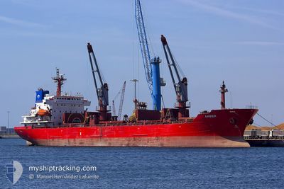
Oil/Chemical Tanker
Current Trip
| Time Travelled | 3 days |
|---|---|
| Remaining Time | --- |
| Distance Travelled | 981.67 nm |
| Remaining Distance | --- |
| AVG Speed | 12.9 Knop |
| MAX Speed | 14.1 Knop |
| AVG Wind | 6.9 knots |
| MAX Wind | 17 knots |
| MIN Temp | 13.5°C / 56.3°F |
| MAX Temp | 19.7°C / 67.46°F |
| Djupgående | 5.2 m |
| Position mottagen | 23 h, 11 m sen |
Current Position
| Longitud | 14.61575° |
|---|---|
| Latitude | 39.00372° |
| Status | Under way using engine |
| Fart | 12.7 Knop |
| Kurs | 299.2° |
| Område | Tyrrhenian Sea |
| Station | T-AIS |
| Position mottagen | 23 h, 11 m sen |
Info
Information
The current position of W NORTH is in Tyrrhenian Sea with coordinates 39.00372° / 14.61575° as reported on 2024-04-30 12:44 by AIS to our vessel tracker app. The vessel's current speed is 12.7 Knop and is heading at the port of LAVERA. The estimated time of arrival as calculated by MyShipTracking vessel tracking app is 2024-05-02 14:30 LT
The vessel W NORTH (IMO: 9272735, MMSI: 256585000) is a Oil/Chemical Tanker that was built in 2003 ( 21 År gammal ). It's sailing under the flag of [MT] Malta.
In this page you can find informations about the vessels current position, last detected port calls, and current voyage information. If the vessels is not in coverage by AIS you will find the latest position.
The current position of W NORTH is detected by our AIS receivers and we are not responsible for the reliability of the data. The last position was recorded while the vessel was in Coverage by the Ais receivers of our vessel tracking app.
The current draught of W NORTH as reported by AIS is 5.2 meters
Weather
| Temperature | 15.7°C / 60.26°F |
|---|---|
| Wind Speed | 14 knots |
| Direction | 249° WSW |
| Pressure | 1007.5 hPa |
| Humidity | 84.5 % |
| Cloud Coverage | 100 % |
Featured Company
Last Port Calls
| Port | Arrival | Departure | Time In Port |
|---|---|---|---|
| 2024-04-27 06:32 | 2024-04-28 07:55 | 1 d | |
| 2024-04-18 10:17 | 2024-04-20 22:20 | 2 d | |
| 2024-04-13 17:33 | 2024-04-15 20:00 | 2 d | |
| 2024-04-07 13:54 | 2024-04-08 20:28 | 1 d | |
| 2024-04-02 09:05 | 2024-04-03 08:59 | 23 h | |
| 2024-03-29 00:37 | 2024-03-29 20:52 | 20 h | |
| 2024-03-24 21:55 | 2024-03-26 08:10 | 1 d | |
| 2024-03-16 08:40 | 2024-03-17 13:54 | 1 d |
Last Trips
| Origin | Departure | Destination | Arrival | Distance | |
|---|---|---|---|---|---|
| 2024-04-21 01:20 | 2024-04-27 08:32 | 1338.72 nm | |||
| 2024-04-16 00:00 | 2024-04-18 13:17 | 637.27 nm | |||
| 2024-04-08 23:28 | 2024-04-13 21:33 | 1353.84 nm | |||
| 2024-04-03 10:59 | 2024-04-07 16:54 | 1148.38 nm | |||
| 2024-03-29 21:52 | 2024-04-02 11:05 | 477.52 nm | |||
| 2024-03-26 09:10 | 2024-03-29 01:37 | 765.37 nm | |||
| 2024-03-17 14:54 | 2024-03-24 22:55 | 63.27 nm | |||
| 2024-02-24 16:39 | 2024-03-16 09:40 | 2589.64 nm |
Events
| Tid | Event | Detaljer | Position / Dest | Information |
|---|---|---|---|---|
| 2024-04-30 12:46 | Status ändrad | Default Under way using engine |
39.00808 / 14.60565
ITRAN > FRLAV
|
Fart: 12.7 kn Kurs: 299.2° |
| 2024-04-30 12:44 | UTANFÖR täckningsområde |
39.00372 / 14.61575
Tyrrhenian Sea
ITRAN > FRLAV
|
Fart: 12.7 kn Kurs: 299.2° |
|
| 2024-04-30 07:19 | Byter havsområde | Italian part of the Tyrrhenian Sea Italian part of the Ionian Sea |
38.25318 / 15.66698
Tyrrhenian Sea
ITRAN > FRLAV
|
Fart: 12.1 kn Kurs: 60.1° |
| 2024-04-30 04:20 | Status ändrad | Under way using engine Default |
37.85291 / 15.96777
ITRAN > FRLAV
|
Fart: 13.2 kn Kurs: 271° |
| 2024-04-30 04:12 | Status ändrad | Default Under way using engine |
37.85237 / 16.00102
ITRAN > FRLAV
|
Fart: 13.3 kn Kurs: 270.7° |
| 2024-04-30 04:05 | Status ändrad | Under way using engine Default |
37.85194 / 16.03784
ITRAN > FRLAV
|
Fart: 13.5 kn Kurs: 262° |
| 2024-04-30 03:34 | Status ändrad | Default Under way using engine |
37.89961 / 16.16701
ITRAN > FRLAV
|
Fart: 13.5 kn Kurs: 239.2° |
| 2024-04-30 03:19 | Status ändrad | Under way using engine Default |
37.92773 / 16.22668
ITRAN > FRLAV
|
Fart: 13.4 kn Kurs: 216° |
| 2024-04-30 03:09 | I täckningsområde |
37.92773 / 16.22668
Ionian Sea
ITRAN > FRLAV
|
Fart: 13.6 kn Kurs: 238.3° |
|
| 2024-04-30 02:03 | UTANFÖR täckningsområde |
38.13625 / 16.46480
Ionian Sea
ITRAN > FRLAV
|
Fart: 13.1 kn Kurs: 225.2° |