
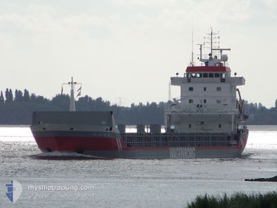
VLISTBORG
General Cargo
Current Trip
| Time Travelled | 3 h, 57 mins |
|---|---|
| Remaining Time | --- |
| Distance Travelled | 38.78 nm |
| Remaining Distance | --- |
| AVG Speed | 10 Knots |
| MAX Speed | 13.1 Knots |
| AVG Wind | 22 knots |
| MAX Wind | 27.2 knots |
| MIN Temp | 9.9°C / 49.82°F |
| MAX Temp | 10.2°C / 50.36°F |
| Draught | 7.8 m |
| Position Received | 19 m ago |
Current Position
| Longitude | 3.37259° |
|---|---|
| Latitude | 51.92538° |
| Status | Under way using engine |
| Speed | 10.7 Knots |
| Course | 12° |
| Area | North Sea |
| Station | T-AIS |
| Position Received | 19 m ago |
Info
Information
The current position of VLISTBORG is in North Sea with coordinates 51.92538° / 3.37259° as reported on 2024-05-03 10:30 by AIS to our vessel tracker app. The vessel's current speed is 10.7 Knots and is heading at the port of PORSGRUNN. The estimated time of arrival as calculated by MyShipTracking vessel tracking app is 2024-05-05 10:00 LT
The vessel VLISTBORG (IMO: 9160346, MMSI: 244850612) is a General Cargo that was built in 1999 ( 25 years old ). It's sailing under the flag of [NL] Netherlands.
In this page you can find informations about the vessels current position, last detected port calls, and current voyage information. If the vessels is not in coverage by AIS you will find the latest position.
The current position of VLISTBORG is detected by our AIS receivers and we are not responsible for the reliability of the data. The last position was recorded while the vessel was in Coverage by the Ais receivers of our vessel tracking app.
The current draught of VLISTBORG as reported by AIS is 7.8 meters
Weather
| Temperature | 9.9°C / 49.82°F |
|---|---|
| Wind Speed | 26 knots |
| Direction | 234° SW |
| Pressure | 1006.6 hPa |
| Humidity | 94.2 % |
| Cloud Coverage | 100 % |
Featured Company
Last Port Calls
| Port | Arrival | Departure | Time In Port |
|---|---|---|---|
| 2024-05-01 23:11 | 2024-05-03 06:53 | 1 d | |
| 2024-04-24 08:32 | 2024-04-26 13:21 | 2 d | |
| 2024-04-17 00:07 | |||
| 2024-03-13 04:52 | 2024-04-14 13:52 | ||
| 2024-03-06 00:36 | 2024-03-08 14:14 | 2 d |
Most Visited Ports (Last year)
| Port | Arrivals | |
|---|---|---|
| 2 | ||
| 2 | ||
| 2 | ||
| 2 | ||
| 2 | ||
| 2 |
Last Trips
| Origin | Departure | Destination | Arrival | Distance | |
|---|---|---|---|---|---|
| 2024-04-26 15:21 | 2024-05-02 01:11 | 76.22 nm | |||
| 2024-04-14 16:52 | 2024-04-17 03:07 | 586.96 nm | |||
| 2024-03-08 15:14 | 2024-03-13 06:52 | 1149.55 nm | |||
| 2024-02-28 18:50 | 2024-03-06 01:36 | 1435.32 nm |
Events
| Time | Event | Details | Position / Dest | Info |
|---|---|---|---|---|
| 2024-05-03 10:35 | Status Changed | Default Under way using engine |
51.93833 / 3.37667
NOHRY
|
Speed: 10.7 kn Course: 12° |
| 2024-05-03 10:30 | Status Changed | Under way using engine Default |
51.92538 / 3.37259
NOHRY
|
Speed: 10.8 kn Course: 10° |
| 2024-05-03 10:26 | Status Changed | Default Under way using engine |
51.91265 / 3.36823
NOHRY
|
Speed: 10.8 kn Course: 10.3° |
| 2024-05-03 10:24 | Status Changed | Under way using engine Default |
51.90575 / 3.36614
NOHRY
|
Speed: 10.9 kn Course: 20° |
| 2024-05-03 10:14 | Status Changed | Default Under way using engine |
51.87865 / 3.35291
NOHRY
|
Speed: 11 kn Course: 18° |
| 2024-05-03 06:53 | PORT DEPARTURE |
|
51.44694 / 3.67048
NOHRY
|
Speed: 9.4 kn Course: 222° |
| 2024-05-03 06:32 | START Moving |
51.45390 / 3.71775
[NL] VLISSINGEN
|
Speed: 4.2 kn Course: 244° |
|
| 2024-05-03 06:28 | Status Changed | Under way using engine Moored |
51.45550 / 3.72091
[NL] VLISSINGEN
|
Speed: 0.6 kn Course: 157° |
| 2024-05-02 19:56 | ETA Changed | 2024/05/05 10:00 2024/05/04 19:00 |
51.45442 / 3.72192
[NL] VLISSINGEN
|
Speed: Course: 59° |
| 2024-05-02 19:27 | Draught Changed | 7.8 7.3 |
51.45443 / 3.72192
[NL] VLISSINGEN
|
Speed: Course: 59° |