
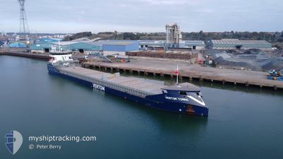
VERTOM TOMMA
Cargo
Current Trip
| Time Travelled | 3 days |
|---|---|
| Remaining Time | 1 h, 8 mins |
| Distance Travelled | 566.51 nm |
| Remaining Distance | 17.38 nm |
| AVG Speed | 6.5 Knots |
| MAX Speed | 12.2 Knots |
| AVG Wind | 19.4 knots |
| MAX Wind | 25.3 knots |
| MIN Temp | 9.1°C / 48.38°F |
| MAX Temp | 12.4°C / 54.32°F |
| Draught | 4.2 m |
| Position Received | 1 m ago |
Current Position
| Longitude | --- |
|---|---|
| Latitude | --- |
| Status | Under way using engine |
| Speed | 6.8 Knots |
| Course | 83.3° |
| Area | North Sea |
| Station | T-AIS |
| Position Received | 1 m ago |
Info
Information
The current position of VERTOM TOMMA is in North Sea with coordinates 51.42411° / 3.58600° as reported on 2025-12-12 20:47 by AIS to our vessel tracker app. The vessel's current speed is 6.8 Knots and is heading at the port of SLUISKIL. The estimated time of arrival as calculated by MyShipTracking vessel tracking app is 2025-12-12 22:56 LT
The vessel VERTOM TOMMA (IMO: 9938743, MMSI: 246320000) is a Cargo It's sailing under the flag of [NL] Netherlands.
In this page you can find informations about the vessels current position, last detected port calls, and current voyage information. If the vessels is not in coverage by AIS you will find the latest position.
The current position of VERTOM TOMMA is detected by our AIS receivers and we are not responsible for the reliability of the data. The last position was recorded while the vessel was in Coverage by the Ais receivers of our vessel tracking app.
The current draught of VERTOM TOMMA as reported by AIS is 4.2 meters
Weather
| Temperature | 9.2°C / 48.56°F |
|---|---|
| Wind Speed | 12 knots |
| Direction | 205° SSW |
| Pressure | 1021.9 hPa |
| Humidity | 91.4 % |
| Cloud Coverage | 100 % |
Featured Company
Last Port Calls
| Port | Arrival | Departure | Time In Port |
|---|---|---|---|
| 2025-12-04 17:17 | 2025-12-09 19:22 | 5 d | |
| 2025-11-13 15:05 | 2025-11-15 22:20 | 2 d | |
| 2025-11-09 16:10 | 2025-11-12 13:56 | 2 d | |
| 2025-10-30 13:57 | 2025-10-30 18:43 | 4 h | |
| 2025-10-19 19:16 | 2025-10-20 09:02 | 13 h | |
| 2025-10-17 17:17 | 2025-10-19 11:18 | 1 d | |
| 2025-10-09 21:59 | 2025-10-13 20:47 | 3 d | |
| 2025-10-02 10:04 |
Last Trips
| Origin | Departure | Destination | Arrival | Distance | |
|---|---|---|---|---|---|
| 2025-11-15 22:20 | 2025-12-04 17:17 | 3317.56 nm | |||
| 2025-11-12 13:56 | 2025-11-13 15:05 | 116.57 nm | |||
| 2025-10-30 18:43 | 2025-11-09 16:10 | 1980.52 nm | |||
| 2025-10-20 09:02 | 2025-10-30 13:57 | 1901.52 nm | |||
| 2025-10-19 11:18 | 2025-10-19 19:16 | 2.43 nm | |||
| 2025-10-13 20:47 | 2025-10-17 17:17 | 838.66 nm | |||
| 2025-10-02 10:04 | 2025-10-09 21:59 | 1325.24 nm |
Events
| Time | Event | Details | Position / Dest | Info |
|---|---|---|---|---|
| 2025-12-12 19:40 | Change Sea Area | Dutch part of the North Sea Belgian part of the North Sea |
51.40098 / 3.34536
North Sea
|
Speed: 9.3 kn Course: 82.4° |
| 2025-12-12 16:21 | START Moving | 13.57 nm, North West of NIEUWPOORT |
51.32807 / 2.56668
NL SLU
|
Speed: 3.3 kn Course: 21° |
| 2025-12-12 16:12 | Status Changed | Under way using engine At anchor |
51.32884 / 2.56463
NL SLU
|
Speed: 0.3 kn Course: 209° |
| 2025-12-12 13:05 | Status Changed | At anchor Default |
51.32864 / 2.56250
NL SLU
|
Speed: Course: 95° |
| 2025-12-12 12:59 | Status Changed | Default At anchor |
51.32868 / 2.56250
NL SLU
|
Speed: Course: 97° |
| 2025-12-12 09:41 | Status Changed | At anchor Under way using engine |
51.32987 / 2.56496
NL SLU
|
Speed: 0.3 kn Course: 199° |
| 2025-12-12 09:33 | STOP Moving | 13.64 nm, North West of NIEUWPOORT |
51.32841 / 2.56384
NL SLU
|
Speed: 0.3 kn Course: 187° |
| 2025-12-12 08:32 | Detected in Sea | Belgian part of the North Sea |
51.32510 / 2.37278
North Sea
NL SLU
|
Speed: 10.6 kn Course: 55.9° |
| 2025-12-12 05:31 | Change Sea Area | French part of the North Sea French part of the English Channel |
50.99775 / 1.62541
North Sea
NL SLU
|
Speed: 12.2 kn Course: 44.2° |
| 2025-12-12 03:38 | Status Changed | Under way using engine Default |
50.68281 / 1.36387
NL SLU
|
Speed: 10.7 kn Course: 30° |