
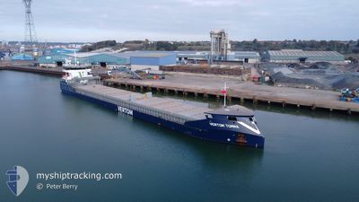
VERTOM TOMMA
Cargo
Current Trip
| Time Travelled | 1 day |
|---|---|
| Remaining Time | 2 days |
| Distance Travelled | 163.85 nm |
| Remaining Distance | 412.28 nm |
| AVG Speed | 5.4 Noeuds |
| MAX Speed | 9 Noeuds |
| AVG Wind | 21.9 knots |
| MAX Wind | 25.3 knots |
| MIN Temp | 9.8°C / 49.64°F |
| MAX Temp | 12°C / 53.6°F |
| Tirant d eau | 4.2 m |
| Position reçue | 4 h, 31 m depuis |
Current Position
| Longitude | --- |
|---|---|
| Latitude | --- |
| Etat | Under way using engine |
| Vitesse | 7.1 Noeuds |
| Parcours | 256.2° |
| Zone | Celtic Sea |
| Station | T-AIS |
| Position reçue | 4 h, 31 m depuis |
Info
Information
The current position of VERTOM TOMMA is in Celtic Sea with coordinates 50.39389° / -5.67289° as reported on 2025-12-10 15:57 by AIS to our vessel tracker app. The vessel's current speed is 7.1 Noeuds and is heading at the port of SLUISKIL. The estimated time of arrival as calculated by MyShipTracking vessel tracking app is 2025-12-13 06:44 LT
The vessel VERTOM TOMMA (IMO: 9938743, MMSI: 246320000) is a Cargo It's sailing under the flag of [NL] Netherlands.
In this page you can find informations about the vessels current position, last detected port calls, and current voyage information. If the vessels is not in coverage by AIS you will find the latest position.
The current position of VERTOM TOMMA is detected by our AIS receivers and we are not responsible for the reliability of the data. The last position was recorded while the vessel was in Coverage by the Ais receivers of our vessel tracking app.
The current draught of VERTOM TOMMA as reported by AIS is 4.2 meters
Weather
| Temperature | 12°C / 53.6°F |
|---|---|
| Wind Speed | 18 knots |
| Direction | 204° SSW |
| Pressure | 1020.3 hPa |
| Humidity | 81.9 % |
| Cloud Coverage | 10 % |
Featured Company
Last Port Calls
| Port | Arrival | Departure | Time In Port |
|---|---|---|---|
| 2025-12-04 17:17 | 2025-12-09 19:22 | 5 d | |
| 2025-11-13 15:05 | 2025-11-15 22:20 | 2 d | |
| 2025-11-09 16:10 | 2025-11-12 13:56 | 2 d | |
| 2025-10-30 13:57 | 2025-10-30 18:43 | 4 h | |
| 2025-10-19 19:16 | 2025-10-20 09:02 | 13 h | |
| 2025-10-17 17:17 | 2025-10-19 11:18 | 1 d | |
| 2025-10-09 21:59 | 2025-10-13 20:47 | 3 d | |
| 2025-10-02 10:04 |
Last Trips
| Origin | Departure | Destination | Arrival | Distance | |
|---|---|---|---|---|---|
| 2025-11-15 22:20 | 2025-12-04 17:17 | 3317.56 nm | |||
| 2025-11-12 13:56 | 2025-11-13 15:05 | 116.57 nm | |||
| 2025-10-30 18:43 | 2025-11-09 16:10 | 1980.52 nm | |||
| 2025-10-20 09:02 | 2025-10-30 13:57 | 1901.52 nm | |||
| 2025-10-19 11:18 | 2025-10-19 19:16 | 2.43 nm | |||
| 2025-10-13 20:47 | 2025-10-17 17:17 | 838.66 nm | |||
| 2025-10-02 10:04 | 2025-10-09 21:59 | 1325.24 nm |
Events
| Heure | Evenement | Détails | Position/ Destination | Info |
|---|---|---|---|---|
| 2025-12-10 16:03 | Etat Changé | Default Under way using engine |
50.39141 / -5.68935
NL SLU
|
Vitesse: 7.1 kn Parcours: 256.2° |
| 2025-12-10 15:57 | Hors de la zone couverte |
50.39389 / -5.67289
Celtic Sea
NL SLU
|
Vitesse: 7.1 kn Parcours: 256.2° |
|
| 2025-12-10 12:20 | Tirant d'eau modifié | 4.2 4 |
50.66762 / -5.06739
NL SLU
|
Vitesse: 7.4 kn Parcours: 220° |
| 2025-12-10 12:20 | Changement d'ETA | 2025/12/12 10:00 |
50.66762 / -5.06739
NL SLU
|
Vitesse: 7.4 kn Parcours: 220° |
| 2025-12-10 12:10 | Etat Changé | Under way using engine Default |
50.68329 / -5.04298
NL SLU
|
Vitesse: 7.7 kn Parcours: 225° |
| 2025-12-10 12:07 | Etat Changé | Default Under way using engine |
50.68798 / -5.03561
NL SLU
|
Vitesse: 7.8 kn Parcours: 221.8° |
| 2025-12-10 12:01 | Etat Changé | Under way using engine Default |
50.69742 / -5.02051
NL SLU
|
Vitesse: 7.4 kn Parcours: 229° |
| 2025-12-10 11:47 | Dans la zone couverte |
50.69687 / -5.02135
Celtic Sea
|
Vitesse: 7.5 kn Parcours: 223.7° |
|
| 2025-12-10 08:39 | Etat Changé | Default Under way using engine |
50.98777 / -4.63979
NL SLU
|
Vitesse: 5.6 kn Parcours: 217° |
| 2025-12-10 08:33 | Hors de la zone couverte |
50.99455 / -4.63241
Celtic Sea
|
Vitesse: 5.6 kn Parcours: 217° |