
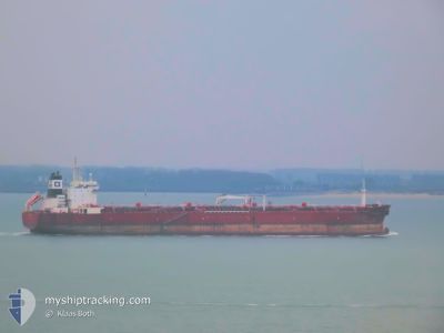
SUNNY LIGER
Oil Products Tanker
Current Trip
| Trip Time | 3 days |
|---|---|
| Trip Distance | 762.00 nm |
| AVG Speed | 11.3 Knots |
| MAX Speed | 14.4 Knots |
| Draught | 9.7 m |
| AVG Wind | 7 knots |
| MAX Wind | 15 knots |
| MIN Temp | 31.5°C / 88.7°F |
| MAX Temp | 49.2°C / 120.56°F |
| Position Received | 8 d ago |
Current Position
| Longitude | 47.96766° |
|---|---|
| Latitude | 30.00124° |
| Status | At anchor |
| Speed | 10.3 Knots |
| Course | 292.8° |
| Area | Persian Gulf |
| Station | T-AIS |
| Position Received | 8 d ago |
Info
Information
The current position of SUNNY LIGER is in Persian Gulf with coordinates 30.00124° / 47.96766° as reported on 2024-06-20 08:38 by AIS to our vessel tracker app. The vessel's current speed is 10.3 Knots and is currently inside the port of KHOR AL ZUBAIR.
The vessel SUNNY LIGER (IMO: 9332626, MMSI: 538009607) is a Oil Products Tanker that was built in 2008 ( 16 years old ). It's sailing under the flag of [MH] Marshall Is.
In this page you can find informations about the vessels current position, last detected port calls, and current voyage information. If the vessels is not in coverage by AIS you will find the latest position.
The current position of SUNNY LIGER is detected by our AIS receivers and we are not responsible for the reliability of the data. The last position was recorded while the vessel was in Coverage by the Ais receivers of our vessel tracking app.
The current draught of SUNNY LIGER as reported by AIS is 9.7 meters
Weather
| Temperature | 41.8°C / 107.24°F |
|---|---|
| Wind Speed | 15 knots |
| Direction | 288° WNW |
| Pressure | 996.6 hPa |
| Humidity | 5.9 % |
| Cloud Coverage | --- |
Featured Company
Last Port Calls
| Port | Arrival | Departure | Time In Port |
|---|---|---|---|
| 2024-06-20 10:48 | |||
| 2024-06-10 15:13 | 2024-06-16 10:53 | 5 d | |
| 2024-05-12 08:39 | 2024-05-14 06:17 | 1 d | |
| 2024-05-08 07:38 | 2024-05-10 05:19 | 1 d | |
| 2024-04-20 09:54 | 2024-04-23 09:47 | 2 d | |
| 2024-04-18 23:34 | 2024-04-20 08:27 | 1 d | |
| 2024-04-16 11:36 | 2024-04-18 20:35 | 2 d | |
| 2024-04-06 00:12 | 2024-04-09 20:22 | 3 d |
Most Visited Ports (Last year)
| Port | Arrivals | |
|---|---|---|
| 8 | ||
| 3 | ||
| 2 | ||
| 1 | ||
| 1 | ||
| 1 |
Last Trips
| Origin | Departure | Destination | Arrival | Distance | |
|---|---|---|---|---|---|
| 2024-06-16 14:53 | 2024-06-20 13:48 | 762.00 nm | |||
| 2024-05-14 16:17 | 2024-06-10 19:13 | 7230.47 nm | |||
| 2024-05-10 15:19 | 2024-05-12 18:39 | 562.64 nm | |||
| 2024-04-23 17:47 | 2024-05-08 17:38 | 4148.19 nm | |||
| 2024-04-20 16:27 | 2024-04-20 17:54 | 8.55 nm | |||
| 2024-04-19 04:35 | 2024-04-19 07:34 | 9.14 nm | |||
| 2024-04-10 04:22 | 2024-04-16 19:36 | 197.92 nm | |||
| 2024-03-28 17:00 | 2024-04-06 08:12 | 896.01 nm |
Events
| Time | Event | Details | Position / Dest | Info |
|---|---|---|---|---|
| 2024-06-20 10:48 | STOP Moving |
30.18480 / 47.89337
[IQ] KHOR AL ZUBAIR
|
Speed: 0.1 kn Course: 335° |
|
| 2024-06-20 10:48 | PORT ARRIVAL |
|
30.18480 / 47.89337
[IQ] KHOR AL ZUBAIR
|
Speed: 1 kn Course: 329° |
| 2024-06-20 08:45 | Status Changed | Default At anchor |
30.01606 / 47.95587
IQKAZ
|
Speed: 10.3 kn Course: 292.8° |
| 2024-06-20 08:38 | OUT of Coverage |
30.00124 / 47.96766
Persian Gulf
|
Speed: 10.3 kn Course: 292.8° |
|
| 2024-06-20 08:26 | Change Sea Area | Iraqi part of the Persian Gulf Kuwaiti part of the Persian Gulf |
29.99387 / 48.01076
Persian Gulf
|
Speed: 11.9 kn Course: 261.5° |
| 2024-06-20 08:14 | Change Sea Area | Kuwaiti part of the Persian Gulf Iraqi part of the Persian Gulf |
30.01994 / 48.04729
Persian Gulf
|
Speed: 12.2 kn Course: 226.8° |
| 2024-06-20 08:13 | Status Changed | At anchor Default |
30.02188 / 48.04967
IQKAZ
|
Speed: 12.9 kn Course: 257° |
| 2024-06-20 08:05 | Status Changed | Default At anchor |
30.03095 / 48.07764
IQKAZ
|
Speed: 12.8 kn Course: 262° |
| 2024-06-20 07:44 | Change Sea Area | Iraqi part of the Persian Gulf Kuwaiti part of the Persian Gulf |
30.02209 / 48.16554
Persian Gulf
|
Speed: 13 kn Course: 298.5° |
| 2024-06-20 07:38 | Change Sea Area | Kuwaiti part of the Persian Gulf Iraqi part of the Persian Gulf |
30.01129 / 48.18741
Persian Gulf
|
Speed: 13 kn Course: 300.1° |