
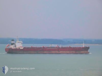
SUNNY LIGER
Oil Products Tanker
Current Trip
IQKAZ
| Time Travelled | 12 h, 46 mins |
|---|---|
| Remaining Time | --- |
| Distance Travelled | 146.53 nm |
| Remaining Distance | --- |
| AVG Speed | 11.6 Knop |
| MAX Speed | 14.1 Knop |
| AVG Wind | 12.8 knots |
| MAX Wind | 14.8 knots |
| MIN Temp | 34.2°C / 93.56°F |
| MAX Temp | 46.5°C / 115.7°F |
| Djupgående | 9.7 m |
| Position mottagen | 20 m sen |
Current Position
| Longitud | 50.01986° |
|---|---|
| Latitude | 28.91640° |
| Status | Under way using engine |
| Fart | 9.3 Knop |
| Kurs | 205.9° |
| Område | Persian Gulf |
| Station | T-AIS |
| Position mottagen | 20 m sen |
Info
Information
The current position of SUNNY LIGER is in Persian Gulf with coordinates 28.91640° / 50.01986° as reported on 2024-06-30 23:11 by AIS to our vessel tracker app. The vessel's current speed is 9.3 Knop
The vessel SUNNY LIGER (IMO: 9332626, MMSI: 538009607) is a Oil Products Tanker that was built in 2008 ( 16 År gammal ). It's sailing under the flag of [MH] Marshall Is.
In this page you can find informations about the vessels current position, last detected port calls, and current voyage information. If the vessels is not in coverage by AIS you will find the latest position.
The current position of SUNNY LIGER is detected by our AIS receivers and we are not responsible for the reliability of the data. The last position was recorded while the vessel was in Coverage by the Ais receivers of our vessel tracking app.
The current draught of SUNNY LIGER as reported by AIS is 9.7 meters
Weather
| Temperature | 34.6°C / 94.28°F |
|---|---|
| Wind Speed | 13 knots |
| Direction | 310° NW |
| Pressure | 994.4 hPa |
| Humidity | 60 % |
| Cloud Coverage | 1 % |
Featured Company
Last Port Calls
| Port | Arrival | Departure | Time In Port |
|---|---|---|---|
| 2024-06-20 10:48 | 2024-06-30 10:45 | 9 d | |
| 2024-06-10 15:13 | 2024-06-16 10:53 | 5 d | |
| 2024-05-12 08:39 | 2024-05-14 06:17 | 1 d | |
| 2024-05-08 07:38 | 2024-05-10 05:19 | 1 d | |
| 2024-04-20 09:54 | 2024-04-23 09:47 | 2 d | |
| 2024-04-18 23:34 | 2024-04-20 08:27 | 1 d | |
| 2024-04-16 11:36 | 2024-04-18 20:35 | 2 d | |
| 2024-04-06 00:12 | 2024-04-09 20:22 | 3 d |
Most Visited Ports (Last year)
| Port | Arrivals | |
|---|---|---|
| 8 | ||
| 3 | ||
| 2 | ||
| 1 | ||
| 1 | ||
| 1 |
Last Trips
| Origin | Departure | Destination | Arrival | Distance | |
|---|---|---|---|---|---|
| 2024-06-16 14:53 | 2024-06-20 13:48 | 762.00 nm | |||
| 2024-05-14 16:17 | 2024-06-10 19:13 | 7230.47 nm | |||
| 2024-05-10 15:19 | 2024-05-12 18:39 | 562.64 nm | |||
| 2024-04-23 17:47 | 2024-05-08 17:38 | 4148.19 nm | |||
| 2024-04-20 16:27 | 2024-04-20 17:54 | 8.55 nm | |||
| 2024-04-19 04:35 | 2024-04-19 07:34 | 9.14 nm | |||
| 2024-04-10 04:22 | 2024-04-16 19:36 | 197.92 nm | |||
| 2024-03-28 17:00 | 2024-04-06 08:12 | 896.01 nm |
Events
| Tid | Event | Detaljer | Position / Dest | Information |
|---|---|---|---|---|
| 2024-06-30 23:14 | Status ändrad | Default Under way using engine |
28.90829 / 50.01976
IQKAZ
|
Fart: 9.3 kn Kurs: 205.9° |
| 2024-06-30 21:58 | Status ändrad | Under way using engine Default |
29.09834 / 49.86717
IQKAZ
|
Fart: 12.8 kn Kurs: 104° |
| 2024-06-30 21:11 | Status ändrad | Default Under way using engine |
29.13933 / 49.68306
IQKAZ
|
Fart: 13 kn Kurs: 103.3° |
| 2024-06-30 21:10 | Status ändrad | Under way using engine Default |
29.13959 / 49.68179
IQKAZ
|
Fart: 13.1 kn Kurs: 104° |
| 2024-06-30 20:59 | Status ändrad | Default Under way using engine |
29.15043 / 49.63279
IQKAZ
|
Fart: 13.1 kn Kurs: 103.9° |
| 2024-06-30 20:54 | Status ändrad | Under way using engine Default |
29.15401 / 49.61664
IQKAZ
|
Fart: 13.1 kn Kurs: 104° |
| 2024-06-30 20:23 | Status ändrad | Default Under way using engine |
29.19080 / 49.49446
IQKAZ
|
Fart: 13.2 kn Kurs: 119° |
| 2024-06-30 20:19 | Status ändrad | Under way using engine Default |
29.19712 / 49.48158
IQKAZ
|
Fart: 13.1 kn Kurs: 117° |
| 2024-06-30 20:09 | Status ändrad | Default Under way using engine |
29.21466 / 49.44490
IQKAZ
|
Fart: 13.2 kn Kurs: 116.1° |
| 2024-06-30 19:11 | Byter havsområde | Iranian part of the Persian Gulf Kuwaiti part of the Persian Gulf |
29.33919 / 49.24593
Persian Gulf
|
Fart: 13.4 kn Kurs: 124.3° |