
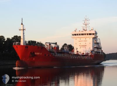
SUDE-S
Oil/Chemical Tanker
Current Trip
| Trip Time | 21 h, 9 mins |
|---|---|
| Trip Distance | 149.05 nm |
| AVG Speed | 8.8 Knots |
| MAX Speed | 11.2 Knots |
| Draught | 5.9 m |
| AVG Wind | 4 knots |
| MAX Wind | 7.5 knots |
| MIN Temp | 4.3°C / 39.74°F |
| MAX Temp | 8.8°C / 47.84°F |
| Position Received | 7 h, 2 m ago |
Current Position
| Longitude | --- |
|---|---|
| Latitude | --- |
| Status | Under way using engine |
| Speed | 7.8 Knots |
| Course | 249.1° |
| Area | North Sea |
| Station | T-AIS |
| Position Received | 7 h, 2 m ago |
Information
The current position of SUDE-S is in North Sea with coordinates 56.00438° / -3.38570° as reported on 2025-03-20 19:45 by AIS to our vessel tracker app. The vessel's current speed is 7.8 Knots and is currently inside the port of GRANGEMOUTH.
The vessel SUDE-S (IMO: 9508378, MMSI: 215516000) is a Oil/Chemical Tanker that was built in 2009 ( 16 years old ). It's sailing under the flag of [MT] Malta.
In this page you can find informations about the vessels current position, last detected port calls, and current voyage information. If the vessels is not in coverage by AIS you will find the latest position.
The current position of SUDE-S is detected by our AIS receivers and we are not responsible for the reliability of the data. The last position was recorded while the vessel was in Coverage by the Ais receivers of our vessel tracking app.
The current draught of SUDE-S as reported by AIS is 5.9 meters
Weather
| Temperature | 3.4°C / 38.12°F |
|---|---|
| Wind Speed | 4 knots |
| Direction | 44° NE |
| Pressure | 1013.4 hPa |
| Humidity | 93.9 % |
| Cloud Coverage | 80 % |
Featured Company
Last Port Calls
| Port | Arrival | Departure | Time In Port |
|---|---|---|---|
| 2025-03-20 21:12 | |||
| 2025-03-19 04:05 | 2025-03-20 00:03 | 19 h | |
| 2025-03-14 00:53 | 2025-03-14 22:50 | 21 h | |
| 2025-03-09 20:29 | 2025-03-10 21:40 | 1 d | |
| 2025-03-07 08:23 | 2025-03-08 03:41 | 19 h | |
| 2025-03-04 18:45 | 2025-03-05 19:47 | 1 d | |
| 2025-03-02 04:12 | 2025-03-03 01:17 | 21 h | |
| 2025-02-25 23:26 | 2025-02-26 18:21 | 18 h | |
| 2025-02-23 11:31 | 2025-02-24 03:41 | 16 h | |
| 2025-02-20 13:28 | 2025-02-21 08:03 | 18 h |
Most Visited Ports (Last year)
| Port | Arrivals | |
|---|---|---|
| 13 | ||
| 8 | ||
| 7 | ||
| 7 | ||
| 6 | ||
| 5 |
Last Trips
| Origin | Departure | Destination | Arrival | Distance | |
|---|---|---|---|---|---|
| 2025-03-20 00:03 | 2025-03-20 21:12 | 149.05 nm | |||
| 2025-03-14 23:50 | 2025-03-19 04:05 | 962.11 nm | |||
| 2025-03-10 22:40 | 2025-03-14 01:53 | 792.82 nm | |||
| 2025-03-08 03:41 | 2025-03-09 21:29 | 450.00 nm | |||
| 2025-03-05 19:47 | 2025-03-07 08:23 | 151.70 nm | |||
| 2025-03-03 02:17 | 2025-03-04 18:45 | 440.68 nm | |||
| 2025-02-26 19:21 | 2025-03-02 05:12 | 275.54 nm | |||
| 2025-02-24 03:41 | 2025-02-26 00:26 | 421.66 nm | |||
| 2025-02-21 08:03 | 2025-02-23 11:31 | 156.24 nm | |||
| 2025-02-15 14:13 | 2025-02-20 13:28 | 631.88 nm |
Events
| Time | Event | Details | Position / Dest | Info |
|---|---|---|---|---|
| 2025-03-20 21:16 | STOP Moving |
56.03529 / -3.68438
[GB] GRANGEMOUTH
|
Speed: 0.3 kn Course: 242° |
|
| 2025-03-20 21:12 | PORT ARRIVAL |
|
56.03571 / -3.68317
[GB] GRANGEMOUTH
|
Speed: 2.1 kn Course: 247° |
| 2025-03-20 19:52 | Status Changed | Default Under way using engine |
56.00265 / -3.41398
GBGRG
|
Speed: 7.8 kn Course: 249.1° |
| 2025-03-20 19:45 | Status Changed | Under way using engine Default |
56.00438 / -3.38570
GBGRG
|
Speed: 7.9 kn Course: 245° |
| 2025-03-20 19:45 | OUT of Coverage |
56.00438 / -3.38570
North Sea
|
Speed: 7.8 kn Course: 249.1° |
|
| 2025-03-20 19:44 | Status Changed | Default Under way using engine |
56.00508 / -3.38266
GBGRG
|
Speed: 10.4 kn Course: 244.8° |
| 2025-03-20 19:37 | Status Changed | Under way using engine Default |
56.01315 / -3.35298
GBGRG
|
Speed: 10.5 kn Course: 246° |
| 2025-03-20 19:36 | Status Changed | Default Under way using engine |
56.01418 / -3.34896
GBGRG
|
Speed: 10.5 kn Course: 246.4° |
| 2025-03-20 18:36 | START Moving | 2.54 nm, East of KINGHORN |
56.07977 / -3.09569
GBGRG
|
Speed: 6.9 kn Course: 254.4° |
| 2025-03-20 18:27 | Status Changed | Under way using engine At anchor |
56.07932 / -3.09086
GBGRG
|
Speed: 0.3 kn Course: 55° |