

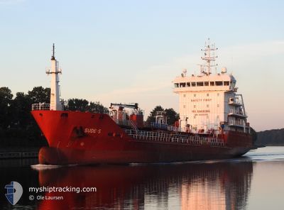
SUDE-S
Oil/Chemical Tanker

Current Trip
| Time Travelled | 13 h, 54 mins |
|---|---|
| Remaining Time | 1 day |
| Distance Travelled | 125.83 nm |
| Remaining Distance | 347.79 nm |
| AVG Speed | 8.8 Noeuds |
| MAX Speed | 10.9 Noeuds |
| AVG Wind | 16.2 knots |
| MAX Wind | 25 knots |
| MIN Temp | 6.9°C / 44.42°F |
| MAX Temp | 15°C / 59°F |
| Tirant d eau | 5.1 m |
| Position reçue | 3 h, 10 m depuis |
Current Position
| Longitude | --- |
|---|---|
| Latitude | --- |
| Etat | Under way using engine |
| Vitesse | 8.4 Noeuds |
| Parcours | 148.8° |
| Zone | North Sea |
| Station | T-AIS |
| Position reçue | 3 h, 10 m depuis |
Information
The current position of SUDE-S is in North Sea with coordinates 55.71662° / -1.01153° as reported on 2025-03-21 23:48 by AIS to our vessel tracker app. The vessel's current speed is 8.4 Noeuds and is heading at the port of GENT. The estimated time of arrival as calculated by MyShipTracking vessel tracking app is 2025-03-23 21:14 LT
The vessel SUDE-S (IMO: 9508378, MMSI: 215516000) is a Oil/Chemical Tanker that was built in 2009 ( 16 Age ). It's sailing under the flag of [MT] Malta.
In this page you can find informations about the vessels current position, last detected port calls, and current voyage information. If the vessels is not in coverage by AIS you will find the latest position.
The current position of SUDE-S is detected by our AIS receivers and we are not responsible for the reliability of the data. The last position was recorded while the vessel was in Coverage by the Ais receivers of our vessel tracking app.
The current draught of SUDE-S as reported by AIS is 5.1 meters
Weather
| Temperature | 8.2°C / 46.76°F |
|---|---|
| Wind Speed | 20 knots |
| Direction | 134° SE |
| Pressure | 1001.8 hPa |
| Humidity | 89.1 % |
| Cloud Coverage | 100 % |


Featured Company
Last Port Calls
| Port | Arrival | Departure | Time In Port |
|---|---|---|---|
| 2025-03-20 21:12 | 2025-03-21 13:04 | 15 h | |
| 2025-03-19 04:05 | 2025-03-20 00:03 | 19 h | |
| 2025-03-14 01:53 | 2025-03-14 23:50 | 21 h | |
| 2025-03-09 21:29 | 2025-03-10 22:40 | 1 d | |
| 2025-03-07 08:23 | 2025-03-08 03:41 | 19 h | |
| 2025-03-04 18:45 | 2025-03-05 19:47 | 1 d | |
| 2025-03-02 05:12 | 2025-03-03 02:17 | 21 h | |
| 2025-02-26 00:26 | 2025-02-26 19:21 | 18 h | |
| 2025-02-23 11:31 | 2025-02-24 03:41 | 16 h | |
| 2025-02-20 13:28 | 2025-02-21 08:03 | 18 h |
Most Visited Ports (Last year)
| Port | Arrivals | |
|---|---|---|
| 13 | ||
| 8 | ||
| 7 | ||
| 7 | ||
| 6 | ||
| 5 |
Last Trips
| Origin | Departure | Destination | Arrival | Distance | |
|---|---|---|---|---|---|
| 2025-03-20 00:03 | 2025-03-20 21:12 | 149.05 nm | |||
| 2025-03-14 23:50 | 2025-03-19 04:05 | 962.11 nm | |||
| 2025-03-10 22:40 | 2025-03-14 01:53 | 792.82 nm | |||
| 2025-03-08 03:41 | 2025-03-09 21:29 | 450.00 nm | |||
| 2025-03-05 19:47 | 2025-03-07 08:23 | 151.70 nm | |||
| 2025-03-03 02:17 | 2025-03-04 18:45 | 440.68 nm | |||
| 2025-02-26 19:21 | 2025-03-02 05:12 | 275.54 nm | |||
| 2025-02-24 03:41 | 2025-02-26 00:26 | 421.66 nm | |||
| 2025-02-21 08:03 | 2025-02-23 11:31 | 156.24 nm | |||
| 2025-02-15 14:13 | 2025-02-20 13:28 | 631.88 nm |
Events
| Heure | Evenement | Détails | Position/ Destination | Info |
|---|---|---|---|---|
| 2025-03-22 00:05 | Etat Changé | Default Under way using engine |
55.68485 / -.97769
BEGNE
|
Vitesse: 8.4 kn Parcours: 148.8° |
| 2025-03-21 23:48 | Hors de la zone couverte |
55.71662 / -1.01153
North Sea
BEGNE
|
Vitesse: 8.4 kn Parcours: 148.8° |
|
| 2025-03-21 18:26 | Changement d'ETA | 2025/03/23 01:00 2025/03/23 00:01 |
56.12465 / -2.16062
BEGNE
|
Vitesse: 10.4 kn Parcours: 91.3° |
| 2025-03-21 18:09 | Etat Changé | Under way using engine Default |
56.12579 / -2.24875
BEGNE
|
Vitesse: 10.1 kn Parcours: 91° |
| 2025-03-21 17:58 | Dans la zone couverte |
56.12579 / -2.24875
North Sea
BEGNE
|
Vitesse: 10.3 kn Parcours: 91.3° |
|
| 2025-03-21 16:52 | Etat Changé | Default Under way using engine |
56.12880 / -2.60780
BEGNE
|
Vitesse: 9.5 kn Parcours: 81° |
| 2025-03-21 16:46 | Hors de la zone couverte |
56.12604 / -2.63756
North Sea
BEGNE
|
Vitesse: 9.5 kn Parcours: 81° |
|
| 2025-03-21 14:26 | Tirant d'eau modifié | 5.1 5.9 |
56.02687 / -3.28016
BEGNE
|
Vitesse: 10.1 kn Parcours: 71.8° |
| 2025-03-21 14:26 | Changement de destination | BEGNE GBGRG |
56.02687 / -3.28016
BEGNE
|
Vitesse: 10.1 kn Parcours: 71.8° |
| 2025-03-21 14:26 | Changement d'ETA | 2025/03/23 00:01 2025/03/20 12:30 |
56.02687 / -3.28016
BEGNE
|
Vitesse: 10.1 kn Parcours: 71.8° |