

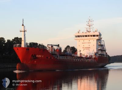
SUDE-S
Oil/Chemical Tanker

Current Trip
| Time Travelled | 1 day |
|---|---|
| Remaining Time | --- |
| Distance Travelled | 398.11 nm |
| Remaining Distance | 49.00 nm |
| AVG Speed | 9.7 Knopen |
| MAX Speed | 11.8 Knopen |
| AVG Wind | 11.5 knots |
| MAX Wind | 25 knots |
| MIN Temp | 6.9°C / 44.42°F |
| MAX Temp | 15°C / 59°F |
| Diepgang | 5.1 M |
| Positie ontvangen | 1 m geleden |
Current Position
| Lengtegraad | --- |
|---|---|
| Breedtegraat | --- |
| Status | At anchor |
| Snelheid | |
| Koers | 193° |
| Gebied | North Sea |
| Station | T-AIS |
| Positie ontvangen | 1 m geleden |
Information
The current position of SUDE-S is in North Sea with coordinates 51.80582° / 3.36554° as reported on 2025-03-23 09:20 by AIS to our vessel tracker app. The vessel's current speed is 0 Knopen and is heading at the port of GENT. The estimated time of arrival as calculated by MyShipTracking vessel tracking app is 2025-03-23 02:00 LT
The vessel SUDE-S (IMO: 9508378, MMSI: 215516000) is a Oil/Chemical Tanker that was built in 2009 ( 16 Jaar oud ). It's sailing under the flag of [MT] Malta.
In this page you can find informations about the vessels current position, last detected port calls, and current voyage information. If the vessels is not in coverage by AIS you will find the latest position.
The current position of SUDE-S is detected by our AIS receivers and we are not responsible for the reliability of the data. The last position was recorded while the vessel was in Coverage by the Ais receivers of our vessel tracking app.
The current draught of SUDE-S as reported by AIS is 5.1 meters
Weather
| Temperature | 7.9°C / 46.22°F |
|---|---|
| Wind Speed | 9 knots |
| Direction | 181° S |
| Pressure | 1002.5 hPa |
| Humidity | 95.7 % |
| Cloud Coverage | 68 % |


Featured Company
Last Port Calls
| Port | Arrival | Departure | Time In Port |
|---|---|---|---|
| 2025-03-20 21:12 | 2025-03-21 13:04 | 15 h | |
| 2025-03-19 04:05 | 2025-03-20 00:03 | 19 h | |
| 2025-03-14 01:53 | 2025-03-14 23:50 | 21 h | |
| 2025-03-09 21:29 | 2025-03-10 22:40 | 1 d | |
| 2025-03-07 08:23 | 2025-03-08 03:41 | 19 h | |
| 2025-03-04 18:45 | 2025-03-05 19:47 | 1 d | |
| 2025-03-02 05:12 | 2025-03-03 02:17 | 21 h | |
| 2025-02-26 00:26 | 2025-02-26 19:21 | 18 h | |
| 2025-02-23 11:31 | 2025-02-24 03:41 | 16 h | |
| 2025-02-20 13:28 | 2025-02-21 08:03 | 18 h |
Most Visited Ports (Last year)
| Port | Arrivals | |
|---|---|---|
| 13 | ||
| 8 | ||
| 7 | ||
| 7 | ||
| 6 | ||
| 5 |
Last Trips
| Origin | Departure | Destination | Arrival | Distance | |
|---|---|---|---|---|---|
| 2025-03-20 00:03 | 2025-03-20 21:12 | 149.05 nm | |||
| 2025-03-14 23:50 | 2025-03-19 04:05 | 962.11 nm | |||
| 2025-03-10 22:40 | 2025-03-14 01:53 | 792.82 nm | |||
| 2025-03-08 03:41 | 2025-03-09 21:29 | 450.00 nm | |||
| 2025-03-05 19:47 | 2025-03-07 08:23 | 151.70 nm | |||
| 2025-03-03 02:17 | 2025-03-04 18:45 | 440.68 nm | |||
| 2025-02-26 19:21 | 2025-03-02 05:12 | 275.54 nm | |||
| 2025-02-24 03:41 | 2025-02-26 00:26 | 421.66 nm | |||
| 2025-02-21 08:03 | 2025-02-23 11:31 | 156.24 nm | |||
| 2025-02-15 14:13 | 2025-02-20 13:28 | 631.88 nm |
Events
| Tijd | Evenement | Details | Positie / Bestemming | Info |
|---|---|---|---|---|
| 2025-03-23 08:47 | Status Changed | At anchor Default |
51.80580 / 3.36568
BEGNE
|
Snelheid: Koers: 197° |
| 2025-03-23 08:44 | Status Changed | Default At anchor |
51.80579 / 3.36568
BEGNE
|
Snelheid: Koers: 198° |
| 2025-03-23 07:11 | Status Changed | At anchor Default |
51.80572 / 3.36581
BEGNE
|
Snelheid: Koers: 203° |
| 2025-03-23 07:08 | Status Changed | Default At anchor |
51.80573 / 3.36582
BEGNE
|
Snelheid: 0.1 kn Koers: 207° |
| 2025-03-23 05:38 | Status Changed | At anchor Under way using engine |
51.80543 / 3.36563
BEGNE
|
Snelheid: 0.5 kn Koers: 232° |
| 2025-03-23 05:34 | Stop beweging | 16.48 nm, North West of NEELTJE JANS |
51.80519 / 3.36535
BEGNE
|
Snelheid: 0.3 kn Koers: 204° |
| 2025-03-23 02:14 | Status Changed | Under way using engine Default |
52.13419 / 2.88147
BEGNE
|
Snelheid: 11.7 kn Koers: 174° |
| 2025-03-23 02:10 | Status Changed | Default Under way using engine |
52.14851 / 2.87778
BEGNE
|
Snelheid: 11.7 kn Koers: 168.7° |
| 2025-03-23 02:02 | Wijzig zee gebeid | Dutch part of the North Sea United Kingdom part of the North Sea |
52.17468 / 2.86972
North Sea
BEGNE
|
Snelheid: 11.7 kn Koers: 168.7° |
| 2025-03-23 02:02 | Status Changed | Under way using engine Default |
52.17468 / 2.86972
BEGNE
|
Snelheid: 11.8 kn Koers: 169° |