
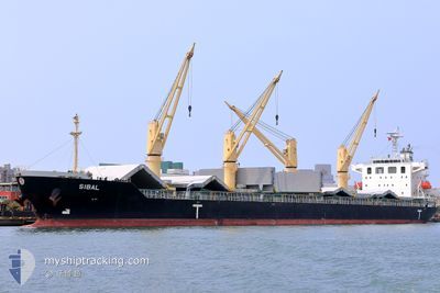
SIBAL
Cargo
Current Trip
| Trip Time | 2 days |
|---|---|
| Trip Distance | 779.97 nm |
| AVG Speed | 11.4 Knots |
| MAX Speed | 14.6 Knots |
| Draught | 6.1 m |
| AVG Wind | 11.2 knots |
| MAX Wind | 19 knots |
| MIN Temp | 3.2°C / 37.76°F |
| MAX Temp | 9.8°C / 49.64°F |
| Position Received | 17 h, 2 m ago |
Current Position
| Longitude | --- |
|---|---|
| Latitude | --- |
| Status | Under way using engine |
| Speed | 12.3 Knots |
| Course | 156.2° |
| Area | Baltic Sea |
| Station | T-AIS |
| Position Received | 17 h, 2 m ago |
Info
Information
The current position of SIBAL is in Baltic Sea with coordinates 54.99355° / 13.37965° as reported on 2025-12-06 02:54 by AIS to our vessel tracker app. The vessel's current speed is 12.3 Knots and is currently inside the port of SWINOUJSCIE.
The vessel SIBAL (IMO: 9712620, MMSI: 256505000) is a Cargo It's sailing under the flag of [MT] Malta.
In this page you can find informations about the vessels current position, last detected port calls, and current voyage information. If the vessels is not in coverage by AIS you will find the latest position.
The current position of SIBAL is detected by our AIS receivers and we are not responsible for the reliability of the data. The last position was recorded while the vessel was in Coverage by the Ais receivers of our vessel tracking app.
The current draught of SIBAL as reported by AIS is 6.1 meters
Weather
| Temperature | 4.4°C / 39.92°F |
|---|---|
| Wind Speed | 15 knots |
| Direction | 169° S |
| Pressure | 1008.9 hPa |
| Humidity | 88 % |
| Cloud Coverage | 100 % |
Featured Company
Last Port Calls
| Port | Arrival | Departure | Time In Port |
|---|---|---|---|
| 2025-12-06 11:59 | |||
| 2025-12-01 18:05 | 2025-12-03 19:10 | 2 d | |
| 2025-11-22 12:49 | 2025-11-28 15:59 | 6 d | |
| 2025-11-18 02:58 | 2025-11-20 19:43 | 2 d | |
| 2025-10-26 23:16 | 2025-10-31 11:52 | 4 d | |
| 2025-10-22 06:59 | 2025-10-22 15:38 | 8 h | |
| 2025-10-04 18:32 | 2025-10-09 06:43 | 4 d |
Most Visited Ports (Last year)
| Port | Arrivals | |
|---|---|---|
| 5 | ||
| 2 | ||
| 2 | ||
| 2 | ||
| 1 | ||
| 1 |
Last Trips
| Origin | Departure | Destination | Arrival | Distance | |
|---|---|---|---|---|---|
| 2025-12-03 19:10 | 2025-12-06 11:59 | 779.97 nm | |||
| 2025-11-28 15:59 | 2025-12-01 18:05 | 803.29 nm | |||
| 2025-11-20 19:43 | 2025-11-22 12:49 | 460.08 nm | |||
| 2025-10-31 11:52 | 2025-11-18 02:58 | 2803.83 nm | |||
| 2025-10-09 06:43 | 2025-10-26 23:16 | 4472.51 nm | |||
| 2025-10-09 06:43 | 2025-10-22 06:59 | 3360.23 nm | |||
| 2025-09-29 13:16 | 2025-10-04 18:32 | 612.61 nm |
Events
| Time | Event | Details | Position / Dest | Info |
|---|---|---|---|---|
| 2025-12-06 10:59 | STOP Moving |
53.90825 / 14.27113
[PL] SWINOUJSCIE
|
Speed: 0.2 kn Course: 230° |
|
| 2025-12-06 10:59 | PORT ARRIVAL |
|
53.90825 / 14.27113
[PL] SWINOUJSCIE
|
Speed: 3 kn Course: -1° |
| 2025-12-06 03:05 | Status Changed | Default Under way using engine |
54.96075 / 13.40470
PL SZZ
|
Speed: 12.3 kn Course: 156.2° |
| 2025-12-06 02:54 | OUT of Coverage |
54.99355 / 13.37965
Baltic Sea
PL SZZ
|
Speed: 12.3 kn Course: 156.2° |
|
| 2025-12-06 02:53 | Change Sea Area | German part of the Baltic Sea Swedish part of the Baltic Sea |
54.99717 / 13.37686
Baltic Sea
PL SZZ
|
Speed: 12.3 kn Course: 156.3° |
| 2025-12-06 02:53 | Status Changed | Under way using engine Default |
54.99827 / 13.37602
PL SZZ
|
Speed: 12.2 kn Course: 155° |
| 2025-12-06 02:53 | IN Coverage |
54.99717 / 13.37686
Baltic Sea
PL SZZ
|
Speed: 12.3 kn Course: 156.3° |
|
| 2025-12-06 01:13 | Status Changed | Default Under way using engine |
55.22333 / 12.92599
PL SZZ
|
Speed: 12.2 kn Course: 125.4° |
| 2025-12-06 01:07 | OUT of Coverage |
55.23503 / 12.89783
Baltic Sea
PL SZZ
|
Speed: 12.2 kn Course: 125.4° |
|
| 2025-12-06 00:58 | Status Changed | Under way using engine Default |
55.24916 / 12.85360
PL SZZ
|
Speed: 11.9 kn Course: 114° |