
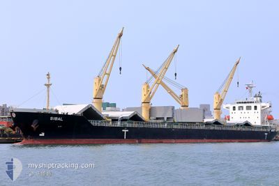
SIBAL
Cargo
Current Trip
| Trip Time | 11 days |
|---|---|
| Trip Distance | 2401.91 nm |
| AVG Speed | 11.6 Noeuds |
| MAX Speed | 13.9 Noeuds |
| Tirant d eau | 10.1 m |
| AVG Wind | 9.3 knots |
| MAX Wind | 16 knots |
| MIN Temp | 12.9°C / 55.22°F |
| MAX Temp | 30.1°C / 86.18°F |
| Position reçue | 9 d depuis |
Current Position
| Longitude | --- |
|---|---|
| Latitude | --- |
| Etat | Under way using engine |
| Vitesse | 11.4 Noeuds |
| Parcours | 170.8° |
| Zone | North Atlantic Ocean |
| Station | T-AIS |
| Position reçue | 9 d depuis |
Info
Information
The current position of SIBAL is in North Atlantic Ocean with coordinates 13.25067° / -17.82365° as reported on 2025-12-31 10:45 by AIS to our vessel tracker app. The vessel's current speed is 11.4 Noeuds and is currently inside the port of LOME.
The vessel SIBAL (IMO: 9712620, MMSI: 256505000) is a Cargo It's sailing under the flag of [MT] Malta.
In this page you can find informations about the vessels current position, last detected port calls, and current voyage information. If the vessels is not in coverage by AIS you will find the latest position.
The current position of SIBAL is detected by our AIS receivers and we are not responsible for the reliability of the data. The last position was recorded while the vessel was in Coverage by the Ais receivers of our vessel tracking app.
The current draught of SIBAL as reported by AIS is 10.1 meters
Weather
| Temperature | 30.6°C / 87.08°F |
|---|---|
| Wind Speed | 5 knots |
| Direction | 227° SW |
| Pressure | 1013 hPa |
| Humidity | 56.7 % |
| Cloud Coverage | 70 % |
Featured Company
Last Port Calls
| Port | Arrival | Departure | Time In Port |
|---|---|---|---|
| 2026-01-08 18:04 | |||
| 2025-12-27 16:20 | 2025-12-28 04:03 | 11 h | |
| 2025-12-10 00:13 | 2025-12-12 09:00 | 2 d | |
| 2025-12-06 11:59 | 2025-12-09 21:04 | 3 d | |
| 2025-12-01 18:05 | 2025-12-03 19:10 | 2 d | |
| 2025-11-22 12:49 | 2025-11-28 15:59 | 6 d | |
| 2025-11-18 02:58 | 2025-11-20 19:43 | 2 d |
Most Visited Ports (Last year)
| Port | Arrivals | |
|---|---|---|
| 5 | ||
| 2 | ||
| 2 | ||
| 2 | ||
| 1 | ||
| 1 |
Last Trips
| Origin | Departure | Destination | Arrival | Distance | |
|---|---|---|---|---|---|
| 2025-12-28 04:03 | 2026-01-08 18:04 | 2401.91 nm | |||
| 2025-12-12 09:00 | 2025-12-27 16:20 | 2879.16 nm | |||
| 2025-12-09 21:04 | 2025-12-10 00:13 | 29.11 nm | |||
| 2025-12-03 19:10 | 2025-12-06 11:59 | 779.97 nm | |||
| 2025-11-28 15:59 | 2025-12-01 18:05 | 803.29 nm | |||
| 2025-11-20 19:43 | 2025-11-22 12:49 | 460.08 nm | |||
| 2025-10-31 11:52 | 2025-11-18 02:58 | 2803.83 nm |
Events
| Heure | Evenement | Détails | Position/ Destination | Info |
|---|---|---|---|---|
| 2026-01-08 18:17 | Arret |
6.13874 / 1.28464
[TG] LOME
|
Vitesse: Parcours: 268° |
|
| 2026-01-08 18:04 | Port d'arrivée |
|
6.13523 / 1.29035
[TG] LOME
|
Vitesse: 4 kn Parcours: 252° |
| 2026-01-08 17:13 | Démarrage | 2.9 nm, South East of LOME |
6.10916 / 1.32648
LOME
|
Vitesse: 4.1 kn Parcours: 285° |
| 2026-01-08 16:44 | Arret | 3.38 nm, South East of LOME |
6.10446 / 1.33282
LOME
|
Vitesse: 0.2 kn Parcours: 252° |
| 2026-01-08 15:37 | Démarrage | 4.78 nm, South of LOME |
6.06130 / 1.31168
LOME
|
Vitesse: 3.9 kn Parcours: 40° |
| 2026-01-05 12:05 | Arret | 4.73 nm, South of LOME |
6.06074 / 1.30677
LOME
|
Vitesse: 0.1 kn Parcours: 264° |
| 2025-12-31 10:50 | Etat Changé | Default Under way using engine |
13.23300 / -17.82089
LOME
|
Vitesse: 11.4 kn Parcours: 170.8° |
| 2025-12-31 10:45 | Hors de la zone couverte |
13.25067 / -17.82365
North Atlantic Ocean
LOME
|
Vitesse: 11.4 kn Parcours: 170.8° |
|
| 2025-12-31 08:55 | Changement de zone | Gambian part of the North Atlantic Ocean Senegalese part of the North Atlantic Ocean |
13.59207 / -17.88089
North Atlantic Ocean
LOME
|
Vitesse: 11.3 kn Parcours: 170.8° |
| 2025-12-30 20:13 | Detecté en mer | Senegalese part of the North Atlantic Ocean |
16.06177 / -18.05991
North Atlantic Ocean
LOME
|
Vitesse: 12.3 kn Parcours: 180.1° |