

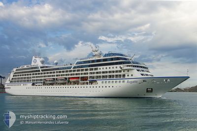
REGATTA
Passengers Ship

Current Trip
PG GUR
| Time Travelled | 14 h, 48 mins |
|---|---|
| Remaining Time | --- |
| Distance Travelled | 37.58 nm |
| Remaining Distance | --- |
| AVG Speed | 17 Knots |
| MAX Speed | 17.7 Knots |
| AVG Wind | 8.5 knots |
| MAX Wind | 10 knots |
| MIN Temp | 29.1°C / 84.38°F |
| MAX Temp | 29.9°C / 85.82°F |
| Draught | 5.9 m |
| Position Received | 6 d ago |
Current Position
| Longitude | --- |
|---|---|
| Latitude | --- |
| Status | Under way using engine |
| Speed | 16.6 Knots |
| Course | 14.5° |
| Area | Coral Sea |
| Station | T-AIS |
| Position Received | 6 d ago |
Information
The current position of REGATTA is in Coral Sea with coordinates -16.65378° / 145.88417° as reported on 2025-03-15 10:19 by AIS to our vessel tracker app. The vessel's current speed is 16.6 Knots
The vessel REGATTA (IMO: 9156474, MMSI: 538001664) is a Passengers Ship that was built in 1998 ( 27 years old ). It's sailing under the flag of [MH] Marshall Is.
In this page you can find informations about the vessels current position, last detected port calls, and current voyage information. If the vessels is not in coverage by AIS you will find the latest position.
The current position of REGATTA is detected by our AIS receivers and we are not responsible for the reliability of the data. The last position was recorded while the vessel was in Coverage by the Ais receivers of our vessel tracking app.
The current draught of REGATTA as reported by AIS is 5.9 meters
Weather
| Temperature | 29.1°C / 84.38°F |
|---|---|
| Wind Speed | 8 knots |
| Direction | 279° W |
| Pressure | 1007 hPa |
| Humidity | 73.6 % |
| Cloud Coverage | 99 % |


Featured Company
Last Port Calls
| Port | Arrival | Departure | Time In Port |
|---|---|---|---|
| 2025-03-21 07:23 | 2025-03-21 18:27 | 11 h | |
| 2025-03-18 08:48 | 2025-03-18 18:43 | 9 h | |
| 2025-03-15 10:20 | 2025-03-15 19:01 | 8 h | |
| 2025-03-12 06:11 | 2025-03-12 19:20 | 13 h | |
| 2025-03-10 04:56 | 2025-03-10 18:21 | 13 h | |
| 2025-03-08 08:29 | 2025-03-08 18:27 | 9 h | |
| 2025-03-06 09:33 | 2025-03-07 17:50 | 1 d | |
| 2025-03-02 09:56 | 2025-03-02 16:34 | 6 h | |
| 2025-03-01 12:09 | 2025-03-01 19:04 | 6 h | |
| 2025-03-01 00:39 | 2025-03-01 01:59 | 1 h |
Last Trips
| Origin | Departure | Destination | Arrival | Distance | |
|---|---|---|---|---|---|
| 2025-03-18 18:43 | 2025-03-21 07:23 | 1061.14 nm | |||
| 2025-03-15 19:01 | 2025-03-18 08:48 | 776.60 nm | |||
| 2025-03-12 19:20 | 2025-03-15 10:20 | 857.79 nm | |||
| 2025-03-10 18:21 | 2025-03-12 06:11 | 536.88 nm | |||
| 2025-03-08 18:27 | 2025-03-10 04:56 | 533.45 nm | |||
| 2025-03-07 17:50 | 2025-03-08 08:29 | 220.45 nm | |||
| 2025-03-02 16:34 | 2025-03-06 09:33 | 1356.82 nm | |||
| 2025-03-01 19:04 | 2025-03-02 09:56 | 196.74 nm | |||
| 2025-03-01 01:59 | 2025-03-01 12:09 | 173.04 nm | |||
| 2025-02-28 19:26 | 2025-03-01 00:39 | 69.20 nm |
Events
| Time | Event | Details | Position / Dest | Info |
|---|---|---|---|---|
| 2025-03-21 08:57 | PORT DEPARTURE |
|
-12.39608 / 130.75472
PG GUR
|
Speed: 15.1 kn Course: 318° |
| 2025-03-21 08:21 | START Moving |
-12.47454 / 130.84401
[AU] DARWIN
|
Speed: 5.8 kn Course: 233° |
|
| 2025-03-20 22:45 | STOP Moving |
-12.47283 / 130.84511
[AU] DARWIN
|
Speed: 0.1 kn Course: 259° |
|
| 2025-03-20 21:53 | PORT ARRIVAL |
|
-12.40262 / 130.76129
[AU] DARWIN
|
Speed: 7.8 kn Course: 142° |
| 2025-03-18 08:43 | PORT DEPARTURE |
|
-9.51603 / 147.15105
PG GUR
|
Speed: 13.2 kn Course: 158° |
| 2025-03-18 08:13 | START Moving |
-9.43286 / 147.11302
[PG] PORT MORESBY
|
Speed: 6.9 kn Course: 147° |
|
| 2025-03-17 23:33 | STOP Moving |
-9.42926 / 147.11055
[PG] PORT MORESBY
|
Speed: 0.1 kn Course: 145° |
|
| 2025-03-17 22:48 | PORT ARRIVAL |
|
-9.46884 / 147.12959
[PG] PORT MORESBY
|
Speed: 13.6 kn Course: 13° |
| 2025-03-16 20:37 | STOP Moving |
-10.31597 / 150.45496
PG GUR
|
Speed: Course: 352° |
|
| 2025-03-15 10:19 | OUT of Coverage |
-16.65378 / 145.88417
Coral Sea
PG GUR
|
Speed: 16.6 kn Course: 14.5° |