

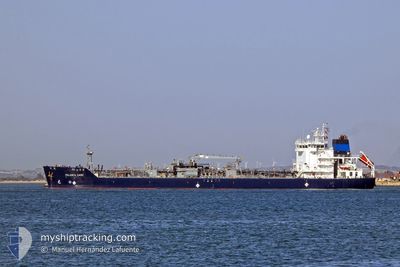
PALANCA CADIZ
Tanker

Current Trip
| Time Travelled | 5 h, 19 mins |
|---|---|
| Remaining Time | --- |
| Distance Travelled | 56.95 nm |
| Remaining Distance | --- |
| AVG Speed | 11.3 Knots |
| MAX Speed | 12.1 Knots |
| AVG Wind | 11.4 knots |
| MAX Wind | 20 knots |
| MIN Temp | 6.2°C / 43.16°F |
| MAX Temp | 10.7°C / 51.26°F |
| Draught | 6.4 m |
| Position Received | 3 h, 21 m ago |
Current Position
| Longitude | --- |
|---|---|
| Latitude | --- |
| Status | Under way using engine |
| Speed | 10.3 Knots |
| Course | 179.8° |
| Area | North Atlantic Ocean |
| Station | T-AIS |
| Position Received | 3 h, 21 m ago |
Information
The current position of PALANCA CADIZ is in North Atlantic Ocean with coordinates 41.44020° / -71.37263° as reported on 2025-03-18 00:20 by AIS to our vessel tracker app. The vessel's current speed is 10.3 Knots and is heading at the port of PORTSMOUTH (NH). The estimated time of arrival as calculated by MyShipTracking vessel tracking app is 2025-03-18 06:00 LT
The vessel PALANCA CADIZ (IMO: 9748007, MMSI: 538007108) is a Tanker It's sailing under the flag of [MH] Marshall Is.
In this page you can find informations about the vessels current position, last detected port calls, and current voyage information. If the vessels is not in coverage by AIS you will find the latest position.
The current position of PALANCA CADIZ is detected by our AIS receivers and we are not responsible for the reliability of the data. The last position was recorded while the vessel was in Coverage by the Ais receivers of our vessel tracking app.
The current draught of PALANCA CADIZ as reported by AIS is 6.4 meters
Weather
| Temperature | 6.4°C / 43.52°F |
|---|---|
| Wind Speed | 13 knots |
| Direction | 5° N |
| Pressure | 1010.1 hPa |
| Humidity | 92.2 % |
| Cloud Coverage | 100 % |


Featured Company
Last Port Calls
| Port | Arrival | Departure | Time In Port |
|---|---|---|---|
| 2025-03-17 09:11 | 2025-03-17 18:23 | 9 h | |
| 2025-03-07 18:44 | 2025-03-09 22:07 | 2 d | |
| 2025-03-03 16:11 | 2025-03-04 08:36 | 16 h | |
| 2025-02-26 22:07 | 2025-02-28 11:03 | 1 d | |
| 2025-02-16 13:51 | 2025-02-19 03:43 | 2 d | |
| 2025-02-10 04:05 | 2025-02-10 21:27 | 17 h | |
| 2025-02-02 02:03 | 2025-02-03 14:19 | 1 d | |
| 2025-01-27 08:27 | 2025-01-28 22:19 | 1 d | |
| 2025-01-22 16:37 | 2025-01-23 13:33 | 20 h | |
| 2025-01-20 16:08 | 2025-01-21 15:30 | 23 h |
Most Visited Ports (Last year)
| Port | Arrivals | |
|---|---|---|
| 33 | ||
| 11 | ||
| 11 | ||
| 4 | ||
| 4 | ||
| 4 |
Last Trips
| Origin | Departure | Destination | Arrival | Distance | |
|---|---|---|---|---|---|
| 2025-03-09 22:07 | 2025-03-17 09:11 | 1184.34 nm | |||
| 2025-03-04 08:36 | 2025-03-07 18:44 | 387.28 nm | |||
| 2025-02-28 11:03 | 2025-03-03 16:11 | 445.16 nm | |||
| 2025-02-19 03:43 | 2025-02-26 22:07 | 1500.94 nm | |||
| 2025-02-10 21:27 | 2025-02-16 13:51 | 1107.05 nm | |||
| 2025-02-03 14:19 | 2025-02-10 04:05 | 1121.75 nm | |||
| 2025-01-28 22:19 | 2025-02-02 02:03 | 546.99 nm | |||
| 2025-01-23 13:33 | 2025-01-27 08:27 | 1057.77 nm | |||
| 2025-01-21 15:30 | 2025-01-22 16:37 | 176.14 nm | |||
| 2025-01-16 13:59 | 2025-01-20 16:08 | 989.15 nm |
Events
| Time | Event | Details | Position / Dest | Info |
|---|---|---|---|---|
| 2025-03-18 00:28 | Status Changed | Default Under way using engine |
41.42847 / -71.35467
US PSM
|
Speed: 10.3 kn Course: 179.8° |
| 2025-03-18 00:20 | OUT of Coverage |
41.44020 / -71.37263
North Atlantic Ocean
US PSM
|
Speed: 10.3 kn Course: 179.8° |
|
| 2025-03-18 00:14 | Status Changed | Under way using engine Default |
41.45920 / -71.37173
US PSM
|
Speed: 11.4 kn Course: 226° |
| 2025-03-18 00:12 | Status Changed | Default Under way using engine |
41.46500 / -71.36765
US PSM
|
Speed: 11.7 kn Course: 199.6° |
| 2025-03-18 00:05 | Status Changed | Under way using engine Default |
41.48147 / -71.34867
US PSM
|
Speed: 11.9 kn Course: 187° |
| 2025-03-17 23:24 | Status Changed | Default Under way using engine |
41.61168 / -71.29678
US PSM
|
Speed: 11.9 kn Course: 161.4° |
| 2025-03-17 22:23 | PORT DEPARTURE |
|
41.78255 / -71.37415
US PSM
|
Speed: 9.1 kn Course: 154° |
| 2025-03-17 22:21 | Draught Changed | 6.4 7 |
41.78825 / -71.37765
[US] PROVIDENCE
|
Speed: 7.5 kn Course: 152° |
| 2025-03-17 22:21 | Destination Changed | US PSM US PVD |
41.78825 / -71.37765
[US] PROVIDENCE
|
Speed: 7.5 kn Course: 152° |
| 2025-03-17 22:21 | ETA Changed | 2025/03/18 10:00 2025/03/17 04:00 |
41.78825 / -71.37765
[US] PROVIDENCE
|
Speed: 7.5 kn Course: 152° |