
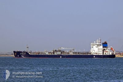
PALANCA CADIZ
Tanker D
Current Trip
CA SJB
| Time Travelled | 12 h, 9 mins |
|---|---|
| Remaining Time | --- |
| Distance Travelled | 148.28 nm |
| Remaining Distance | --- |
| AVG Speed | 12.2 Knopen |
| MAX Speed | 15 Knopen |
| AVG Wind | 11.8 knots |
| MAX Wind | 19.6 knots |
| MIN Temp | 1.2°C / 34.16°F |
| MAX Temp | 5.8°C / 42.44°F |
| Diepgang | 5.8 M |
| Positie ontvangen | 4 d geleden |
Current Position
| Lengtegraad | -75.73016° |
|---|---|
| Breedtegraat | 34.43392° |
| Status | Under way using engine |
| Snelheid | 12.7 Knopen |
| Koers | 46.7° |
| Gebied | North Atlantic Ocean |
| Station | T-AIS |
| Positie ontvangen | 4 d geleden |
Info
Information
The current position of PALANCA CADIZ is in North Atlantic Ocean with coordinates 34.43392° / -75.73016° as reported on 2024-04-25 21:32 by AIS to our vessel tracker app. The vessel's current speed is 12.7 Knopen
The vessel PALANCA CADIZ (IMO: 9748007, MMSI: 538007108) is a Tanker D It's sailing under the flag of [MH] Marshall Is.
In this page you can find informations about the vessels current position, last detected port calls, and current voyage information. If the vessels is not in coverage by AIS you will find the latest position.
The current position of PALANCA CADIZ is detected by our AIS receivers and we are not responsible for the reliability of the data. The last position was recorded while the vessel was in Coverage by the Ais receivers of our vessel tracking app.
The current draught of PALANCA CADIZ as reported by AIS is 5.8 meters
Weather
| Temperature | 5.7°C / 42.26°F |
|---|---|
| Wind Speed | 1 knots |
| Direction | 340° NNW |
| Pressure | 1016.7 hPa |
| Humidity | 67.2 % |
| Cloud Coverage | 100 % |
Featured Company
Last Port Calls
| Port | Arrival | Departure | Time In Port |
|---|---|---|---|
| 2024-04-28 19:12 | 2024-04-30 07:15 | 1 d | |
| 2024-04-24 09:44 | 2024-04-25 01:50 | 16 h | |
| 2024-04-20 15:07 | 2024-04-21 12:37 | 21 h | |
| 2024-04-16 22:17 | 2024-04-18 11:14 | 1 d | |
| 2024-04-12 19:44 | 2024-04-13 21:57 | 1 d | |
| 2024-04-09 22:25 | 2024-04-10 14:37 | 16 h | |
| 2024-04-06 13:13 | 2024-04-08 01:49 | 1 d | |
| 2024-04-03 14:56 | 2024-04-05 20:10 | 2 d | |
| 2024-04-02 07:11 | 2024-04-03 03:39 | 20 h | |
| 2024-03-30 07:15 | 2024-04-01 07:18 | 2 d |
Most Visited Ports (Last year)
| Port | Arrivals | |
|---|---|---|
| 28 | ||
| 7 | ||
| 7 | ||
| 4 | ||
| 3 | ||
| 3 |
Last Trips
| Origin | Departure | Destination | Arrival | Distance | |
|---|---|---|---|---|---|
| 2024-04-24 21:50 | 2024-04-28 16:12 | 1055.33 nm | |||
| 2024-04-21 08:37 | 2024-04-24 05:44 | 791.85 nm | |||
| 2024-04-18 08:14 | 2024-04-20 11:07 | 517.83 nm | |||
| 2024-04-13 17:57 | 2024-04-16 19:17 | 722.63 nm | |||
| 2024-04-10 10:37 | 2024-04-12 15:44 | 415.54 nm | |||
| 2024-04-07 22:49 | 2024-04-09 18:25 | 485.97 nm | |||
| 2024-04-05 16:10 | 2024-04-06 10:13 | 208.46 nm | |||
| 2024-04-02 23:39 | 2024-04-03 10:56 | 113.37 nm | |||
| 2024-04-01 04:18 | 2024-04-02 03:11 | 238.05 nm | |||
| 2024-03-25 04:19 | 2024-03-30 04:15 | 893.61 nm |
Events
| Tijd | Evenement | Details | Positie / Bestemming | Info |
|---|---|---|---|---|
| 2024-04-30 07:15 | Vertrekhaven |
|
45.24333 / -66.04833
CA SJB
|
Snelheid: 9.5 kn Koers: 168° |
| 2024-04-30 07:04 | Start beweging |
45.26767 / -66.04207
[CA] SAINT JOHN
|
Snelheid: 5.9 kn Koers: 200° |
|
| 2024-04-28 19:47 | Stop beweging |
45.27378 / -66.03972
[CA] SAINT JOHN
|
Snelheid: Koers: 180° |
|
| 2024-04-28 19:12 | Aankomsthaven |
|
45.25834 / -66.04667
[CA] SAINT JOHN
|
Snelheid: 9 kn Koers: 343° |
| 2024-04-25 21:37 | Status Changed | Default Under way using engine |
34.44500 / -75.71667
CA SJB
|
Snelheid: 12.7 kn Koers: 46.7° |
| 2024-04-25 21:32 | Buitenbereik |
34.43392 / -75.73016
North Atlantic Ocean
CA SJB
|
Snelheid: 12.7 kn Koers: 46.7° |
|
| 2024-04-25 21:04 | Status Changed | Under way using engine Default |
34.36572 / -75.81947
CA SJB
|
Snelheid: 13 kn Koers: 47° |
| 2024-04-25 20:40 | Status Changed | Default Under way using engine |
34.30667 / -75.89667
CA SJB
|
Snelheid: 12.7 kn Koers: 47.4° |
| 2024-04-25 20:30 | Status Changed | Under way using engine Default |
34.28462 / -75.92534
CA SJB
|
Snelheid: 13 kn Koers: 49° |
| 2024-04-25 20:19 | Status Changed | Default Under way using engine |
34.25667 / -75.96167
CA SJB
|
Snelheid: 12.7 kn Koers: 47.8° |