
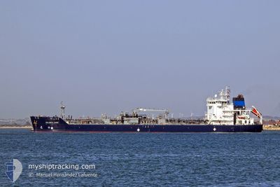
PALANCA CADIZ
Tanker
Current Trip
CASJB
| Time Travelled | 1 day |
|---|---|
| Remaining Time | --- |
| Distance Travelled | 350.55 морская миля |
| Remaining Distance | --- |
| AVG Speed | 11.7 Узлы |
| MAX Speed | 13.4 Узлы |
| AVG Wind | 8.6 knots |
| MAX Wind | 18.3 knots |
| MIN Temp | -5.5°C / 22.1°F |
| MAX Temp | 2.4°C / 36.32°F |
| Осадка | 5.7 м |
| Позиция Получена | 4 d тому назад |
Current Position
| Долгота | --- |
|---|---|
| Широта | --- |
| Статус | Under way using engine |
| Скорость | 12.1 Узлы |
| Курс | 82° |
| Район | North Atlantic Ocean |
| Станция | T-AIS |
| Позиция Получена | 4 d тому назад |
Info
Information
The current position of PALANCA CADIZ is in North Atlantic Ocean with coordinates 42.50230° / -70.23553° as reported on 2025-01-13 14:23 by AIS to our vessel tracker app. The vessel's current speed is 12.1 Узлы
The vessel PALANCA CADIZ (IMO: 9748007, MMSI: 538007108) is a Tanker It's sailing under the flag of [MH] Marshall Is.
In this page you can find informations about the vessels current position, last detected port calls, and current voyage information. If the vessels is not in coverage by AIS you will find the latest position.
The current position of PALANCA CADIZ is detected by our AIS receivers and we are not responsible for the reliability of the data. The last position was recorded while the vessel was in Coverage by the Ais receivers of our vessel tracking app.
The current draught of PALANCA CADIZ as reported by AIS is 5.7 meters
Weather
| Temperature | 2.4°C / 36.32°F |
|---|---|
| Wind Speed | 12 knots |
| Direction | 335° NNW |
| Pressure | 1021.4 hPa |
| Humidity | 65.6 % |
| Cloud Coverage | 78 % |
Featured Company
Last Port Calls
| Port | Arrival | Departure | Time In Port |
|---|---|---|---|
| 2025-01-15 04:11 | 2025-01-16 17:59 | 1 d | |
| 2025-01-12 09:13 | 2025-01-13 03:11 | 17 h | |
| 2025-01-09 15:02 | |||
| 2025-01-02 18:24 | 2025-01-04 17:59 | 1 d | |
| 2024-12-27 20:04 | |||
| 2024-12-18 05:58 | 2024-12-20 18:19 | 2 d | |
| 2024-12-04 03:38 | 2024-12-05 14:11 | 1 d | |
| 2024-11-30 12:42 | 2024-12-01 08:57 | 20 h | |
| 2024-11-26 13:50 | 2024-11-28 00:30 | 1 d | |
| 2024-11-21 10:02 | 2024-11-22 00:06 | 14 h |
Most Visited Ports (Last year)
| Port | Arrivals | |
|---|---|---|
| 36 | ||
| 10 | ||
| 9 | ||
| 5 | ||
| 4 | ||
| 4 |
Last Trips
| Origin | Departure | Destination | Arrival | Distance | |
|---|---|---|---|---|---|
| 2025-01-12 22:11 | 2025-01-15 00:11 | 394.86 морская миля | |||
| 2025-01-09 10:02 | 2025-01-12 04:13 | 680.52 морская миля | |||
| 2024-12-20 14:19 | 2025-01-02 14:24 | 1638.84 морская миля | |||
| 2024-12-20 14:19 | 2024-12-27 15:04 | 1418.42 морская миля | |||
| 2024-12-05 09:11 | 2024-12-18 01:58 | 1195.28 морская миля | |||
| 2024-12-01 03:57 | 2024-12-03 22:38 | 713.37 морская миля | |||
| 2024-11-27 20:30 | 2024-11-30 07:42 | 523.30 морская миля | |||
| 2024-11-21 19:06 | 2024-11-26 09:50 | 254.78 морская миля | |||
| 2024-11-17 21:30 | 2024-11-21 05:02 | 634.99 морская миля | |||
| 2024-11-15 22:10 | 2024-11-17 19:25 | 412.92 морская миля |
Events
| Время | Событие | Детали | Позиция / Направление | Информация |
|---|---|---|---|---|
| 2025-01-16 17:59 | ПОРТ ОТПРАВЛЕНИЯ |
|
45.23620 / -66.04369
CASJB
|
Скорость: 8.8 kn Курс: 170° |
| 2025-01-16 17:43 | Начало движения |
45.26930 / -66.04121
[CA] SAINT JOHN
|
Скорость: 5.1 kn Курс: 200° |
|
| 2025-01-15 04:47 | Окончание движения |
45.27587 / -66.04040
[CA] SAINT JOHN
|
Скорость: Курс: 168° |
|
| 2025-01-15 04:11 | Порт |
|
45.25692 / -66.04773
[CA] SAINT JOHN
|
Скорость: 10.1 kn Курс: 356° |
| 2025-01-15 02:19 | Начало движения | 5.36 nm, South West of CANAPORT LNG |
45.16742 / -66.09210
CASJB
|
Скорость: 3.7 kn Курс: 154° |
| 2025-01-14 12:51 | Окончание движения | 5.27 nm, South West of CANAPORT LNG |
45.17005 / -66.09143
CASJB
|
Скорость: 0.2 kn Курс: 266° |
| 2025-01-13 15:02 | Статус изменился | Default Under way using engine |
42.55461 / -70.07182
CASJB
|
Скорость: 12.1 kn Курс: 82° |
| 2025-01-13 14:23 | Вне покрытия |
42.50230 / -70.23553
North Atlantic Ocean
CASJB
|
Скорость: 12.1 kn Курс: 82° |
|
| 2025-01-13 14:23 | Статус изменился | Under way using engine Default |
42.50227 / -70.23615
CASJB
|
Скорость: 12.4 kn Курс: 66° |
| 2025-01-13 14:12 | Статус изменился | Default Under way using engine |
42.48879 / -70.28155
CASJB
|
Скорость: 12.3 kn Курс: 73.2° |