
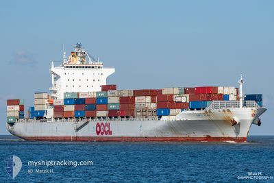
OOCL KOBE
Container Ship
Current Trip
| Time Travelled | 4 days |
|---|---|
| Remaining Time | 3 days |
| Distance Travelled | 1690.54 nm |
| Remaining Distance | 1253.44 nm |
| AVG Speed | 14.3 Knots |
| MAX Speed | 18.8 Knots |
| AVG Wind | 17.7 knots |
| MAX Wind | 33.2 knots |
| MIN Temp | 6.6°C / 43.88°F |
| MAX Temp | 17°C / 62.6°F |
| Draught | 12.4 m |
| Position Received | 18 m ago |
Current Position
| Longitude | -0.22495° |
|---|---|
| Latitude | 36.57228° |
| Status | Under way using engine |
| Speed | 14.2 Knots |
| Course | 75° |
| Area | Mediterranean Sea - Western Basin |
| Station | T-AIS |
| Position Received | 18 m ago |
Info
Information
The current position of OOCL KOBE is in Mediterranean Sea - Western Basin with coordinates 36.57228° / -0.22495° as reported on 2024-05-02 13:34 by AIS to our vessel tracker app. The vessel's current speed is 14.2 Knots and is heading at the port of PIRAEUS. The estimated time of arrival as calculated by MyShipTracking vessel tracking app is 2024-05-06 04:38 LT
The vessel OOCL KOBE (IMO: 9329526, MMSI: 477883300) is a Container Ship that was built in 2007 ( 17 years old ). It's sailing under the flag of [HK] Hong Kong.
In this page you can find informations about the vessels current position, last detected port calls, and current voyage information. If the vessels is not in coverage by AIS you will find the latest position.
The current position of OOCL KOBE is detected by our AIS receivers and we are not responsible for the reliability of the data. The last position was recorded while the vessel was in Coverage by the Ais receivers of our vessel tracking app.
The current draught of OOCL KOBE as reported by AIS is 12.4 meters
Weather
| Temperature | 17°C / 62.6°F |
|---|---|
| Wind Speed | 16 knots |
| Direction | 241° WSW |
| Pressure | 1018 hPa |
| Humidity | 67.8 % |
| Cloud Coverage | 53 % |
Featured Company
Last Port Calls
| Port | Arrival | Departure | Time In Port |
|---|---|---|---|
| 2024-04-27 02:47 | 2024-04-27 22:53 | 20 h | |
| 2024-04-25 02:30 | 2024-04-26 02:09 | 23 h | |
| 2024-04-23 06:25 | 2024-04-24 05:41 | 23 h | |
| 2024-04-20 03:06 | 2024-04-21 00:47 | 21 h | |
| 2024-04-08 06:22 | 2024-04-08 17:26 | 11 h | |
| 2024-04-05 12:39 | 2024-04-06 04:04 | 15 h | |
| 2024-04-02 14:09 | 2024-04-04 00:15 | 1 d | |
| 2024-03-30 14:38 | 2024-03-31 17:45 | 1 d | |
| 2024-03-28 08:08 | 2024-03-28 23:55 | 15 h | |
| 2024-03-23 15:19 | 2024-03-24 12:48 | 21 h |
Most Visited Ports (Last year)
| Port | Arrivals | |
|---|---|---|
| 17 | ||
| 9 | ||
| 9 | ||
| 9 | ||
| 9 | ||
| 9 |
Last Trips
| Origin | Departure | Destination | Arrival | Distance | |
|---|---|---|---|---|---|
| 2024-04-26 04:09 | 2024-04-27 04:47 | 402.56 nm | |||
| 2024-04-24 07:41 | 2024-04-25 04:30 | 302.35 nm | |||
| 2024-04-21 01:47 | 2024-04-23 08:25 | 120.94 nm | |||
| 2024-04-08 19:26 | 2024-04-20 04:06 | 2400.01 nm | |||
| 2024-04-06 07:04 | 2024-04-08 08:22 | 658.87 nm | |||
| 2024-04-04 02:15 | 2024-04-05 15:39 | 521.95 nm | |||
| 2024-03-31 20:45 | 2024-04-02 16:09 | 437.07 nm | |||
| 2024-03-29 02:55 | 2024-03-30 17:38 | 104.45 nm | |||
| 2024-03-24 14:48 | 2024-03-28 11:08 | 795.86 nm | |||
| 2024-03-15 14:28 | 2024-03-23 17:19 | 2940.26 nm |
Events
| Time | Event | Details | Position / Dest | Info |
|---|---|---|---|---|
| 2024-05-02 10:03 | Change Sea Area | Algerian part of the Mediterranean Sea - Western Basin Spanish part of the Mediterranean Sea - Western Basin |
36.38335 / -1.24080
Mediterranean Sea - Western Basin
BEANR=>GRPIR
|
Speed: 15.5 kn Course: 85° |
| 2024-05-02 10:03 | Status Changed | Under way using engine Default |
36.38335 / -1.24080
BEANR=>GRPIR
|
Speed: 15.4 kn Course: 84° |
| 2024-05-02 09:47 | Status Changed | Default Under way using engine |
36.38228 / -1.25888
BEANR=>GRPIR
|
Speed: 15 kn Course: 80° |
| 2024-05-02 08:57 | Status Changed | Under way using engine Default |
36.35202 / -1.55297
BEANR=>GRPIR
|
Speed: 14.8 kn Course: 81° |
| 2024-05-02 08:05 | Status Changed | Default Under way using engine |
36.32718 / -1.78030
BEANR=>GRPIR
|
Speed: 14.3 kn Course: 82° |
| 2024-05-02 08:02 | Detected in Sea | Spanish part of the Mediterranean Sea - Western Basin |
36.32555 / -1.79650
Mediterranean Sea - Western Basin
BEANR=>GRPIR
|
Speed: 14.3 kn Course: 82° |
| 2024-05-02 06:39 | Status Changed | Under way using engine Default |
36.27607 / -2.18023
BEANR=>GRPIR
|
Speed: 13.1 kn Course: 77° |
| 2024-05-02 06:28 | Status Changed | Default Under way using engine |
36.26750 / -2.22597
BEANR=>GRPIR
|
Speed: 13.1 kn Course: 77° |
| 2024-05-02 06:01 | Status Changed | Under way using engine Default |
36.25068 / -2.34532
BEANR=>GRPIR
|
Speed: 13.1 kn Course: 86° |
| 2024-05-02 05:45 | Status Changed | Default Under way using engine |
36.24703 / -2.41547
BEANR=>GRPIR
|
Speed: 12.8 kn Course: 85° |