
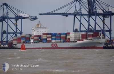
OOCL KOBE
Container Ship
Current Trip
| Time Travelled | 1 day |
|---|---|
| Remaining Time | 10 h, 43 mins |
| Distance Travelled | 487.22 nm |
| Remaining Distance | 140.98 nm |
| AVG Speed | 15.6 Knots |
| MAX Speed | 17.3 Knots |
| AVG Wind | 10.5 knots |
| MAX Wind | 21 knots |
| MIN Temp | 14.6°C / 58.28°F |
| MAX Temp | 18.1°C / 64.58°F |
| Dybgang | 10 m |
| Position Modtaget | 1 h, 6 m siden |
Current Position
| Longitude | --- |
|---|---|
| Latitude | --- |
| Status | Under way using engine |
| Fart | 11.4 Knots |
| Kurs | 84° |
| Område | Mediterranean Sea - Eastern Basin |
| Station | T-AIS |
| Position Modtaget | 1 h, 6 m siden |
Info
Information
The current position of OOCL KOBE is in Mediterranean Sea - Eastern Basin with coordinates 35.89978° / 32.20193° as reported on 2025-03-07 20:41 by AIS to our vessel tracker app. The vessel's current speed is 11.4 Knots and is heading at the port of MERSIN. The estimated time of arrival as calculated by MyShipTracking vessel tracking app is 2025-03-08 08:30 LT
The vessel OOCL KOBE (IMO: 9329526, MMSI: 477883300) is a Container Ship that was built in 2007 ( 18 år gamle ). It's sailing under the flag of [HK] Hong Kong.
In this page you can find informations about the vessels current position, last detected port calls, and current voyage information. If the vessels is not in coverage by AIS you will find the latest position.
The current position of OOCL KOBE is detected by our AIS receivers and we are not responsible for the reliability of the data. The last position was recorded while the vessel was in Coverage by the Ais receivers of our vessel tracking app.
The current draught of OOCL KOBE as reported by AIS is 10 meters
Weather
| Temperature | 17.4°C / 63.32°F |
|---|---|
| Wind Speed | 7 knots |
| Direction | 315° NW |
| Pressure | 1014.8 hPa |
| Humidity | 54.2 % |
| Cloud Coverage | --- |
Featured Company
Last Port Calls
| Port | Arrival | Departure | Time In Port |
|---|---|---|---|
| 2025-03-04 23:30 | 2025-03-06 12:10 | 1 d | |
| 2025-02-15 04:52 | 2025-02-16 06:01 | 1 d | |
| 2025-02-11 14:56 | 2025-02-13 01:25 | 1 d | |
| 2025-02-09 21:00 | 2025-02-09 21:15 | 15 m | |
| 2025-02-08 18:31 | |||
| 2025-02-06 02:41 | 2025-02-08 02:35 | 1 d | |
| 2025-01-28 14:36 | 2025-01-29 07:33 | 16 h | |
| 2025-01-25 05:45 | 2025-01-26 11:20 | 1 d | |
| 2025-01-21 11:05 | 2025-01-22 08:33 | 21 h | |
| 2025-01-18 18:26 | 2025-01-19 23:39 | 1 d |
Most Visited Ports (Last year)
| Port | Arrivals | |
|---|---|---|
| 16 | ||
| 9 | ||
| 9 | ||
| 8 | ||
| 8 | ||
| 8 |
Last Trips
| Origin | Departure | Destination | Arrival | Distance | |
|---|---|---|---|---|---|
| 2025-02-16 07:01 | 2025-03-05 01:30 | 2969.35 nm | |||
| 2025-02-13 02:25 | 2025-02-15 05:52 | 414.66 nm | |||
| 2025-02-09 22:15 | 2025-02-11 15:56 | 335.21 nm | |||
| 2025-02-08 02:35 | 2025-02-09 22:00 | 128.62 nm | |||
| 2025-02-08 02:35 | 2025-02-08 19:31 | 127.31 nm | |||
| 2025-01-29 08:33 | 2025-02-06 02:41 | 2364.21 nm | |||
| 2025-01-26 13:20 | 2025-01-28 15:36 | 660.32 nm | |||
| 2025-01-22 10:33 | 2025-01-25 07:45 | 532.39 nm | |||
| 2025-01-20 02:39 | 2025-01-21 13:05 | 439.14 nm | |||
| 2025-01-18 04:56 | 2025-01-18 21:26 | 94.69 nm |
Events
| Tid | Hændelsen | Detaljer | Position / Dest | Info |
|---|---|---|---|---|
| 2025-03-07 20:53 | Status er ændret | Default Under way using engine |
35.90199 / 32.25115
GRPIR>TRMER
|
Fart: 11.4 kn Kurs: 84° |
| 2025-03-07 20:41 | Udenfor Dækning |
35.89978 / 32.20193
Mediterranean Sea - Eastern Basin
GRPIR>TRMER
|
Fart: 11.4 kn Kurs: 84° |
|
| 2025-03-07 20:33 | Status er ændret | Under way using engine Default |
35.89737 / 32.17123
GRPIR>TRMER
|
Fart: 11.8 kn Kurs: 86° |
| 2025-03-07 20:23 | Status er ændret | Default Under way using engine |
35.89488 / 32.13131
GRPIR>TRMER
|
Fart: 11.9 kn Kurs: 85° |
| 2025-03-07 13:57 | ETA er ændret | 2025/03/08 10:00 2025/03/08 12:00 |
35.85078 / 30.46905
GRPIR>TRMER
|
Fart: 12.9 kn Kurs: 88° |
| 2025-03-07 13:51 | ETA er ændret | 2025/03/08 12:00 2025/03/08 18:30 |
35.85030 / 30.43808
GRPIR>TRMER
|
Fart: 13 kn Kurs: 88° |
| 2025-03-07 11:31 | Ændre havområde | Turkish part of the Mediterranean Sea - Eastern Basin Greek part of the Mediterranean Sea - Eastern Basin |
35.83240 / 29.81517
Mediterranean Sea - Eastern Basin
GRPIR>TRMER
|
Fart: 12.9 kn Kurs: 87° |
| 2025-03-07 09:13 | Ændre havområde | Greek part of the Mediterranean Sea - Eastern Basin Turkish part of the Mediterranean Sea - Eastern Basin |
35.81543 / 29.19312
Mediterranean Sea - Eastern Basin
GRPIR>TRMER
|
Fart: 14 kn Kurs: 88° |
| 2025-03-07 07:55 | Ændre havområde | Turkish part of the Mediterranean Sea - Eastern Basin Greek part of the Mediterranean Sea - Eastern Basin |
35.81557 / 28.79062
Mediterranean Sea - Eastern Basin
GRPIR>TRMER
|
Fart: 15.6 kn Kurs: 84° |
| 2025-03-07 04:19 | Ændre havområde | Greek part of the Mediterranean Sea - Eastern Basin Greek part of the Aegean Sea |
35.81995 / 27.63955
Mediterranean Sea - Eastern Basin
GRPIR>TRMER
|
Fart: 16.6 kn Kurs: 113° |