

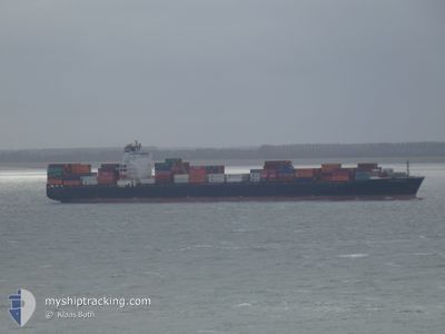
NYK NEBULA
Container Ship

Current Trip
| Time Travelled | 2 days |
|---|---|
| Remaining Time | --- |
| Distance Travelled | 615.25 nm |
| Remaining Distance | --- |
| AVG Speed | 10.5 Knots |
| MAX Speed | 13.3 Knots |
| AVG Wind | 14.4 knots |
| MAX Wind | 30 knots |
| MIN Temp | 10°C / 50°F |
| MAX Temp | 17.4°C / 63.32°F |
| Draught | 8.6 m |
| Position Received | 2 m ago |
Current Position
| Longitude | --- |
|---|---|
| Latitude | --- |
| Status | At anchor |
| Speed | 0.1 Knots |
| Course | 220° |
| Area | English Channel |
| Station | T-AIS |
| Position Received | 2 m ago |
Information
The current position of NYK NEBULA is in English Channel with coordinates 50.61868° / -1.06888° as reported on 2025-03-22 12:47 by AIS to our vessel tracker app. The vessel's current speed is 0.1 Knots
The vessel NYK NEBULA (IMO: 9337640, MMSI: 354891000) is a Container Ship that was built in 2007 ( 18 years old ). It's sailing under the flag of [PA] Panama.
In this page you can find informations about the vessels current position, last detected port calls, and current voyage information. If the vessels is not in coverage by AIS you will find the latest position.
The current position of NYK NEBULA is detected by our AIS receivers and we are not responsible for the reliability of the data. The last position was recorded while the vessel was in Coverage by the Ais receivers of our vessel tracking app.
The current draught of NYK NEBULA as reported by AIS is 8.6 meters
Weather
| Temperature | 10°C / 50°F |
|---|---|
| Wind Speed | 9 knots |
| Direction | 121° ESE |
| Pressure | 999.4 hPa |
| Humidity | 91.9 % |
| Cloud Coverage | 100 % |


Featured Company
Last Port Calls
| Port | Arrival | Departure | Time In Port |
|---|---|---|---|
| 2025-03-19 18:20 | 2025-03-19 18:27 | 7 m | |
| 2025-02-10 08:55 | 2025-03-19 18:12 | ||
| 2025-02-06 21:45 | 2025-02-07 18:21 | 20 h | |
| 2025-01-30 20:10 | 2025-01-31 12:09 | 15 h | |
| 2025-01-29 00:11 | 2025-01-29 16:48 | 16 h | |
| 2025-01-18 15:28 | 2025-01-18 23:48 | 8 h | |
| 2025-01-11 05:25 | 2025-01-12 03:57 | 22 h |
Most Visited Ports (Last year)
| Port | Arrivals | |
|---|---|---|
| 7 | ||
| 6 | ||
| 6 | ||
| 6 | ||
| 4 | ||
| 4 |
Last Trips
| Origin | Departure | Destination | Arrival | Distance | |
|---|---|---|---|---|---|
| 2025-03-19 18:12 | 2025-03-19 18:20 | 0.92 nm | |||
| 2025-02-07 18:21 | 2025-02-10 08:55 | 798.70 nm | |||
| 2025-01-31 12:09 | 2025-02-06 21:45 | 134.23 nm | |||
| 2025-01-29 16:48 | 2025-01-30 20:10 | 276.13 nm | |||
| 2025-01-18 23:48 | 2025-01-29 00:11 | 3277.07 nm | |||
| 2025-01-12 03:57 | 2025-01-18 15:28 | 1785.38 nm | |||
| 2024-12-30 07:59 | 2025-01-11 05:25 | 1265.12 nm |
Events
| Time | Event | Details | Position / Dest | Info |
|---|---|---|---|---|
| 2025-03-21 20:53 | STOP Moving | 3.59 nm, South East of SANDOWN |
50.61869 / -1.07410
ES FRO > GB SOU
|
Speed: 0.3 kn Course: 126° |
| 2025-03-21 20:44 | Status Changed | At anchor Under way using engine |
50.61731 / -1.07345
ES FRO > GB SOU
|
Speed: 0.7 kn Course: 117° |
| 2025-03-21 18:12 | Status Changed | Under way using engine Default |
50.27437 / -1.49188
ES FRO > GB SOU
|
Speed: 11.2 kn Course: 34° |
| 2025-03-21 18:12 | Status Changed | Default Under way using engine |
50.27303 / -1.49333
ES FRO > GB SOU
|
Speed: 11.5 kn Course: 26.7° |
| 2025-03-21 17:58 | Status Changed | Under way using engine Default |
50.23354 / -1.52457
ES FRO > GB SOU
|
Speed: 11.7 kn Course: 21° |
| 2025-03-21 17:52 | Status Changed | Default Under way using engine |
50.21462 / -1.53573
ES FRO > GB SOU
|
Speed: 11.6 kn Course: 18.4° |
| 2025-03-21 17:44 | Change Sea Area | United Kingdom part of the English Channel Guernsey part of the English Channel |
50.19120 / -1.54792
English Channel
ES FRO > GB SOU
|
Speed: 11.6 kn Course: 18.4° |
| 2025-03-21 17:44 | Status Changed | Under way using engine Default |
50.19120 / -1.54792
ES FRO > GB SOU
|
Speed: 11.6 kn Course: 18° |
| 2025-03-21 17:32 | IN Coverage |
50.19120 / -1.54792
English Channel
ES FRO > GB SOU
|
Speed: 11.6 kn Course: 18.4° |
|
| 2025-03-21 13:18 | OUT of Coverage |
49.86922 / -2.75493
English Channel
ES FRO > GB SOU
|
Speed: 12.7 kn Course: 72.9° |