
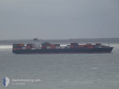
NYK NEBULA
Container Ship
Current Trip
| Time Travelled | 3 days |
|---|---|
| Remaining Time | --- |
| Distance Travelled | 1213.84 nm |
| Remaining Distance | --- |
| AVG Speed | 14.1 Noeuds |
| MAX Speed | 18.9 Noeuds |
| AVG Wind | 14.5 knots |
| MAX Wind | 22.9 knots |
| MIN Temp | 10.7°C / 51.26°F |
| MAX Temp | 14.8°C / 58.64°F |
| Tirant d eau | 12.5 m |
| Position reçue | 1 d depuis |
Current Position
| Longitude | -5.22566° |
|---|---|
| Latitude | 49.74948° |
| Etat | Under way using engine |
| Vitesse | 17.6 Noeuds |
| Parcours | 265.5° |
| Zone | English Channel |
| Station | T-AIS |
| Position reçue | 1 d depuis |
Info
Information
The current position of NYK NEBULA is in English Channel with coordinates 49.74948° / -5.22566° as reported on 2024-05-30 07:18 by AIS to our vessel tracker app. The vessel's current speed is 17.6 Noeuds and is heading at the port of HALIFAX. The estimated time of arrival as calculated by MyShipTracking vessel tracking app is 2024-06-04 15:00 LT
The vessel NYK NEBULA (IMO: 9337640, MMSI: 354891000) is a Container Ship that was built in 2007 ( 17 Age ). It's sailing under the flag of [PA] Panama.
In this page you can find informations about the vessels current position, last detected port calls, and current voyage information. If the vessels is not in coverage by AIS you will find the latest position.
The current position of NYK NEBULA is detected by our AIS receivers and we are not responsible for the reliability of the data. The last position was recorded while the vessel was in Coverage by the Ais receivers of our vessel tracking app.
The current draught of NYK NEBULA as reported by AIS is 12.5 meters
Weather
| Temperature | 12.8°C / 55.04°F |
|---|---|
| Wind Speed | 12 knots |
| Direction | 129° SE |
| Pressure | 1027.5 hPa |
| Humidity | 93 % |
| Cloud Coverage | 100 % |
Featured Company
Last Port Calls
| Port | Arrival | Departure | Time In Port |
|---|---|---|---|
| 2024-05-28 09:23 | 2024-05-29 06:09 | 20 h | |
| 2024-05-26 01:35 | 2024-05-26 21:09 | 19 h | |
| 2024-05-19 00:53 | 2024-05-20 02:18 | 1 d | |
| 2024-05-17 13:10 | 2024-05-18 06:38 | 17 h | |
| 2024-05-16 10:00 | 2024-05-17 03:21 | 17 h | |
| 2024-05-08 15:29 | 2024-05-09 02:10 | 10 h | |
| 2024-05-03 13:48 | 2024-05-04 05:29 | 15 h | |
| 2024-04-28 05:04 | 2024-04-28 20:01 | 14 h | |
| 2024-04-23 13:42 | 2024-04-23 20:53 | 7 h | |
| 2024-04-12 06:20 | 2024-04-14 17:30 | 2 d |
Last Trips
| Origin | Departure | Destination | Arrival | Distance | |
|---|---|---|---|---|---|
| 2024-05-26 21:09 | 2024-05-28 09:23 | 404.06 nm | |||
| 2024-05-20 02:18 | 2024-05-26 01:35 | 333.52 nm | |||
| 2024-05-18 06:38 | 2024-05-19 00:53 | 246.61 nm | |||
| 2024-05-17 03:21 | 2024-05-17 13:10 | 116.55 nm | |||
| 2024-05-09 02:10 | 2024-05-16 10:00 | 2607.49 nm | |||
| 2024-05-04 05:29 | 2024-05-08 15:29 | 1704.99 nm | |||
| 2024-04-28 20:01 | 2024-05-03 13:48 | 724.96 nm | |||
| 2024-04-23 20:53 | 2024-04-28 05:04 | 436.66 nm | |||
| 2024-04-14 17:30 | 2024-04-23 13:42 | 3336.56 nm | |||
| 2024-04-10 04:24 | 2024-04-12 06:20 | 449.09 nm |
Events
| Heure | Evenement | Détails | Position/ Destination | Info |
|---|---|---|---|---|
| 2024-05-30 07:24 | Etat Changé | Default Under way using engine |
49.74758 / -5.27463
CA HAL
|
Vitesse: 17.6 kn Parcours: 265.5° |
| 2024-05-30 07:18 | Hors de la zone couverte |
49.74948 / -5.22566
English Channel
CA HAL
|
Vitesse: 17.6 kn Parcours: 265.5° |
|
| 2024-05-30 02:57 | Etat Changé | Under way using engine Default |
50.28265 / -3.46686
CA HAL
|
Vitesse: 17.3 kn Parcours: 209° |
| 2024-05-30 02:56 | Etat Changé | Default Under way using engine |
50.28518 / -3.46466
CA HAL
|
Vitesse: 17.3 kn Parcours: 208.6° |
| 2024-05-30 02:56 | Etat Changé | Under way using engine Default |
50.28595 / -3.46399
CA HAL
|
Vitesse: 17.1 kn Parcours: 207° |
| 2024-05-30 02:52 | Etat Changé | Default Under way using engine |
50.30275 / -3.45084
CA HAL
|
Vitesse: 15.9 kn Parcours: 191.4° |
| 2024-05-29 19:53 | Etat Changé | Under way using engine Default |
50.44891 / -1.42144
CA HAL
|
Vitesse: 17.2 kn Parcours: 270° |
| 2024-05-29 19:52 | Etat Changé | Default Under way using engine |
50.44897 / -1.41109
CA HAL
|
Vitesse: 17.3 kn Parcours: 269.4° |
| 2024-05-29 12:46 | Changement de zone | United Kingdom part of the English Channel United Kingdom part of the North Sea |
51.04858 / 1.50492
English Channel
CA HAL
|
Vitesse: 16.3 kn Parcours: 225.8° |
| 2024-05-29 10:52 | Changement de zone | United Kingdom part of the North Sea French part of the North Sea |
51.39681 / 2.06595
North Sea
CA HAL
|
Vitesse: 17.2 kn Parcours: 300.3° |