
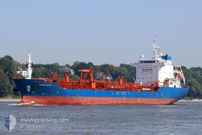
MURRAY STAR
Oil/Chemical Tanker
Current Trip
| Time Travelled | 2 days |
|---|---|
| Remaining Time | 12 h, 8 mins |
| Distance Travelled | 584.07 nm |
| Remaining Distance | 127.17 nm |
| AVG Speed | 11.1 Knots |
| MAX Speed | 15.3 Knots |
| AVG Wind | 8.3 knots |
| MAX Wind | 20 knots |
| MIN Temp | 8.4°C / 47.12°F |
| MAX Temp | 11.2°C / 52.16°F |
| Draught | 5.8 m |
| Position Received | 9 h, 29 m ago |
Current Position
| Longitude | -5.88196° |
|---|---|
| Latitude | 50.81639° |
| Status | Under way using engine |
| Speed | 10.9 Knots |
| Course | 1.5° |
| Area | Celtic Sea |
| Station | T-AIS |
| Position Received | 9 h, 29 m ago |
Info
Information
The current position of MURRAY STAR is in Celtic Sea with coordinates 50.81639° / -5.88196° as reported on 2024-04-28 08:31 by AIS to our vessel tracker app. The vessel's current speed is 10.9 Knots and is heading at the port of LIVERPOOL ANCH. The estimated time of arrival as calculated by MyShipTracking vessel tracking app is 2024-04-29 06:08 LT
The vessel MURRAY STAR (IMO: 9527635, MMSI: 215178000) is a Oil/Chemical Tanker that was built in 2011 ( 13 years old ). It's sailing under the flag of [MT] Malta.
In this page you can find informations about the vessels current position, last detected port calls, and current voyage information. If the vessels is not in coverage by AIS you will find the latest position.
The current position of MURRAY STAR is detected by our AIS receivers and we are not responsible for the reliability of the data. The last position was recorded while the vessel was in Coverage by the Ais receivers of our vessel tracking app.
The current draught of MURRAY STAR as reported by AIS is 5.8 meters
Weather
| Temperature | 9.8°C / 49.64°F |
|---|---|
| Wind Speed | 18 knots |
| Direction | 230° SW |
| Pressure | 1007.8 hPa |
| Humidity | 74.2 % |
| Cloud Coverage | 53 % |
Featured Company
Last Port Calls
| Port | Arrival | Departure | Time In Port |
|---|---|---|---|
| 2024-04-25 01:39 | 2024-04-26 13:44 | 1 d | |
| 2024-04-22 08:40 | 2024-04-22 09:41 | 1 h | |
| 2024-04-20 23:42 | 2024-04-22 08:08 | 1 d | |
| 2024-04-20 22:36 | 2024-04-20 23:18 | 41 m | |
| 2024-04-20 00:30 | 2024-04-20 18:48 | 18 h | |
| 2024-04-18 07:08 | 2024-04-19 07:24 | 1 d | |
| 2024-04-12 06:03 | 2024-04-13 11:15 | 1 d | |
| 2024-04-07 20:03 | 2024-04-07 20:55 | 51 m | |
| 2024-04-06 22:40 | 2024-04-07 18:26 | 19 h | |
| 2024-03-29 11:46 | 2024-03-29 12:38 | 52 m |
Last Trips
| Origin | Departure | Destination | Arrival | Distance | |
|---|---|---|---|---|---|
| 2024-04-22 10:41 | 2024-04-25 03:39 | 735.09 nm | |||
| 2024-04-22 09:08 | 2024-04-22 09:40 | 1.97 nm | |||
| 2024-04-21 00:18 | 2024-04-21 00:42 | 1.93 nm | |||
| 2024-04-19 08:24 | 2024-04-20 23:36 | 240.13 nm | |||
| 2024-04-19 08:24 | 2024-04-20 01:30 | 210.21 nm | |||
| 2024-04-13 13:15 | 2024-04-18 08:08 | 796.41 nm | |||
| 2024-04-07 22:55 | 2024-04-12 08:03 | 192.11 nm | |||
| 2024-04-07 20:26 | 2024-04-07 22:03 | 4.38 nm | |||
| 2024-03-29 12:38 | 2024-04-07 00:40 | 863.39 nm | |||
| 2024-03-29 11:15 | 2024-03-29 11:46 | 1.92 nm |
Events
| Time | Event | Details | Position / Dest | Info |
|---|---|---|---|---|
| 2024-04-28 08:38 | Status Changed | Default Under way using engine |
50.83871 / -5.88192
GB SOW
|
Speed: 10.9 kn Course: 1.5° |
| 2024-04-28 08:31 | OUT of Coverage |
50.81639 / -5.88196
Celtic Sea
GB SOW
|
Speed: 10.9 kn Course: 1.5° |
|
| 2024-04-28 08:25 | Status Changed | Under way using engine Default |
50.79924 / -5.88211
GB SOW
|
Speed: 10.9 kn Course: 0° |
| 2024-04-28 07:42 | Status Changed | Default Under way using engine |
50.66827 / -5.88313
GB SOW
|
Speed: 10.8 kn Course: 359° |
| 2024-04-28 04:55 | Status Changed | Under way using engine Default |
50.15151 / -5.88256
GB SOW
|
Speed: 11.5 kn Course: 358° |
| 2024-04-28 04:22 | Status Changed | Default Under way using engine |
50.04654 / -5.88652
GB SOW
|
Speed: 11.3 kn Course: 1.8° |
| 2024-04-28 04:16 | Change Sea Area | United Kingdom part of the Celtic Sea United Kingdom part of the English Channel |
50.02765 / -5.88683
Celtic Sea
GB SOW
|
Speed: 11.3 kn Course: 359.6° |
| 2024-04-28 04:16 | Status Changed | Under way using engine Default |
50.02712 / -5.88685
GB SOW
|
Speed: 11.3 kn Course: 3° |
| 2024-04-28 04:06 | IN Coverage |
50.02765 / -5.88683
Celtic Sea
GB SOW
|
Speed: 11.3 kn Course: 359.6° |
|
| 2024-04-28 02:00 | OUT of Coverage |
49.83862 / -5.40437
English Channel
GB SOW
|
Speed: 11.7 kn Course: 273.7° |