
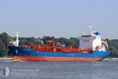
MURRAY STAR
Oil/Chemical Tanker
Current Trip
| Time Travelled | 9 days |
|---|---|
| Remaining Time | 20 h, 25 mins |
| Distance Travelled | 476.48 nm |
| Remaining Distance | 192.73 nm |
| AVG Speed | 11.3 Knop |
| MAX Speed | 15 Knop |
| AVG Wind | 15.6 knots |
| MAX Wind | 32 knots |
| MIN Temp | 4.5°C / 40.1°F |
| MAX Temp | 13.3°C / 55.94°F |
| Djupgående | 6.3 m |
| Position mottagen | 1 m sen |
Current Position
| Longitud | --- |
|---|---|
| Latitude | --- |
| Status | Under way using engine |
| Fart | 8.8 Knop |
| Kurs | 342.5° |
| Område | North Sea |
| Station | T-AIS |
| Position mottagen | 1 m sen |
Info
Information
The current position of MURRAY STAR is in North Sea with coordinates 57.95175° / 4.80628° as reported on 2025-03-04 23:37 by AIS to our vessel tracker app. The vessel's current speed is 8.8 Knop and is heading at the port of MONGSTAD . The estimated time of arrival as calculated by MyShipTracking vessel tracking app is 2025-03-05 20:04 LT
The vessel MURRAY STAR (IMO: 9527635, MMSI: 215178000) is a Oil/Chemical Tanker that was built in 2011 ( 14 År gammal ). It's sailing under the flag of [MT] Malta.
In this page you can find informations about the vessels current position, last detected port calls, and current voyage information. If the vessels is not in coverage by AIS you will find the latest position.
The current position of MURRAY STAR is detected by our AIS receivers and we are not responsible for the reliability of the data. The last position was recorded while the vessel was in Coverage by the Ais receivers of our vessel tracking app.
The current draught of MURRAY STAR as reported by AIS is 6.3 meters
Weather
| Temperature | 7°C / 44.6°F |
|---|---|
| Wind Speed | 31 knots |
| Direction | 244° WSW |
| Pressure | 1007.5 hPa |
| Humidity | 82.4 % |
| Cloud Coverage | 100 % |
Featured Company
Last Port Calls
| Port | Arrival | Departure | Time In Port |
|---|---|---|---|
| 2025-02-22 01:10 | 2025-02-23 13:28 | 1 d | |
| 2025-02-18 21:45 | 2025-02-20 09:55 | 1 d | |
| 2025-02-10 20:35 | 2025-02-12 05:16 | 1 d | |
| 2025-02-09 04:42 | 2025-02-10 06:22 | 1 d | |
| 2025-02-06 01:21 | 2025-02-07 01:20 | 23 h | |
| 2025-02-03 03:16 | 2025-02-03 03:46 | 30 m | |
| 2025-02-01 22:30 | 2025-02-03 02:26 | 1 d | |
| 2025-02-01 21:19 | 2025-02-01 21:54 | 34 m | |
| 2025-01-28 05:28 | 2025-01-29 04:23 | 22 h | |
| 2025-01-23 23:16 | 2025-01-25 02:56 | 1 d |
Last Trips
| Origin | Departure | Destination | Arrival | Distance | |
|---|---|---|---|---|---|
| 2025-02-20 09:55 | 2025-02-22 02:10 | 279.66 nm | |||
| 2025-02-12 06:16 | 2025-02-18 21:45 | 661.61 nm | |||
| 2025-02-10 07:22 | 2025-02-10 21:35 | 141.31 nm | |||
| 2025-02-07 02:20 | 2025-02-09 05:42 | 174.86 nm | |||
| 2025-02-03 04:46 | 2025-02-06 02:21 | 494.13 nm | |||
| 2025-02-03 03:26 | 2025-02-03 04:16 | 4.47 nm | |||
| 2025-02-01 22:54 | 2025-02-01 23:30 | 4.61 nm | |||
| 2025-01-29 05:23 | 2025-02-01 22:19 | 605.78 nm | |||
| 2025-01-25 03:56 | 2025-01-28 06:28 | 606.63 nm | |||
| 2025-01-23 22:40 | 2025-01-24 00:16 | 17.11 nm |
Events
| Tid | Event | Detaljer | Position / Dest | Information |
|---|---|---|---|---|
| 2025-03-04 18:24 | Status ändrad | Under way using engine Default |
57.14724 / 5.27851
BE ANR > NO MON
|
Fart: 9.3 kn Kurs: 342° |
| 2025-03-04 18:12 | Status ändrad | Default Under way using engine |
57.11340 / 5.29780
BE ANR > NO MON
|
Fart: 9.3 kn Kurs: 342° |
| 2025-03-04 18:11 | Status ändrad | Under way using engine Default |
57.11340 / 5.29780
BE ANR > NO MON
|
Fart: 9.1 kn Kurs: 341° |
| 2025-03-04 17:59 | Status ändrad | Default Under way using engine |
57.08181 / 5.31539
BE ANR > NO MON
|
Fart: 9.6 kn Kurs: 342.3° |
| 2025-03-04 17:53 | Status ändrad | Under way using engine Default |
57.06829 / 5.32318
BE ANR > NO MON
|
Fart: 10 kn Kurs: 344° |
| 2025-03-04 17:44 | Status ändrad | Default Under way using engine |
57.04366 / 5.33692
BE ANR > NO MON
|
Fart: 10.2 kn Kurs: 342.4° |
| 2025-03-04 15:52 | Byter havsområde | Norwegian part of the North Sea Danish part of the North Sea |
56.74384 / 5.51902
North Sea
BE ANR > NO MON
|
Fart: 10.3 kn Kurs: 341° |
| 2025-03-04 08:46 | Byter havsområde | Danish part of the North Sea German part of the North Sea |
55.44458 / 5.65660
North Sea
BE ANR > NO MON
|
Fart: 11.5 kn Kurs: 357.8° |
| 2025-03-04 07:47 | Djupgående ändrat | 6.3 6 |
55.26205 / 5.54604
BE ANR > NO MON
|
Fart: 11.8 kn Kurs: 25.7° |
| 2025-03-04 07:34 | Upptäckt i hav | German part of the North Sea |
55.22299 / 5.51679
North Sea
BE ANR > NO MON
|
Fart: 11.6 kn Kurs: 21.7° |