
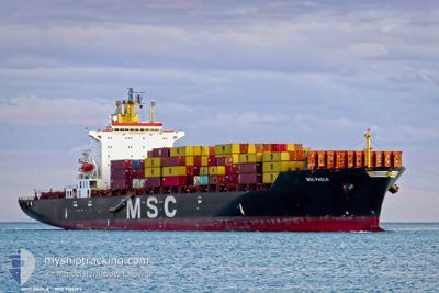
MSC PAOLA
Container Ship
Current Trip
| Time Travelled | 1 day |
|---|---|
| Remaining Time | 4 days |
| Distance Travelled | 296.84 nm |
| Remaining Distance | 1365.60 nm |
| AVG Speed | 13.1 Knots |
| MAX Speed | 14.5 Knots |
| AVG Wind | 6.8 knots |
| MAX Wind | 11 knots |
| MIN Temp | 26.5°C / 79.7°F |
| MAX Temp | 27.8°C / 82.04°F |
| Draught | 10.9 m |
| Position Received | 21 h, 35 m ago |
Current Position
| Longitude | --- |
|---|---|
| Latitude | --- |
| Status | Under way using engine |
| Speed | 13.1 Knots |
| Course | 81.4° |
| Area | Singapore Strait |
| Station | T-AIS |
| Position Received | 21 h, 35 m ago |
Info
Information
The current position of MSC PAOLA is in Singapore Strait with coordinates 1.26604° / 104.23962° as reported on 2024-12-24 13:09 by AIS to our vessel tracker app. The vessel's current speed is 13.1 Knots and is heading at the port of XIAMEN. The estimated time of arrival as calculated by MyShipTracking vessel tracking app is 2024-12-29 17:17 LT
The vessel MSC PAOLA (IMO: 9161297, MMSI: 636018318) is a Container Ship that was built in 1998 ( 26 years old ). It's sailing under the flag of [LR] Liberia.
In this page you can find informations about the vessels current position, last detected port calls, and current voyage information. If the vessels is not in coverage by AIS you will find the latest position.
The current position of MSC PAOLA is detected by our AIS receivers and we are not responsible for the reliability of the data. The last position was recorded while the vessel was in Coverage by the Ais receivers of our vessel tracking app.
The current draught of MSC PAOLA as reported by AIS is 10.9 meters
Weather
| Temperature | 27.1°C / 80.78°F |
|---|---|
| Wind Speed | 3 knots |
| Direction | 303° WNW |
| Pressure | 1008.9 hPa |
| Humidity | 66.6 % |
| Cloud Coverage | 100 % |
Featured Company
Last Port Calls
| Port | Arrival | Departure | Time In Port |
|---|---|---|---|
| 2024-12-24 01:49 | 2024-12-24 08:21 | 6 h | |
| 2024-12-21 19:23 | 2024-12-23 16:06 | 1 d | |
| 2024-12-18 04:51 | 2024-12-19 20:01 | 1 d | |
| 2024-12-16 00:37 | 2024-12-17 12:18 | 1 d | |
| 2024-12-12 21:42 | 2024-12-13 23:31 | 1 d | |
| 2024-12-03 02:56 | 2024-12-03 16:00 | 13 h | |
| 2024-11-27 12:43 | 2024-11-28 00:40 | 11 h | |
| 2024-11-12 03:32 | 2024-11-13 07:44 | 1 d | |
| 2024-11-10 19:10 | 2024-11-11 20:45 | 1 d | |
| 2024-11-06 13:00 | 2024-11-07 08:44 | 19 h |
Most Visited Ports (Last year)
| Port | Arrivals | |
|---|---|---|
| 23 | ||
| 14 | ||
| 8 | ||
| 5 | ||
| 5 | ||
| 5 |
Last Trips
| Origin | Departure | Destination | Arrival | Distance | |
|---|---|---|---|---|---|
| 2024-12-24 00:06 | 2024-12-24 09:49 | 26.91 nm | |||
| 2024-12-20 04:01 | 2024-12-22 03:23 | 233.00 nm | |||
| 2024-12-17 20:18 | 2024-12-18 12:51 | 192.00 nm | |||
| 2024-12-14 06:31 | 2024-12-16 08:37 | 586.96 nm | |||
| 2024-12-04 00:00 | 2024-12-13 04:42 | 2157.96 nm | |||
| 2024-11-28 08:40 | 2024-12-03 10:56 | 819.77 nm | |||
| 2024-11-13 15:44 | 2024-11-27 20:43 | 2989.31 nm | |||
| 2024-11-12 04:45 | 2024-11-12 11:32 | 58.85 nm | |||
| 2024-11-07 15:44 | 2024-11-11 03:10 | 847.29 nm | |||
| 2024-11-01 14:24 | 2024-11-06 20:00 | 890.04 nm |
Events
| Time | Event | Details | Position / Dest | Info |
|---|---|---|---|---|
| 2024-12-25 10:16 | START Moving |
5.01928 / 106.59058
CNXMN
|
Speed: 3.5 kn Course: 32° |
|
| 2024-12-25 09:46 | STOP Moving |
5.02117 / 106.59018
CNXMN
|
Speed: 0.3 kn Course: 73° |
|
| 2024-12-24 13:17 | Status Changed | Default Under way using engine |
1.26962 / 104.26653
CNXMN
|
Speed: 13.1 kn Course: 81.4° |
| 2024-12-24 13:09 | Status Changed | Under way using engine Default |
1.26604 / 104.23962
CNXMN
|
Speed: 13 kn Course: 82° |
| 2024-12-24 13:09 | OUT of Coverage |
1.26604 / 104.23962
Singapore Strait
CNXMN
|
Speed: 13.1 kn Course: 81.4° |
|
| 2024-12-24 13:05 | Status Changed | Default Under way using engine |
1.26372 / 104.22347
CNXMN
|
Speed: 13 kn Course: 82.3° |
| 2024-12-24 12:50 | Detected in Sea | Malaysian part of the Singapore Strait |
1.25732 / 104.17087
Singapore Strait
CNXMN
|
Speed: 12.8 kn Course: 83.8° |
| 2024-12-24 11:06 | ETA Changed | 2024/12/30 14:00 2024/12/30 01:00 |
1.16846 / 103.81778
CNXMN
|
Speed: 11.8 kn Course: 61.5° |
| 2024-12-24 10:22 | Draught Changed | 10.9 11.2 |
1.06949 / 103.69399
CNXMN
|
Speed: 12.8 kn Course: 55.1° |
| 2024-12-24 10:22 | Destination Changed | CNXMN MYTPP |
1.06949 / 103.69399
CNXMN
|
Speed: 12.8 kn Course: 55.1° |