
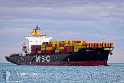
MSC PAOLA
Container Ship
Current Trip
| Time Travelled | 14 h, 1 mins |
|---|---|
| Remaining Time | 4 days |
| Distance Travelled | 174.13 nm |
| Remaining Distance | 1529.49 nm |
| AVG Speed | 12.9 Knoten |
| MAX Speed | 14.3 Knoten |
| AVG Wind | 6.8 knots |
| MAX Wind | 11 knots |
| MIN Temp | 26.6°C / 79.88°F |
| MAX Temp | 27.8°C / 82.04°F |
| Tiefgang | 10.9 m |
| Position erhalten | 9 h, 13 m alt |
Current Position
| Länge | --- |
|---|---|
| Breite | --- |
| Zustand | Under way using engine |
| Geschwindigkeit | 13.1 Knoten |
| Kurs | 81.4° |
| Gebiet | Singapore Strait |
| Station | T-AIS |
| Position erhalten | 9 h, 13 m alt |
Info
Information
Die aktuelle Position von MSC PAOLA befindet sich in Singapore Strait mit den Koordinaten 1.26604° / 104.23962°, wie von AIS am 2024-12-24 13:09 an unsere Schiffsverfolgungs-App. Die aktuelle Geschwindigkeit des Schiffes betragt 13.1 Knoten und fahrt in den Hafen von XIAMEN. Die geschatzte Ankunftszeit, berechnet von der MyShipTracking-App zur Schiffsverfolgung, ist 2024-12-29 22:18 LT
Das Schiff MSC PAOLA (IMO: 9161297, MMSI: 636018318) ist Container Ship das wurde im Jahr 1998 ( 26 Jahre alt ) gebaut. Es segelt unter der Flagge [LR] Liberia.
Auf dieser Seite finden Sie Informationen zur aktuellen Position des Schiffes, zu den zuletzt erkannten Hafenanlaufen und zu aktuellen Reiseinformationen. Wenn die Schiffe nicht von AIS abgedeckt werden, finden Sie die neueste Position.
Die aktuelle Position von MSC PAOLA wird von unseren AIS-Empfangern erkannt und wir sind nicht fur die Zuverlassigkeit der Daten verantwortlich. Die letzte Position wurde von den Ais-Empfangern unserer Schiffsverfolgungs-App aufgezeichnet, wahrend sich das Schiff in Deckung befand.
Der aktuelle Entwurf von MSC PAOLA, wie von AIS gemeldet, betragt 10.9 meter
Weather
| Temperature | 26.5°C / 79.7°F |
|---|---|
| Wind Speed | 9 knots |
| Direction | 6° N |
| Pressure | 1009.6 hPa |
| Humidity | 75.3 % |
| Cloud Coverage | 100 % |
Featured Company
Last Port Calls
| Port | Arrival | Departure | Time In Port |
|---|---|---|---|
| 2024-12-24 09:49 | 2024-12-24 16:21 | 6 h | |
| 2024-12-22 03:23 | 2024-12-24 00:06 | 1 d | |
| 2024-12-18 12:51 | 2024-12-20 04:01 | 1 d | |
| 2024-12-16 08:37 | 2024-12-17 20:18 | 1 d | |
| 2024-12-13 04:42 | 2024-12-14 06:31 | 1 d | |
| 2024-12-03 10:56 | 2024-12-04 00:00 | 13 h | |
| 2024-11-27 20:43 | 2024-11-28 08:40 | 11 h | |
| 2024-11-12 11:32 | 2024-11-13 15:44 | 1 d | |
| 2024-11-11 03:10 | 2024-11-12 04:45 | 1 d | |
| 2024-11-06 20:00 | 2024-11-07 15:44 | 19 h |
Most Visited Ports (Last year)
| Port | Arrivals | |
|---|---|---|
| 23 | ||
| 14 | ||
| 8 | ||
| 5 | ||
| 5 | ||
| 5 |
Last Trips
| Origin | Departure | Destination | Arrival | Distance | |
|---|---|---|---|---|---|
| 2024-12-24 00:06 | 2024-12-24 09:49 | 26.91 nm | |||
| 2024-12-20 04:01 | 2024-12-22 03:23 | 233.00 nm | |||
| 2024-12-17 20:18 | 2024-12-18 12:51 | 192.00 nm | |||
| 2024-12-14 06:31 | 2024-12-16 08:37 | 586.96 nm | |||
| 2024-12-04 00:00 | 2024-12-13 04:42 | 2157.96 nm | |||
| 2024-11-28 08:40 | 2024-12-03 10:56 | 819.77 nm | |||
| 2024-11-13 15:44 | 2024-11-27 20:43 | 2989.31 nm | |||
| 2024-11-12 04:45 | 2024-11-12 11:32 | 58.85 nm | |||
| 2024-11-07 15:44 | 2024-11-11 03:10 | 847.29 nm | |||
| 2024-11-01 14:24 | 2024-11-06 20:00 | 890.04 nm |
Events
| Zeit | Ereignis | Details | Position / Ziel | Information |
|---|---|---|---|---|
| 2024-12-24 13:17 | geänderter Status | Default Under way using engine |
1.26962 / 104.26653
CNXMN
|
Geschwindigkeit: 13.1 kn Kurs: 81.4° |
| 2024-12-24 13:09 | geänderter Status | Under way using engine Default |
1.26604 / 104.23962
CNXMN
|
Geschwindigkeit: 13 kn Kurs: 82° |
| 2024-12-24 13:09 | außerhalb Abdeckung |
1.26604 / 104.23962
Singapore Strait
CNXMN
|
Geschwindigkeit: 13.1 kn Kurs: 81.4° |
|
| 2024-12-24 13:05 | geänderter Status | Default Under way using engine |
1.26372 / 104.22347
CNXMN
|
Geschwindigkeit: 13 kn Kurs: 82.3° |
| 2024-12-24 12:50 | Auf See entdeckt | Malaysian part of the Singapore Strait |
1.25732 / 104.17087
Singapore Strait
CNXMN
|
Geschwindigkeit: 12.8 kn Kurs: 83.8° |
| 2024-12-24 11:06 | geänderte voraussichtliche Ankunftszeit | 2024/12/30 14:00 2024/12/30 01:00 |
1.16846 / 103.81778
CNXMN
|
Geschwindigkeit: 11.8 kn Kurs: 61.5° |
| 2024-12-24 10:22 | geänderter Tiefgang | 10.9 11.2 |
1.06949 / 103.69399
CNXMN
|
Geschwindigkeit: 12.8 kn Kurs: 55.1° |
| 2024-12-24 10:22 | geändertes Ziel | CNXMN MYTPP |
1.06949 / 103.69399
CNXMN
|
Geschwindigkeit: 12.8 kn Kurs: 55.1° |
| 2024-12-24 10:22 | geänderte voraussichtliche Ankunftszeit | 2024/12/30 01:00 2024/12/24 01:40 |
1.06949 / 103.69399
CNXMN
|
Geschwindigkeit: 12.8 kn Kurs: 55.1° |
| 2024-12-24 10:14 | geänderter Status | Under way using engine Default |
1.05602 / 103.67103
MYTPP
|
Geschwindigkeit: 12.8 kn Kurs: 67° |