
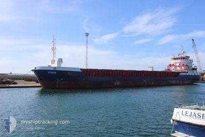
LEONIE
Cargo
Current Trip
| Time Travelled | 1 day |
|---|---|
| Remaining Time | 4 h, 25 mins |
| Distance Travelled | 309.61 nm |
| Remaining Distance | 126.04 nm |
| AVG Speed | 10.5 Knots |
| MAX Speed | 11.7 Knots |
| AVG Wind | 8 knots |
| MAX Wind | 16 knots |
| MIN Temp | 11.5°C / 52.7°F |
| MAX Temp | 12.7°C / 54.86°F |
| Draught | 3.2 m |
| Position Received | 14 h, 11 m ago |
Current Position
| Longitude | --- |
|---|---|
| Latitude | --- |
| Status | Under way using engine |
| Speed | 11 Knots |
| Course | 258° |
| Area | North Atlantic Ocean |
| Station | T-AIS |
| Position Received | 14 h, 11 m ago |
Information
The current position of LEONIE is in North Atlantic Ocean with coordinates 43.64711° / -9.04707° as reported on 2025-03-26 16:03 by AIS to our vessel tracker app. The vessel's current speed is 11 Knots and is heading at the port of LEIXOES. The estimated time of arrival as calculated by MyShipTracking vessel tracking app is 2025-03-27 10:40 LT
The vessel LEONIE (IMO: 9858682, MMSI: 305242000) is a Cargo It's sailing under the flag of [AG] Antigua Barbuda.
In this page you can find informations about the vessels current position, last detected port calls, and current voyage information. If the vessels is not in coverage by AIS you will find the latest position.
The current position of LEONIE is detected by our AIS receivers and we are not responsible for the reliability of the data. The last position was recorded while the vessel was in Coverage by the Ais receivers of our vessel tracking app.
The current draught of LEONIE as reported by AIS is 3.2 meters
Weather
| Temperature | 12.5°C / 54.5°F |
|---|---|
| Wind Speed | 4 knots |
| Direction | 140° SE |
| Pressure | 1018 hPa |
| Humidity | 79.6 % |
| Cloud Coverage | 5 % |
Featured Company
Last Port Calls
| Port | Arrival | Departure | Time In Port |
|---|---|---|---|
| 2025-03-25 06:21 | 2025-03-25 18:25 | 12 h | |
| 2025-03-19 11:29 | 2025-03-21 17:24 | 2 d | |
| 2025-03-17 14:06 | 2025-03-18 18:02 | 1 d | |
| 2025-03-15 06:30 | 2025-03-16 07:18 | 1 d | |
| 2025-03-11 22:04 | 2025-03-13 20:15 | 1 d | |
| 2025-03-02 21:34 | 2025-03-04 03:05 | 1 d | |
| 2025-02-20 11:58 | 2025-02-24 10:15 | 3 d | |
| 2025-02-18 12:35 | 2025-02-18 21:19 | 8 h | |
| 2025-02-10 03:23 | 2025-02-10 19:46 | 16 h | |
| 2025-02-06 15:17 | 2025-02-07 17:57 | 1 d |
Last Trips
| Origin | Departure | Destination | Arrival | Distance | |
|---|---|---|---|---|---|
| 2025-03-21 18:24 | 2025-03-25 07:21 | 780.98 nm | |||
| 2025-03-18 19:02 | 2025-03-19 12:29 | 150.61 nm | |||
| 2025-03-16 07:18 | 2025-03-17 15:06 | 203.09 nm | |||
| 2025-03-13 20:15 | 2025-03-15 06:30 | 270.05 nm | |||
| 2025-03-04 03:05 | 2025-03-11 22:04 | 1722.97 nm | |||
| 2025-02-24 10:15 | 2025-03-02 21:34 | 494.81 nm | |||
| 2025-02-18 22:19 | 2025-02-20 11:58 | 153.97 nm | |||
| 2025-02-10 19:46 | 2025-02-18 13:35 | 1151.46 nm | |||
| 2025-02-07 18:57 | 2025-02-10 03:23 | 227.78 nm | |||
| 2025-01-24 22:33 | 2025-02-06 16:17 | 1773.20 nm |
Events
| Time | Event | Details | Position / Dest | Info |
|---|---|---|---|---|
| 2025-03-26 16:04 | Status Changed | Default Under way using engine |
43.64669 / -9.04998
PTLEI
|
Speed: 11 kn Course: 258° |
| 2025-03-26 16:03 | OUT of Coverage |
43.64711 / -9.04707
North Atlantic Ocean
PTLEI
|
Speed: 11 kn Course: 258° |
|
| 2025-03-26 15:37 | Status Changed | Under way using engine Default |
43.66382 / -8.93826
PTLEI
|
Speed: 11.1 kn Course: 258° |
| 2025-03-26 15:28 | Status Changed | Default Under way using engine |
43.66960 / -8.89951
PTLEI
|
Speed: 11 kn Course: 258° |
| 2025-03-26 15:16 | Status Changed | Under way using engine Default |
43.67804 / -8.84774
PTLEI
|
Speed: 11 kn Course: 257° |
| 2025-03-26 14:54 | Status Changed | Default Under way using engine |
43.69338 / -8.75926
PTLEI
|
Speed: 11 kn Course: 255.1° |
| 2025-03-26 14:49 | Status Changed | Under way using engine Default |
43.69692 / -8.73899
PTLEI
|
Speed: 11.1 kn Course: 257° |
| 2025-03-26 14:38 | Status Changed | Default Under way using engine |
43.70517 / -8.69289
PTLEI
|
Speed: 11.2 kn Course: 257.8° |
| 2025-03-26 14:32 | Status Changed | Under way using engine Default |
43.70933 / -8.66869
PTLEI
|
Speed: 11.1 kn Course: 258° |
| 2025-03-26 13:56 | Status Changed | Default Under way using engine |
43.73654 / -8.51475
PTLEI
|
Speed: 11.2 kn Course: 253.5° |