

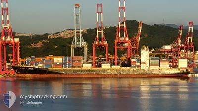
KOTA LUMBA
Container Ship

Current Trip
| Time Travelled | 6 days |
|---|---|
| Remaining Time | 5 days |
| Distance Travelled | 2681.98 nm |
| Remaining Distance | 2493.84 nm |
| AVG Speed | 17.6 Knots |
| MAX Speed | 19.9 Knots |
| AVG Wind | 14.1 knots |
| MAX Wind | 23.8 knots |
| MIN Temp | 16.6°C / 61.88°F |
| MAX Temp | 29.8°C / 85.64°F |
| Draught | 11.2 m |
| Position Received | 5 d ago |
Current Position
| Longitude | --- |
|---|---|
| Latitude | --- |
| Status | Under way using engine |
| Speed | 18.5 Knots |
| Course | 314.3° |
| Area | South Pacific Ocean |
| Station | T-AIS |
| Position Received | 5 d ago |
Information
The current position of KOTA LUMBA is in South Pacific Ocean with coordinates -34.70880° / 174.35231° as reported on 2025-02-15 08:44 by AIS to our vessel tracker app. The vessel's current speed is 18.5 Knots and is heading at the port of HONG KONG. The estimated time of arrival as calculated by MyShipTracking vessel tracking app is 2025-02-26 18:16 LT
The vessel KOTA LUMBA (IMO: 9439761, MMSI: 477302600) is a Container Ship that was built in 2010 ( 15 years old ). It's sailing under the flag of [HK] Hong Kong.
In this page you can find informations about the vessels current position, last detected port calls, and current voyage information. If the vessels is not in coverage by AIS you will find the latest position.
The current position of KOTA LUMBA is detected by our AIS receivers and we are not responsible for the reliability of the data. The last position was recorded while the vessel was in Coverage by the Ais receivers of our vessel tracking app.
The current draught of KOTA LUMBA as reported by AIS is 11.2 meters
Weather
| Temperature | 28.1°C / 82.58°F |
|---|---|
| Wind Speed | 14 knots |
| Direction | 298° WNW |
| Pressure | 1011.3 hPa |
| Humidity | 77 % |
| Cloud Coverage | 100 % |


Featured Company
Last Port Calls
| Port | Arrival | Departure | Time In Port |
|---|---|---|---|
| 2025-02-13 20:58 | 2025-02-14 20:59 | 1 d | |
| 2025-02-10 20:20 | 2025-02-12 04:28 | 1 d | |
| 2025-02-09 02:59 | 2025-02-09 19:29 | 16 h | |
| 2025-02-06 05:45 | 2025-02-07 04:34 | 22 h | |
| 2025-02-02 15:30 | 2025-02-04 07:04 | 1 d | |
| 2025-01-22 01:14 | 2025-01-22 09:01 | 7 h | |
| 2025-01-19 03:34 | 2025-01-20 02:49 | 23 h | |
| 2025-01-15 07:33 | 2025-01-16 00:13 | 16 h | |
| 2025-01-08 18:45 | 2025-01-09 12:05 | 17 h | |
| 2024-12-26 00:06 | 2024-12-26 15:08 | 15 h |
Last Trips
| Origin | Departure | Destination | Arrival | Distance | |
|---|---|---|---|---|---|
| 2025-02-12 17:28 | 2025-02-14 09:58 | 338.74 nm | |||
| 2025-02-10 08:29 | 2025-02-11 09:20 | 351.25 nm | |||
| 2025-02-07 17:34 | 2025-02-09 15:59 | 181.37 nm | |||
| 2025-02-04 20:04 | 2025-02-06 18:45 | 588.42 nm | |||
| 2025-01-22 17:01 | 2025-02-03 04:30 | 4827.98 nm | |||
| 2025-01-20 10:49 | 2025-01-22 09:14 | 392.12 nm | |||
| 2025-01-16 08:13 | 2025-01-19 11:34 | 995.86 nm | |||
| 2025-01-09 20:05 | 2025-01-15 15:33 | 471.51 nm | |||
| 2024-12-27 04:08 | 2025-01-09 02:45 | 5326.00 nm | |||
| 2024-12-24 15:45 | 2024-12-26 13:06 | 14.87 nm |
Events
| Time | Event | Details | Position / Dest | Info |
|---|---|---|---|---|
| 2025-02-15 08:52 | Status Changed | Default Under way using engine |
-34.68308 / 174.32039
CNHKG
|
Speed: 18.5 kn Course: 314.3° |
| 2025-02-15 08:44 | OUT of Coverage |
-34.70880 / 174.35231
South Pacific Ocean
CNHKG
|
Speed: 18.5 kn Course: 314.3° |
|
| 2025-02-15 08:44 | Status Changed | Under way using engine Default |
-34.71132 / 174.35547
CNHKG
|
Speed: 18.2 kn Course: 316° |
| 2025-02-15 08:11 | Status Changed | Default Under way using engine |
-34.83822 / 174.48789
CNHKG
|
Speed: 18.1 kn Course: 321.4° |
| 2025-02-15 07:53 | Status Changed | Under way using engine Default |
-34.90988 / 174.55038
CNHKG
|
Speed: 18 kn Course: 325° |
| 2025-02-15 07:48 | Status Changed | Default Under way using engine |
-34.93303 / 174.57100
CNHKG
|
Speed: 18 kn Course: 325.2° |
| 2025-02-15 07:42 | Status Changed | Under way using engine Default |
-34.95373 / 174.58947
CNHKG
|
Speed: 18.1 kn Course: 324° |
| 2025-02-15 07:40 | IN Coverage |
-34.95373 / 174.58947
South Pacific Ocean
CNHKG
|
Speed: 18 kn Course: 325.2° |
|
| 2025-02-15 06:52 | Status Changed | Default Under way using engine |
-35.16079 / 174.79198
CNHKG
|
Speed: 19 kn Course: 318.7° |
| 2025-02-15 06:40 | OUT of Coverage |
-35.20714 / 174.84077
South Pacific Ocean
CNHKG
|
Speed: 19 kn Course: 318.7° |